In the 1960s I studied Geography at the University of Birmingham. I remember that Alice Coleman directed the Second Land Use Survey of Britain. This followed Dudley Stamp’s survey of the 1930’s.
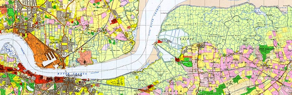
The challenge of land use mapping came to mind within the context of understanding agricultural land use in Annapolis County. If we wish to promote agriculture in this part of the Annapolis Valley, a first step is to understand the existing land use. If the next generation wishes to expand agriculture or agricultural tourism, we need to know what we are growing, and where.
Recently, in a meeting, Brian Arnott floated the idea of a ’digital 4H’. What would it take to empower 4H members in the Valley to apply current geographic technologies (and “Learn by Doing”)?
At COGS we have access to range of technologies from Cartography, GIS and Remote Sensing.
We could take an idea from Kent Thompson’s book ’Biking to Blissville’. For each ride, he provides a context, where to stay, and a map of the ride. It is easy to imagine with the completion of a current land use map we could develop an experiential tourism guide which not only describes the agricultural land use but highlights places to stop, to sample different products of the landscape, provide information on seasons, hours of opening etc. — for example, road side stands, U-pick operations, local restaurants, breweries.
This type of mapping should not be limited to Annapolis County. It should certainly extend to Kings County and the ’Harvest Highway’, and could indeed be a provincial initiative.
Given the historical experience in Britain, there is a high probability that geographers elsewhere have developed similar applications using current technologies. It is the potential access to resources at COGS which makes the idea so appealing.
The creation of a new family of digital land use maps would follow in the tradition of the A.F. Church wall maps from over a century ago (see blog post HERE).
It would focus attention on the landscape of rural Nova Scotia. It would engage 4H and the staff and technology resources at the Centre of Geographic Sciences (COGS). Go COGS go !!
Postscript
This is written in New Glasgow. I have just discovered the latest issue of Ah! At Home on the North Shore. It includes the article: Little Shop of Treasures: Bidding Farewell to Water Street Studios, Pictou (see blog post “Travels with Heather“).
As we entered New Glasgow along the Abercrombie Road, I speculated on the location of the new Gordonstoun Nova Scotia school. Too early to tell.
Acknowledgements
Brian Arnott, Leslie Wright, John Wightman provided a context for these ideas. Rachel Thevenard and David Colville exemplified the context. Heather found the Kent Thompson book. Edward added his magic touch.
References
For more detail on Alice Coleman, check Land Utilization Survey of Britain on Wikipedia or Google her name.
Ah! At Home on the North Shore, Spring 2022, Vol 7, No 2, p.48, Little Shop of Treasures. Bidding Farewell to Water Street Studios.
Kent Thompson, 1993, Biking to Blissville, A Cycling Guide to the Maritimes and the Magdalen Islands, Goose Lane Press.

I like how you have applied mapping as a means of visual storytelling that enables a deeper relationship to people and place. Thanks!
LikeLike
Bob
Just a quick note to say we are in Baddeck to work with our client, Theatre Baddeck. I had hope to have all day to catch up but the possibility of getting stranded by the incoming storm has cause us to have our TB meetings this morning rather than tomorrow and head back to Lunenburg immediately. I’ve got some thoughts to share and will get back to you as soon as I can.
Brian
Brian Arnott Principal Novita Interpares | Leaf + Branch
novitainterpares.ca
>
LikeLike
Brian:
Glad to connect. I think it would be excellent if 4H and COGS could collaborate.
Bob
LikeLike