Last Friday, I attended the 17th Annual COGS Student Success celebration at the Lawrencetown Fire Hall. Approximately fifty awards were handed out to students in the Geographic Sciences.  This included GIS, Remote Sensing, Marine Geomatics, Survey Technology and Technician, Community Planning and Information Technology. Today, the student population is around one hundred and fifty. In my day (1980-88), we had similar student numbers, divided into three departments: Surveying, Computer Programming, and Cartography/Planning. It will be interesting to speculate on the numbers and disciplinary interests over the next thirty years.
Konrad Dramowicz and Kathleen Stewart, both announced their retirement from the NSCC. We wish them well in the third age.
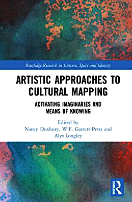 A couple of conversations caught my attention. The first was a chat about the conversion of a LiDAR-derived topographic landscape into a hooked rug. This resonated with a new book that I had signed out from the COGS library. Artistic Approaches to Cultural Mapping: activating imaginaries and means of knowing. The second conversation, with Ed Symons, related to my experience at the walk-in clinic in Berwick, looking for a doctor. There, I had picked up a brochure describing the process for 811 registration. Here was my question: why not allow communities to actively engage in the doctor shortage issue. Can we not map citizens who do not have a family doctor from the registry? Can we not map the communities where doctors are retiring? This would allow individual communities, without government oversight and control, to be more proactive.
![]() Yesterday, Heather and I joined a group of about thirty woodlot owners for a field trip organized by the Western Woodlot Services Cooperative (WWSC) to North Range, Digby County. It started at the Forest Products Mill outside of Barton. Our host was Harold Alexander who has been managing woodlots in the area for over forty years. It was a joy to spend the time in the woods with a knowledgeable person and to appreciate the complexity of the decision process behind woodlot management and to understand the potential for a better alternative through citizen collaboration.
Yesterday, Heather and I joined a group of about thirty woodlot owners for a field trip organized by the Western Woodlot Services Cooperative (WWSC) to North Range, Digby County. It started at the Forest Products Mill outside of Barton. Our host was Harold Alexander who has been managing woodlots in the area for over forty years. It was a joy to spend the time in the woods with a knowledgeable person and to appreciate the complexity of the decision process behind woodlot management and to understand the potential for a better alternative through citizen collaboration.
 This week, I received emails, from my brother and Frank Fox, about the new book by Robert MacFarlane, Underland. On BBC Radio 4 at 9:45 am, each day there was a short podcast from a different chapter. The book looks at landscape features below the ground, especially caves, mines, sewer systems throughout Europe. It reminded me of two occasions in my own life. While at the University of Birmingham, we hitch-hiked to the west coast of Ireland to go caving near Lisdoonvarna and the Burren. A few years later (1970) I joined Derek Ford, Michael Goodchild and others to explore Castleguard Cave in the Canadian Rockies, beneath the Columbia Icefields. Both are a classic example of physical geography in action.
One final reflection. Again beginning with a conversation with Ed Symons, he gave me the latest issue of Municipal World (May 2019). It includes an article New Uses for Historic Places of Faith. Up near Wolfville, they have converted a church into a local craft brewery. Yesterday I noticed at Plympton, they are deconstructing the church. Only the frame remains standing. What an interesting commentary on society.
Acknowledgements
Ed Symons for the conversations, before and during at the COGS Award Ceremony. Harold Alexander for his in-depth knowledge of the woods in Southwest Nova Scotia. Peter Maher and Frank Fox for forwarding the reviews of Robert McFarlane’s new book. Edward Wedler for his artistic contribution.
References
Nancy Duxbury, WF Garrett-Petts and A. Longley. (ed). 2019. Artistic Approaches to Cultural Mapping: activating imaginaries and means of knowing. Routledge Publishing.
Robert MacFarlane. 2019 Underland: a deep time journey. Hamish Hamilton Publishing.
Footnote
In the Duxbury book, two items caught my eye. There is a reference to Tom van Sant’s map The Earth – From Space: a Satellite View of the World. Here, right next to my computer, I have a signed copy of this image dated 12-13-90 from my days with Esri, Redlands and meeting Tom at his studio.
The second item is a reference to the work of radical geographer, William Bunge: 1968. Where Detroit’s run over Black Children on the Pointes-Downtown Track map. Bill spent time in the Department of Geography, University of Western Ontario, London, Ontario.
