Posted in Event Review, New thinking, Uncategorized

Mapping the Geography of Places

This week (May 20/21) COGS hosted a symposium of student presentations (Cartography and Geovisualization, Geospatial Data Analytics, GIS and GIS:Remote Sensing.
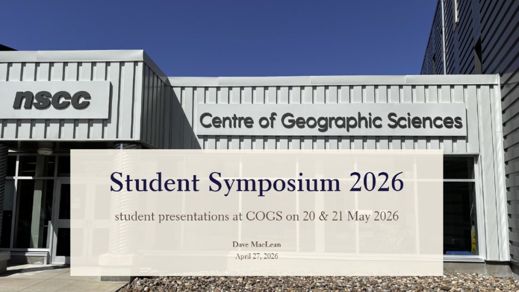
The presentations were made with Teams in the AV Room and the Board Room.

One of the presentations was by Christian Gastmeier: “Mapping the Geography of Places: A GeoAI and Cyber-cartographic study of the Annapolis Valley. Data input included Volumes 1-10 of my blog, ernestblairexperiment.wordpress.com from 2017-2026.

ernestblairexperiment takes its name from Ernest Buckler, author of ‘The Mountain and the Valley’. The British author, Eric Blair who wrote under the name, George Orwell. Experiment because it has been an experiment in the use of online communication (blogging).

Christian has taken on the challenge of applying the tools of GIS and AI to this collection of blog posts.

While at COGS, I was talking to Andrew Hannam, Library Technician in Lawrencetown. He confirmed that all Librarians at NSCC campuses have been ‘let go’ to meet provincial budget cuts. Given the importance of the written history of these collections to the institutions and future students, this is a matter of considerable concern (see Community Engagement, Antiques Map Tour and Map Stories).
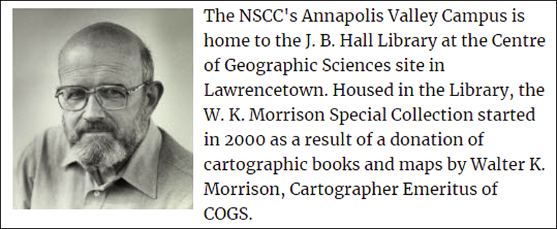
Today, while I listened to the student online presentations, I had to worry about the ‘sense of place’, and the viability of three separate campuses in the Annapolis Valley: Lawrencetown, Middleton and Kentville — especially one with a focus on the Geographic Sciences.

It seems to be a contradiction to talk about ‘a sense of place’ and yet have the students online with no, or an empty, consideration of ‘place’. What does this mean for our ‘community’?

Postscript

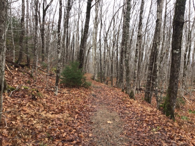
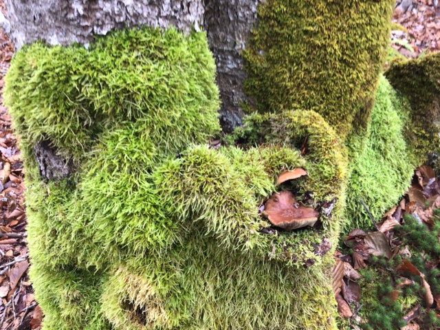
Yesterday, Heather and I, in order to maintain our ‘sense of place’, walked the Peter Point trail in Kejimkujik National Park.

Posted in New thinking

Moonshot 4: The Sustainable Energy Corridor

AI-Geomatics
Moonshot Project 4

Our conversation with Gemini on 28th January 2025. By showcasing these innovative projects, COGS and AGRG can effectively communicate their value to the government and the people of Nova Scotia, positioning the province as a leader in applied Geographic Sciences and driving sustainable economic growth.

Vision: Develop a comprehensive geospatial framework to guide the development of a sustainable energy corridor across Nova Scotia.

COGS & AGRG Role:

Resource Mapping: Utilize remote sensing and GIS to map and assess the potential for wind, solar, tidal, and hydrogen production across the province.

Environmental Impact Assessment: Conduct environmental impact assessments to identify and mitigate potential risks, such as wildlife impacts and ecosystem disturbances.

Infrastructure Planning: Develop optimal routes for transmission lines, hydrogen pipelines, and other critical infrastructure, considering environmental, social, and economic factors.

Community Engagement: Utilize interactive maps and visualization tools to engage with communities and stakeholders, ensuring their concerns and priorities are considered in the planning process.

Impact:

Sustainable Energy Development: Facilitate the responsible and efficient development of renewable energy sources, contributing to Nova Scotia’s energy transition.

Economic Growth: Attract investment in green energy technologies and create new jobs in the renewable energy sector.

Environmental Stewardship: Minimize the environmental impact of energy development and contribute to a more sustainable future for the province.

This project would directly address the Premier’s emphasis on “New-to-Nova Scotia” industries, demonstrating how geospatial technologies can play a critical role in ensuring the safe, responsible, and successful development of these sectors.

By showcasing these innovative “Moonshot” projects, COGS and AGRG can effectively communicate their value to the government and the people of Nova Scotia, positioning the province as a leader in applied Geographic Sciences and driving sustainable economic growth.

See also
Moonshot 1 The Nova Scotia Digital Twin
Moonshot 2 The Ocean Intelligence Platform
Moonshot 3 The Nova Scotia Geo-Innovation Hub


After meeting with David Bowlby today, I don’t have much to add to Edward’s draft. The key issue will be the level of interest shown by students at COGS/AGRG. This could be complemented by input from the GIS industry, and their experimentation with AI.

Postscript

Edward has returned to Florida. With access to less technology, there will be fewer graphics and links over the next month.

Posted in New thinking

Moonshot 3: The Nova Scotia Geo-Innovation Hub

AI-Geomatics
Moonshot Project 3

Our conversation with Gemini on 28th January 2025. By showcasing these innovative projects, COGS and AGRG can effectively communicate their value to the government and the people of Nova Scotia, positioning the province as a leader in applied Geographic Sciences and driving sustainable economic growth.

  • Vision: Establish a collaborative hub where industry, government, and academia can leverage geospatial technologies to address critical challenges.
  • COGS & AGRG Role: Provide expertise, training, and resources to support innovation projects in various sectors, including agriculture, forestry, transportation, tourism, and (critical) mineral exploration.
  • Impact:
    • Job Creation: Foster the growth of a skilled geospatial workforce and attract talent from around the world.
    • Economic Diversification: Drive innovation and economic growth by supporting the development of new products, services, and technologies.
    • Global Leadership: Position Nova Scotia as a leader in applied Geographic Sciences and a hub for geospatial innovation.

These projects demonstrate how COGS and AGRG can leverage their expertise to address critical challenges and create a more sustainable, resilient, and prosperous future for Nova Scotia. By showcasing their capabilities and raising awareness of their work, they can inspire the government and the public to invest in geospatial technologies and support the province’s transition to a knowledge-based economy.

This is the third Moonshot. I hope it is well received by students at COGS, government and industry partners interested in AI-Geomatics (see Moonshot 1 — The Nova Scotia Digital Twin — and Moonshot 2 — The Ocean Intelligence Platform).


Today, Heather and I took a drive to Canning on a beautiful, sunny Winter day. Our destination was the ArtCan Gallery. Unfortunately the kitchen was closed.

However, the staff were preparing for The Drawing Room Community Show, March 1st-29th. “Make a drawing in the Gallery and Hang It!”

I enjoy their book collection, local authors, books on art, etc. I found Simon Winchester’s Knowing What We Know: The Transmission of Knowledge from Ancient Wisdom to Modern Magic. It will likely replace my reading of Backwater: Nova Scotia’s economic decline

Acknowledgements

Heather shared the outing. Edward is making preparations for Florida.

Reference

Simon Winchester, 2023, Knowing What We Know: The Transmission of Knowledge from Ancient Wisdom to Modern Magic, 383 pp, Harper Collins.

Posted in New thinking

Moonshot 2: The Ocean Intelligence Platform

AI-Geomatics
Moonshot Project 2

In conversation with Gemini on 28th January 2025. By showcasing these innovative projects, COGS and AGRG can effectively communicate their value to the government and the people of Nova Scotia, positioning the province as a leader in applied Geographic Sciences and driving sustainable economic growth.

COGS & AGRG Role: Utilize marine geomatics, underwater robotics, and AI to collect and analyze data on ocean currents, water quality, marine life, and human activities.

Impact:

Sustainable Fisheries: Support sustainable fishing practices by providing real-time data on fish stocks and migration patterns.

Coastal Protection: Monitor coastal erosion and sea-level rise to inform coastal management strategies.

Blue Economy: Facilitate the development of new ocean-based industries, such as offshore renewable energy and aquaculture.

By showcasing these innovative projects, COGS and AGRG can effectively communicate their value to the government and the people of Nova Scotia, positioning the province as a leader in applied Geographic Sciences and driving sustainable economic growth.


Last Saturday, I hosted a meeting at my house in Middleton with John Wightman and David MacLean. The topic under discussion was the possibility of an event, equivalent to the COGS Industry Expo; this Summer, June- July time frame. The emphasis would be on Nova Scotia, natural resources, in particular minerals, fisheries, forestry and agriculture.

The event’s working title would be ‘CANMAP Government Expo’.

It would showcase the use of AI-Geomatics in these four sectors, and the collaboration between the educational institutions, industry and government.

To move forward with this agenda, we need the engagement of the provincial government, as well as the AI-Geomatics industry.

Acknowledgements

Edward Wedler started this journey. Both John Wightman, from the mining exploration industry perspective and David MacLean from the application of GIS technology perspective demonstrated their commitment and interest.

Posted in New thinking

Moonshot 1: The Nova Scotia Digital Twin

This morning, I went to the CORAH Men’s’ Fitness class. Other participants, included Howard Selig (Valley Flax) and David Bowlby (MLA Annapolis County). This week, Edward has been in dialogue with Gemini ( AI). Together they identified four ‘moonshots’. I will publish one per week. Through the ErnestBlairExperiment blog. We want to try to engage the community, industry, government and education.

Edward and I have collaborated on earlier projects e.g. Ride the Lobster and The Road to Georgetown, PEI.

AI-Geomatics
Moonshot Project 1

Edward’s conversation with Gemini was on 28th January 2025. By showcasing these innovative projects, COGS and AGRG can effectively communicate their value to the government and the people of Nova Scotia, positioning the province as a leader in applied Geographic Sciences and driving sustainable economic growth.

Vision: Create a comprehensive, real-time digital replica of Nova Scotia, encompassing its physical, natural, and human environments.

COGS & AGRG Role: Leverage their expertise in GIS, remote sensing, and AI to integrate various data sources, including LiDAR, satellite imagery, sensor networks, and historical records.

Impact:

Resource Management: Optimize resource extraction (forestry, fishing, mining) while minimizing environmental impact.

Disaster Preparedness: Simulate natural disasters (floods, wildfires) to improve response and mitigation strategies.

Economic Development: Attract investment by showcasing the province’s potential for sustainable development and innovation.

Acknowledgements

Edward Wedler was on the faculty, teaching Remote Sensing at COGS. At the same time. I was teaching GIS. We have been friends and colleagues for over forty years.

Posted in New thinking

Geospatial Moonshots: Where AI Meets Nova Scotia’s Future

What should not be a surprise, is that both of us, although officially retired, remain engaged in the questions of the day.

Today (January 28) Edward had a conversation with Gemini. This led to four ‘moon-shot-type’ projects. COGS and AGRG with their expertise in the Geographic Sciences, can play a crucial role in these sectors and drive innovation to become a global leader for Nova Scotia in Artificial Intelligence and Geomatics.

Our exploration was spurred on by Nova Scotia’s Premier’s reported comments on our traditional industries (such as Farming, Fisheries and Forestry) and our potential in “new-to-Nova-Scotia” industries (such as Hydrogen, Wind and Critical Minerals).

We will explore these four “moonshot” projects in future blog posts.

PROJECT 1: The Nova Scotia Digital Twin.

PROJECT 2: The Ocean Intelligence program.

PROJECT 3: The Nova Scotia Geo-Innovation Hub

PROJECT 4: The Sustainable Energy Corridor

Heather and I attended the second day of the COGS Industry Expo. At the ESRI Canada booth, we were fortunate to pick up a copy of the latest ESRI Map Book, Volume 39.

Acknowledgements

I appreciate Edward’s inquiring spirit, checking out the relationship between AI and GIS.

Posted in Common Place, New thinking

Community Geography

What is the importance of knowing the geography of your community?

What is the difference between rural and urban geography? In the rural environment, it is possible to understand the changes that happen in the local landscape.

What happens when communication is electronic, and it is not related to place?

With these questions in mind, what is the ‘definition of a ‘community college’? On top of that, what does it mean to manage a ‘centre of geographic sciences’ in a community college context, in a rural landscape?

This leads my thinking to CORAH. A Centre of Rural Aging and Health. What exactly is rural aging? Aging in Place? Where does technology fit into the picture? What is the relationship between health in a rural landscape, when compared to an urban landscape?

Certainly, there are many citizens who elect to live in a rural landscape, where it is easier to monitor the changes in the wildlife populations, old growth forests, agricultural practices. Human densities are lower. There are less of the trappings of the ‘built’ environment.

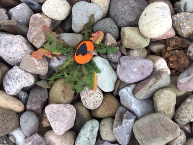
Recently, I have been exploring ‘hidden treasures’ (see posts Hidden Treasures, Landscape and Food, Treasure Hunt and Micro Adventure) in its various forms. Paul Colville informs me that there are painted rocks at the Margaretsville wharf.

Edward has challenged me to define the role of community in understanding our local geography, our sense of place. To complement the role of our educational institutions.

Many years ago, we instituted this relationship with MapAnnapolis.

Perhaps it’s time for a second thought, with CORAH in mind, as well as the changes in access to new technologies.

Certainly, Edward and myself would be happy to join others in the community to see what is possible. We have all the elements. We just need to continue the conversation.

Posted in Book Review, New thinking, Uncategorized

A Geography of Annapolis County

Saturday was a dreary wet day. In The Reader, I noticed a book signing at Endless Shores in Bridgetown. It was a good excuse for a short drive. We met Cate Wilding. She lives in Port Lorne and has written three novels.

While at the bookstore, I picked up a flier ‘Great Reading Ideas for the Holidays’. It features Allison Maher’s The Last of Firsts“, DJ Wiseman’s Cara Rosa” and Sheila Graham-Smith’s The View from Errisbeg“.


This set me thinking, about the relationship between authors and landscape and goes back to my abiding interest in Ernest Buckler and ‘The Mountain and the Valley’ (read my post The Mountain and the Valley).

What is the relationship between ‘place’ and our perception of ‘geography’?

Given the physical location of COGS (The Centre of Geographic Sciences) in Annapolis County, would there be merit in a book on ‘The Geography of Annapolis County’? (see earlier post Geobiography and the Annapolis Valley)

How would I define Geography?

Going back to my days at the University of Birmingham, it would include:
Physical Geography: Geomorphology, Biogeography, Climatology.
Economic Geography: Transportation, Settlement Infrastructure, Land Use
Resource Management: Agriculture, Forestry, Mining, Fishing.
Historical Geography, Regional Geography plus the various methodologies: Cartography, GIS, and Remote Sensing.

Saturday evening, I shared my thoughts over a beer with John Wightman. In particular, I was interested in the different trajectories of the towns: Annapolis Royal, Bridgetown, and Middleton, and the lack of a coherent vision.

Annapolis Valley

I was also interested in the definition of the region. What are the real differences between Annapolis County and Kings County? Would it be better to look at the Annapolis Valley as a Bioregional entity? (see also Island of Hope: the Annapolis Valley, Rewilding the Annapolis Valley, A Vision for the Annapolis Region and The Valley Brand)

John, correctly, expressed a concern that today, rather than think in terms of a book, we need to think in terms of an ‘online electronic presence’.

This led me to Bridgetown on a rainy Sunday afternoon. I wanted to photograph the site of the new building at Mountain Lea Lodge.

Photo by Bob Maher

What are the implications for the economic development of Bridgetown? If the Liberal party was successful in the provincial election, would we see a new hospital in town? Could Bridgetown become a centre of excellence in the long-term care for the elderly and infirmed? Would this attract a new generation of healthcare professionals to the Annapolis Valley? Would they be interested in understanding the Geography of Annapolis County? Would this expand the course offerings and the student population at the Annapolis Campus of the NSCC?

As always, comments welcome.

Posted in Common Place, New thinking

Treasure Hunt

Yesterday, Heather and I walked in Valley View Park.

I did not take my phone or iPad. On the walk, we discovered some interesting stones. One thing led to another.

Today we returned to the Park with my iPad. I took the following photographs.

Can you find the treasure ?

Today, I had a second iteration. I noticed some stones at COGS. Again, this could provide material for a second treasure hunt (or geocache).

Let’s take the concept to a higher level. Imagine you wanted to engage students at COGS in exploring the landscape of Annapolis County. You could locate ‘geocache’ or treasures on various trails, bicycle routes, canoe routes etc. The treasures should be hidden on accessible public land.

Would this be a way to engage students at COGS with the surrounding community? Conversely, could this engage the community with resident students?

The common denominator would be a better understanding of our landscape.

The end result could be a book of hidden treasures of the Annapolis Valley. Ideally, the treasures would be natural features. They could be viewpoints or picnic sites too.

POSTSCRIPT FROM EDWARD

I sent a note to Bob, to include the following link and graphic in one of his posts. He hesitated, then wrote, “Please adapt the blog to include the information. I am biased. I do think the Brits have a better handle on Geography, the discipline than Canada“.

This global survey supports his “bias”.

2024 Shanghai Global Ranking of Academic Subjects
in GEOGRAPHY

Note how well the UK schools rank. Seven schools in the top 10 tell me they’re doing something right. Maybe COGS should look closely at this to unearth what makes the UK institutes so strong. Going out on a limb here, COGS could adapt or adopt valuable lessons from this ranking (and invite some UK geography talent?). UBC didn’t do too badly.

Posted in Art, Common Place, New thinking

My Mind is Racing: looking at geography through a refreshing lens

MY EMAIL THREAD WITH Dr BOB MAHER:

Tonight, I plan to attend a discussion panel at Dal University triggered by an article in The Coast, “In This Economy, Try Art“.

The panelists will pull on narrative threads in “Strange Birds”, including creative ways to engage with the climate crisis, and add their perspectives on curation, academic perspectives on environmental sustainability and the ways art can bring awareness, action and optimism to the struggle for the planet’s future.

I explored the backgrounds of the panelists, particularly, celebrated exhibition curator Ray Cronin and Dal U environmental studies professor Melanie Zurba. They approach geography through a very different lens than I have been used to — Ray Cronin through place-based art and artists, and Zurba through community and indigenous collaborators of our environmental spaces.

Then, to continue this thread, I could not then help but explore who, to me, is one of the most interesting professors I HAVE NEVER MET — Acadia U prof Dr Jon Saklofske. If there is one thing I would ask of you today is to grab a coffee and watch his 17-minute YouTube video “Creating Worlds Together“.

Here, is a really exciting way to view geography, literature, books, virtual worlds, and place-based stories; together. The type of work he does with undergraduates and a COGS-Acadia collaboration would blow my mind [I would jump at the chance to be one of his students].

How do I know of Jon Saklofske? He once requested some promotional literature/book posters we had when I ran The Inside Story bookstore. Again, I have never met him but his research mind-space excites me.


This then got me thinking … this time following a Jon Saklofske-thread into an Esri and virtual world.

Since Saklofske has delved into the geographic world of gaming, has Esri ever explored or embraced the type of geographic-gaming explored by Saklofske — especially since the entertainment world is such a large part of current culture?

I wonder where an Esri-Saklofske collaboration would lead — hmmm, maybe a COGS-Esri-Saklofske collaboration.

Let’s explore the ending “S” in “Centre for Geographic Sciences“.