(This blog has two links of interest: one from GoGeomatics and one from COGS).
In a recent issue of GoGeomatics magazine, there was an online interview with Alia Kotb, Community Maps Advocate at Esri Canada.
This peaked my interest, and reminded me of earlier initiatives in Nova Scotia. For example, Community Counts, the CLICK project and MapAnnapolis. What is the current status of these initiatives?
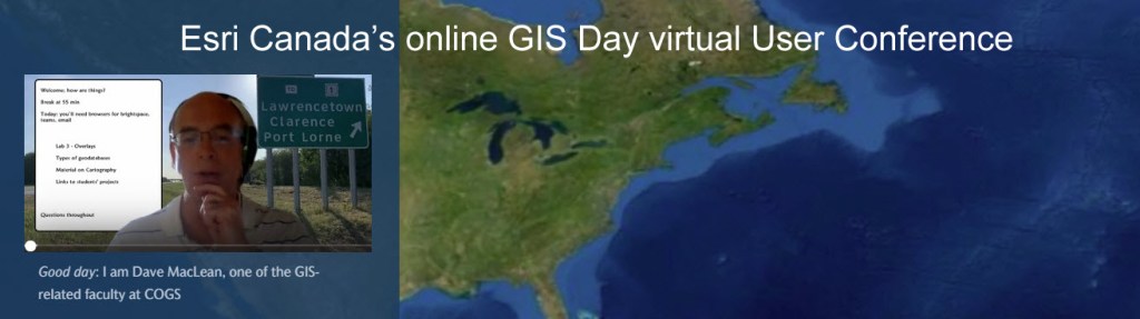
I raised the question with faculty at the Centre of Geographic Sciences (COGS). While I did not receive any definitive answers, I did have a response from Dave Maclean about the current virtual learning environment in Lawrencetown. Not being familiar with this world, I thought it worth sharing. Other members of the community may have an interest in the happenings inside the walls of COGS.
The virtual environment is global. So there is real potential to engage the GIS community in a network of mapping experiences. Here are a couple of possible examples.
One of my grandchildren lives in Iqaluit. What would it take to create a community map of the town from his perspective? Could the map be shared with his age cohort across other Northern communities? Or elsewhere in the world?
One of the issues in rural Nova Scotia is clearcutting the forests. Could we produce maps of clearcuts and potential clearcuts for Southwest Nova? Could we compare these maps of activity on crown land with equivalent maps in other countries, e.g. UK, New Zealand? If they apply ecological forestry, can we detect the difference? No spraying.
The reduction in face to face learning creates an opportunity. It can be more individualized, and less influenced by local context. Can we create customized networks around the individual needs of the community? Can we merge communities of place with communities of interest?
Acknowledgements
To Jon Murphy and Dave Maclean, both COGS graduates. Edward Wedler, COGS faculty in a earlier life.
References
GoGeomatics magazine interview, November 24, 2020.
Dave Maclean presentation for Esri Canada GIS Day Fall 2020.

If there is a silver lining in our current pandemic, it is the local-to-global reach of online teaching, instruction, mentoring, cheerleading and coaching — and the new relationships that result. I’m pleased to see COGS reach out. Perhaps this might stir other Geomatics offerings such as community information and dialogue sessions.
On my part, having migrated from a remote sensing background to fine art, I’m now in my 30th consecutive week of holding a weekly, online “Art Meet Group Critique”, attracting artists in Nova Scotia and in the USA. Here is a snippet from an earlier meeting … https://youtu.be/G4KuAKFlqR8
LikeLike
Edward:
Thank you for this contribution.
Bob
LikeLike