Posted in New thinking, Opinion

Maps from an animal’s perspective

We often talk about geography and the land from a human perspective. What about from an animal’s perspective?
How do they understand the land? They do not use our compasses and maps but must understand landmarks, boundaries and “sense”.
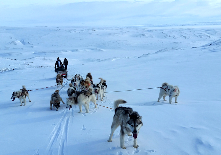
I think of the resilient service sledding dogs offer to travel in the North, such as those shown here on Andrew Maher’s recent trip.
dogsledTeam_Apr2018_750w90dpi
I think of migrating caribou and how they are impacted by human interaction.
I think of the industrious beaver and how their drive to “use the land” is different from our “land-use”.
I think of the wolf — how we “re-introduce” species and we learn, serendipitously, over time how important they are to the health of the (ours and theirs) ecosystem and physical geography.
Bob’s past posts on clearcutting highlights, for me, our insensitivities; placing our needs to strip bare our land ahead of animals’ needs of land to maintain their livelihood and form basic shelter and protection.
dawsonOnMoshersIsland
As an experiment, I decided one morning to carry a video camera at knee height (my dog’s eye view)  for almost an hour as I walked an island in The La Have area of Nova Scotia (this was no easy task). Upon review, I was intrigued to experience the world’s perspectives, vistas, obstacles, nooks and crannies as my dog saw them.
And, what would maps look like if crafted from an animal’s
point of view?
Posted in New thinking, Opinion

Can maps do a better job in our back-yard?

If the technology exists to instantly light up our phones when our village has been hit in the game “Clash of Clans” surely we can work to do the same when our land/water/air is being impacted in real-life.

clashOfClansClearCut
With the many technical advances these days maybe we need to set aside or identify tracts of land where we research ideal mapping practices — maps that readily and fully inform and seamlessly engage us, citizens.

Sure, Google has made mapping strides with easy access to street view, traffic assists, and feature identification. Many of us use these maps. ESRI lets us, not as easily, mash databases and tell stories to create personalized maps. Fewer of us use these maps. I suggest, however, that maps can reflect a larger part of our DNA when they subsume social-media/market value. We need to explore the real market potential for interactive, immersive, and adaptive maps.
As I have been south this season and have read many of Bob  Maher’s blogs I have been pondering as to WHO, these days, most interacts with the natural landscape and HOW we interact with it, and of the role of maps. Seeing forest clear-cuts first-hand, for example, contrasts drastically with viewing them on a screen, days/weeks/months later. If we could better connect maps with our daily lives we could find greater transparency of forestry and other practices or issues.
If game developers can market and make b/millions with “what if” scenarios and if we can be tweeted, poked and notified instantly then surely we can create maps to do do the same for us citizens. Can we improve maps by better connecting them via social media network for all stakeholders and citizens?
Maybe, Bob and Heather who live in Paradise, Nova Scotia would not have had to discover, with surprise, that their “back-yard” had been violated with forest clear-cuts.