My daughter, Allison, spent much of the summer camping in Southern Ontario, close to her home. On those trips my two grandchildren created maps as one of their pastime activities. My grandson is six years old and his sister is four years old.
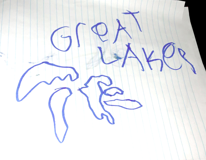
To place his campsite location in context within a larger geography, my grandson mapped the Great Lakes from memory — something I would have difficulty doing.
Closer to home, he mapped features that were important to him at each campground.
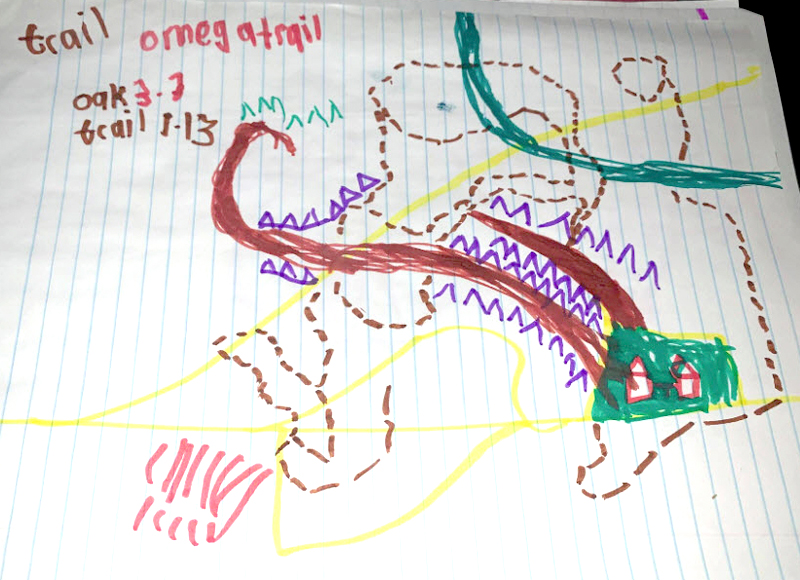
The features intrigued me. He names the trails and records their lengths, marks roadways and walkways, streams and green spaces, and important features to a six-year old that I cannot recognize. Tents are numerous and line well-travelled paths. Important to him (and the family) is the location of the public washrooms. This is one of about eight maps he drew at different campsites.
Of importance to his younger four-year-old sibling was the location of two blue water bodies, connecting river, and the land in between. An understandably simpler map.

I recall my many mapping conversations with former COGS instructor Konrad Dramowicz, years ago. He studied how children perceive their space and geography from maps he had them create, based on their travels to and from school.

Looking further into this topic, I was referred to Dr David Sobel in New Hampshire, and his book Mapmaking With Children, in which he discusses the crisis in geography education. The story doesn’t end here. I emailed Dr Sobel and he writes,
“Yes, some children have the mapmaking gene expressed more strongly — a great thing to encourage. Unusual, from a developmental perspective, for a 6 year old to have internalized a map image of the scope of the Great Lakes system.“
My two older grandchildren from Nova Scotia also create maps. These maps are dynamic and strategic based on their invented game call “The Wall”. It is a game designed to see who can outwit the other, to infiltrate their opponent over, under, around or through The Wall. This game has provided hours of entertainment for them, and their adult challengers as well.
While instructing at COGS, eons ago, I did visit some elementary schools in Annapolis County to talk about Canada’s space, remote sensing and mapping programs. When bringing in some local airphotos and topographic maps to middle school aged youth their exuberance was surprisingly upbeat. Youth want to understand their geography. I hope that COGS continues to fightback the geography crisis noted by Dr Sobel.
Reference
Dr David Sobel, 1998, Mapmaking with Children: sense of place education for elementary years, Heinemann.
Postscript
For those interested in making a “collage map” watch this video from the Art Gallery of Nova Scotia. LINK: https://youtu.be/H1FXyFH7HrE This project is inspired by the 1975 work, “A Map of Meagher’s Grant”, by artist Evelyn Dickie.
“This is a great activity to do to celebrate the neighbourhood we live in or a home from the past that holds dear to our heart.”


 In the podcast, he makes a couple of interesting points.
 References
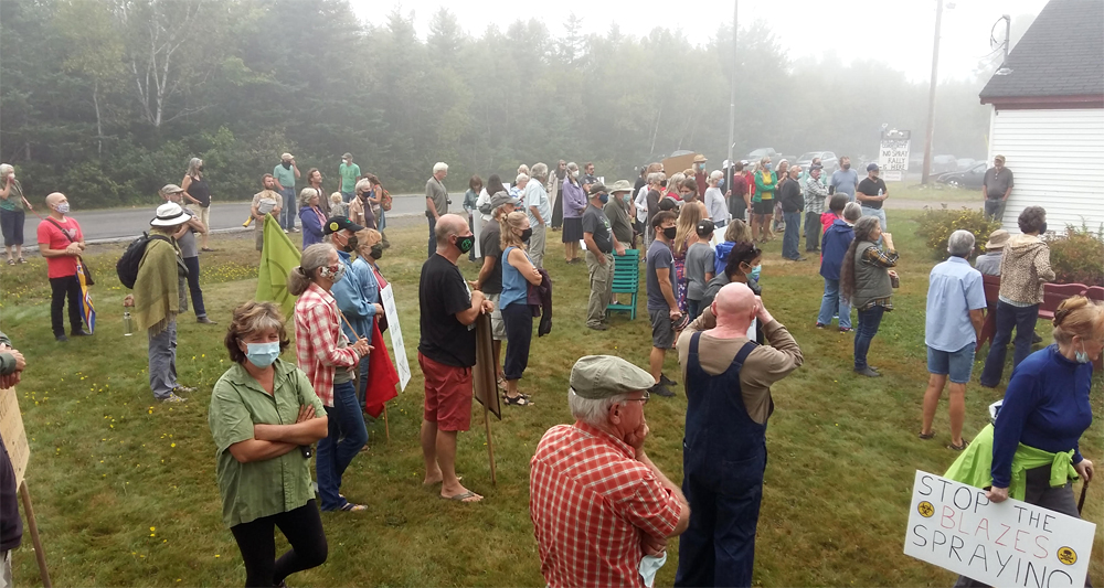
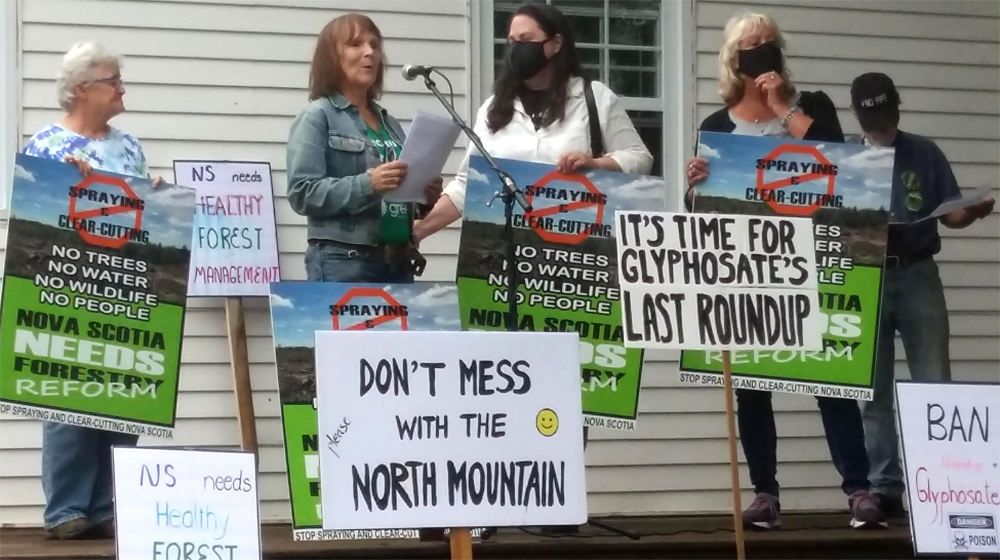
 Living in Annapolis County, one of the many pleasures is to be able to support local businesses. It is a joy to go to the
  The venue had a number of positives:
 Postscript