
This weekend, we were away from the Valley at Pictou Lodge. It gave me the opportunity to read John Higgs’ book, Watling Street. Higgs uses the geography of Watling Street from Dover to Anglesey, stopping in Canterbury, St Albans and Rugby to tell the story of the British landscape
”Watling Street is simultaneously mundane and extraordinary. It facilitates movement, which generates stories, which creates history.”
At Western Park (Chapter 12), hé raises the Lloyd George question:
”Who made 10,000 owners of the land and the rest of us trespassers in the land of our birth?” P.308.
“Many who campaigned to leave the European Union did so because they want to ‘take their country back’“. There is one perspective from which the slogan becomes meaningful and one way it could be achieved.
”When a new system to replace European farming subsidies is debated, the subject of land reform and a Land Value Tax may be finally be exposed to light.”
This presents a parallel to discussion in Nova Scotia about the definition and use of Crown Land.
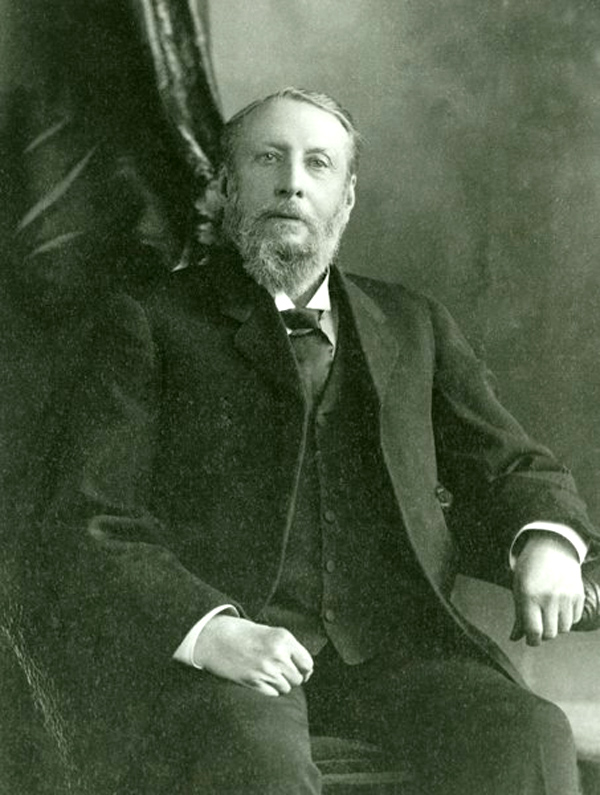
David Raymond sent me a paper by Charles Fergusson, published in the Dalhousie Review, on Ambrose F. Church, Map-Maker. Church published a series of topographical township maps between 1865-1888.
He forwarded an electronic copy of the Church map for Cumberland County, which I was able to display on my iMac. I had planned to visit Heather’s family farm (South Victoria and Streets Ridge).
My next step is to obtain a smaller subset of the Church map. Second, from David Raymond, his document for genealogists to add census data from that time period. This will form the basis of my next blog, entitled, Map Stories.
Acknowledgements
David Raymond for creating a digital copy of the Church maps, and for instructions on adding early census data. Heather and John Stewart have expressed an interest in the project. Edward added the graphics.
References
John Higgs, 2017, Watling Street: Travels through Britain and it’s ever-present past, Weidenfeld and Nicholson.
Charles Fergusson, Dalhousie Review, P.505-516, Ambrose F. Church: Map-Maker.

Bob
This looks like an interesting book. Is Watling Street a Roman road? As you know from my book, I believe the Roman roads gave Britain a huge advantage by providing all-season, stable fareways capable of handing heavy loaded wheeled vehicles; whereas in Canada, we did not get this capability until the railroad network was established.
I assume the book is still available?
Brian
Brian Arnott Principal Novita Interpares | Leaf + Branch
novitainterpares.ca >
LikeLike
I ordered book through the library. It came from U of A for $10. It was a good deal. Bob
Sent from my iPad
LikeLike