This weekend, we were in New Glasgow, visiting Heather’s family. On Saturday afternoon, we joined Sandy and John on a visit to the deCoste Performing Arts Centre on the Pictou waterfront. This Summer is the Grand Reopening.
A new cultural hub combines the Pictou-Antigonish Regional Library (PARL) and the deCoste Performing Arts Centre. We enjoyed the new library facilities, the indigenous paintings, and the sculpture on the waterfront by Alan Syliboy.
Driving up from the Annapolis Valley, Pictou demonstrates what is possible for other small towns in Nova Scotia.
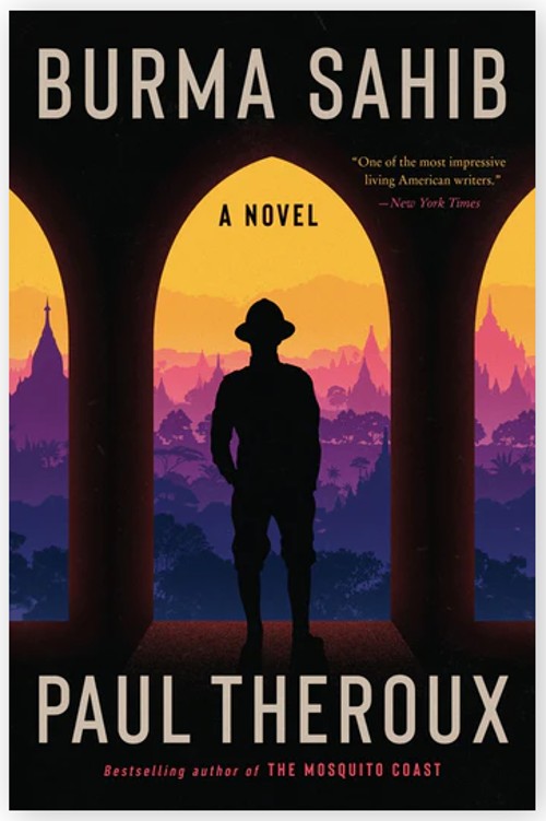
At the Library I was able to sign out David Suzuki’s ‘The Sacred Balance’. Heather picked up Paul Theroux’ ‘Burma Sahib’.
Returning to New Glasgow, the day was completed with homemade shepherds pie, beets and chard from Sandy’s garden, PBS’ Maine Saturday night fare ‘As Time Goes By’ and ‘Doc Martin’.
Sunday.
Time for the beautiful three hour drive back through the Rawdon Hills. At home, we were immersed again in the challenges of real estate sales. But we took time out for a stroll around the French Basin Trail (view my post Walking Paths). It was deserted, on a holiday weekend.
Acknowledgements
Sandy suggested the visit to the Pictou waterfront.
Pictou Library offers special programs. They also offer Virtual Care and have a Virtual Care Navigator. The Library is a ‘Community Information Utility’, combined with the deCoste Centre. Together they continue to support the Creative Rural Economy of the region.
In 2011, I proposed the concept of a Community Information Utility. The concept came originally, I think from Paul Beach in Sault Ste Marie.
Now, 2024, in my retirement, there have been many changes in the planning process in Annapolis County. Today, I am a resident of the Town of Middleton. As a retiree, I become more aware of the needs of the local population. In Middleton, there is CORAH, (Centre of Rural Aging and Health) to meet the needs of our population (read also Antiques Map Tour and Applied Geomatics/CORAH Presentation).
We should review the CIU concept.
What is needed from a CIU? Who determines the content? How is it maintained?
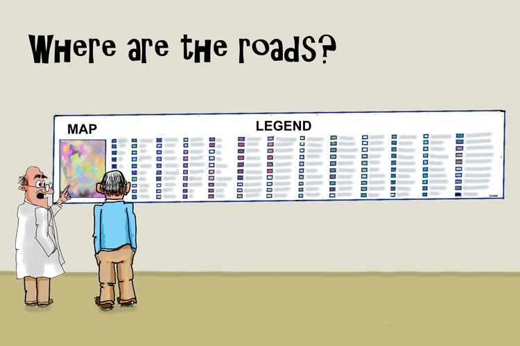
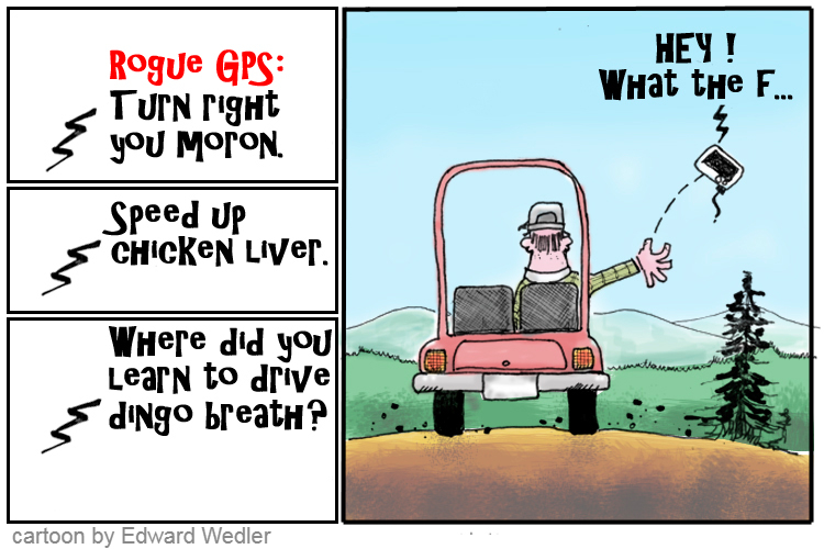
Cartoon by Edward. Lots of community information, but we always miss something.
Throughout my career at COGS I have been a proponent of understanding our geography and its relationship to both physical and mental health. This means access to information, for example:
Walking, bicycle and canoe trails. Maps and description
Access to businesses and services in the landscape: location, hours, services
Health services, education/library resources
Voting, community planning services
What is needed to make this a reality?
Access to the resources at the NSCC, Annapolis campus:
courses, workshops, seminars:
Information on self-guided tours
Material in both electronic form, and printed hard copy
The bottom line is that members of our rural society (in Canada) need access to geographic information to keep healthy.
PROPOSAL Expand the capabilities of CORAH to include access to geographic information related to the resources that support an ageing population and their mental/physical health.
What does that mean? Information related to our current landscape and information on how to access these resources (both electronic and hard copy).
If we implement a CIU, it must be portable, and the concept transferrable to other rural geographies.
Acknowledgements
This morning, I met with David MacLean at COGS. He helped me troubleshoot the WordPress software. He also offered helpful feedback on the CIU concept. Part of the problem is that access to geographic information does not arrive in the form of a ‘utility’ — just turn on the tap, or switch on the light.
Thanks to Brian Arnott and Edward Wedler for their encouragement in this pursuit.
EMAIL NOTES FROM EDWARD During the writing of this CIU concept, Edward offered some observations and views. Food for thought.
ESTONIA You have a great opportunity to advocate your “Community Information Utility”. Like having on-demand access to water when we turn on the tap or to electricity and light when we flip the switch, we should have ready access to [data] and to what is happening in our backyards.
I would argue that one of the most plugged-in countries in the world is Estonia; a potential CIU role model.
“Over the last decade, Estonia has constructed a system of digital infrastructure that made nearly all of its government services available online. 99.9% of Estonian public services are digitally accessible. This includes everything from filing taxes to viewing healthcare records to voting in federal elections.” (Wiki)
THE CIU IDEA
I do take issue with [your colleague’s] sentiment, “Part of the problem is that access to information does not arrive in the form of a ‘utility’. Just turn on the tap, or switch on the light.“
I couldn’t disagree more. The fuel for this information utility is US; as in you, me and others — in the form of social media, the internet, big data, AI, “Hey Siri …”, “Hey Google …”, etc. We “turn on the tap” daily when we go to YouTube, request auto-route directions when we travel, or click on the weather button. WE are the utility. It’s a matter of feeding the utility (like rain), storing the utility (like dams), and distributing the utility (like pipes and taps). Look at Google Maps and Street View. As I travel the Google terrain, I discover the coffee shops and restaurant locations. I click on one and find their hours of operation, their contact info and much more.
Check out the Fisherman’s Cove Gallery where I post my art, for example. https://tinyurl.com/2yy99p3h or the painting locations for artists in the Annapolis Valley and HRM tinyurl.com/PleinAirMap (clicked now 30,000 times).
Isn’t that Community Information?
What we need to develop is a common way to access that information. Maybe this is where search engines and AI voice inquiries play a role. Maybe … we already HAVE a community information utility. We just need to feed the utility for it to be of value to our communities.
Maybe we are asking the wrong question about CIU.
Let’s not ask, “Do we have a CIU?” (because I think we already do) but “Do we have a CIU that best serves our [local] communities’ interests?“
On Sunday, Heather had attended Shambala Meditation at the hall and had accidentally left her jacket on the hook.
We arrived early and stopped at JoAnn’s Chocolate Shop & Café and bookstore in Annapolis Royal for a take-out coffee. The books were irresistible. Picked up two.
Good news. The hall was open at 1:15 pm and we retrieved the jacket from the hook. Afterwards, we stopped at Bob and Dessie Howard’s house outside of Granville Ferry. Bob gave us a wonderful tour of his garden; in particular, hydrangeas, and dahlia species. The conversation covered the history of market gardening in both England and North America. Bob has spent a career, tending a range of species, growing different varieties from seed.
Buoyed by the conversation, we decided to explore the Nova Scotia landscape on a beautiful September day. We headed to Victoria Beach.
Sketch at Victoria Beach by Edward
This reminded me of our need to fully appreciate the geography of Annapolis County. We drove to the end of the paved road. En route, we noted the changing colours, the beautiful houses – the domes, and the Mare Gold retreat at the end. We marvelled at the residents who drive this road. Like, Russell who runs the Mare Gold bookstore in Annapolis Royal (see An Authors’ Market) .
Before setting out for Granville Ferry, I had stopped at CORAH to register for sessions later in the week. I had the inspiration that CORAH, the Centre of Rural Aging and Health could benefit from a Community Information Utility. But that is another blog post, for another day.
The drive to Victoria Beach, the conversation with Bob Howard reinforced the need for a better understanding of our landscape. Beyond, the simple economic view of the landscape as a resource for exploitation.
Both Jeff and David worked at COGS/AGRG. Besides teaching, David was responsible for a network of climate stations. David has retired. Jeff works for the NS Department of Agriculture. Both Jeff and I left COGS in 2011.
Part of the conversation was about the status of agriculture in the Annapolis Valley. Anyone driving through Clarence will have noticed the increase in vineyards on the slopes of North Mountain.
Talking with David, I was interested in the region’s microclimate network status (see the post COGS Weather Network). Talking to Jeff, I was interested to hear about the use of technology in support of resilient agriculture.
In recent years the college has introduced a Forestry Geomatics program. Both of these Agriculture and Forestry programs would demonstrate the application of a suite of geo-technologies to different parts of the landscape.
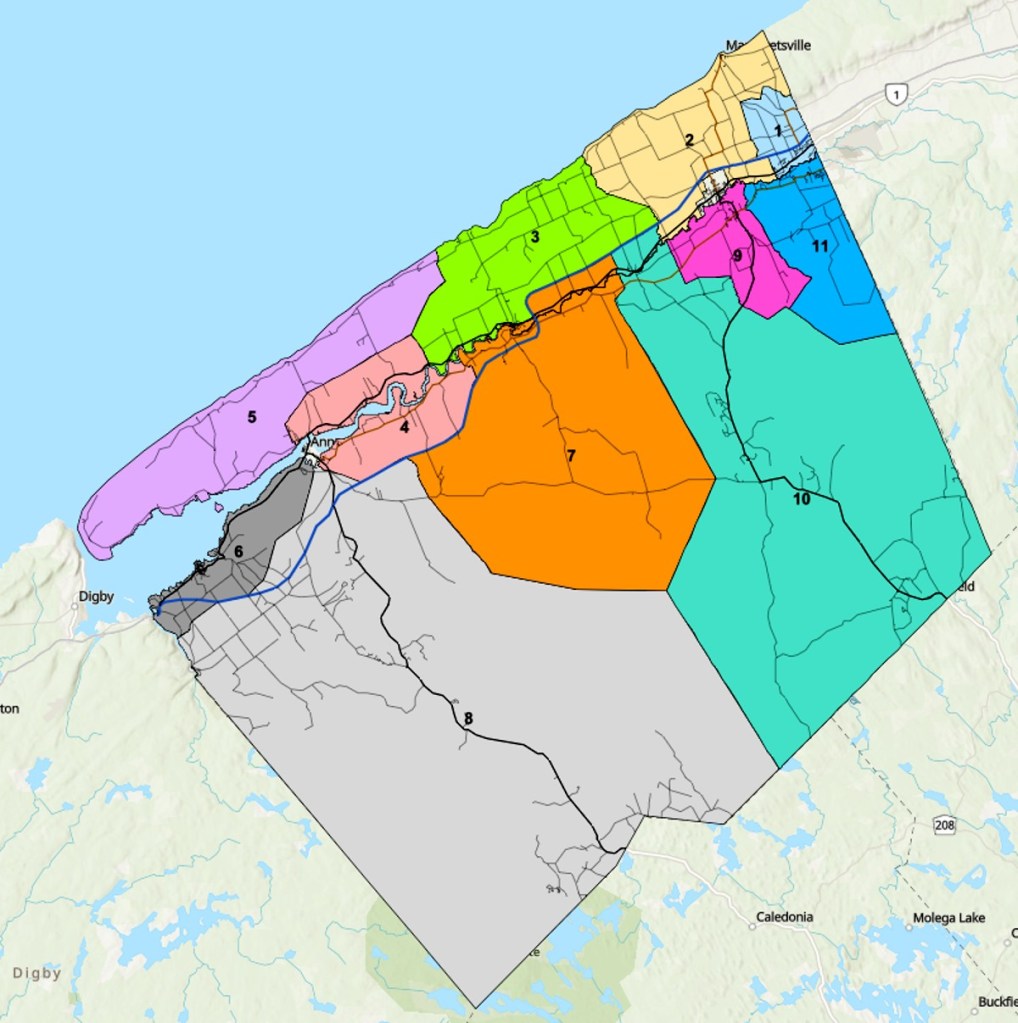
In my previous blog post, I noted the lack of district maps for the town of Middleton. I stand corrected there are no districts within the town. The town’s administrative structure is a Mayor ( Gail Smith) and six council members. In Annapolis County, we have eleven districts. If you wish to discover your district, you can go online, Google search Annapolis County Election District Map and enter your civic address.
Annapolis County Municipal Districts
Acknowledgements
I want to acknowledge the creativity of Edward Wedler. Edward added the links and graphics. He also transformed the original title ‘Agriculture Geomatics’ into ‘In-Cider talk’.
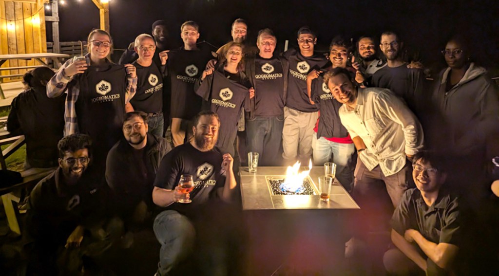
On Friday, GoGeomatics hosted a back-to-school social at COGS (see previous post A Hidden Gem: Harbourville). It included a series of short presentations in the AV room by Tim Webster, Colin MacDonald, Jon Murphy and Ted MacKinnon. The audience was primarily COGS students and a few friends of COGS (e.g. Cliff Drysdale, Simeon Roberts and myself).
The meeting theme was extreme events and climate change; in particular coastal flooding and forest fires. The speakers were forthcoming about the role of Geomatics technology in their work and careers.
Afterwards, GoGeomatics hosted a social evening at the Capitol Pub in Middleton. This allowed for further interaction across the generations.
The event gave me ‘food for thought’ especially in relation to ‘geographic information’.
My memories take me back to the 1980s. NSLSI (later COGS) was looking to bring new technology, computers, into land surveying, cartography and planning. Today, we live in a technology-driven world — computers, cell phones and the Internet. In the 1980s we had three departments: Computer Programming, Surveying and Cartography/Planning.
Later, we renamed the institution to the College of Geographic Sciences and added the Applied Geomatics Research Group. Today, the technology drives learning. Many students attend COGS online. thus missing much of the physical geographic context of the local landscape.
Listening to the speakers, I wondered what had happened to ‘geographic information’. We started with geographic information systems (GIS). GIS included access to many sensing platforms and devices: satellites, aircraft, drones, LiDAR, etc.
The next day (Saturday) I received a back door visit in Middleton by a candidate for town council. She explained the challenge of trying to obtain a base map defining her district.
This made me wonder. What has happened to the cartography and planning programs at COGS? How were they serving the citizens?
Over a decade ago I remember promoting the concept of a ‘community information utility’. Where did that go? Today, the only evidence of different districts are the signs in town, as we go into a municipal election.
CONCLUSION
It is tremendous that COGS’ reputation draws students from across the country, and beyond. It is excellent that the graduates have access to modern technology. But, as a society, are we increasing our understanding of the local geography? If candidates for the municipal election have to scramble for current mapping, we clearly do not have a ‘community information utility’. We are missing the opportunity to showcase the history and talents of COGS for the betterment of citizens and groups in the Annapolis Valley and beyond.
How do we bridge that gap?
POSTSCRIPT
I just discovered in the basement, after our move:
“Mapping our Common Ground. A community and green mapping resource guide” (download PDF HERE).
We went to New Glasgow on the weekend to celebrate John’s 95th. Birthday (Heather’s Dad). On the way home we turned off Highway #101 at Berwick. I wanted to check out Harbourville on the Fundy shore.
It is a delightful, isolated harbour focused on crafts and fishing. How many of these communities can be found off the beaten track?
(Harbourville watercolour by Edward)
On our return to the Valley, we passed through Burlington. The site of one of our protests against the spraying with glyphosate (read a previous post: Citizen Celebration in Burlington). It is that season; once again the provincial government ignores the concerns of its rural citizens.
There will be presentations at COGS in the AV Room, 3-4:30 pm on Friday. Followed by a meet and greet at the Capitol Pub in Middleton, 5 pm onwards. This is an annual event promoted by Jon Murphy and GoGeomatics Canada across the country. Jon graduated from COGS in the early 2000’s, alongside Ted MacKinnon and many others.
My interest remains in the application of these technologies to the local economy, whether agriculture, forestry, fisheries, mining or tourism. Decisions on rural economic development are contingent on current geographic information detailing the local landscape and the people.. Fortunately, COGS (and the NSCC) has access to current technology, faculty, students and researchers, who can apply these tools to our understanding of the modern rural economy.
One of the interested buyers of our Paradise property wanted to take the trail up to the Inglisville Road. Today, we checked out the trail condition and markers.
We made it easily to the powerline. Afterwards, we spent time finding the linkage to the property boundary. Fortunately, we had hired Grant McBurney, surveyor at COGS, to mark the eastern boundary with a series of red posts and monuments. At the top of the mountain, we followed the stone wall field boundary to the Inglisville Road.
The return to our house was simple. Follow the road until you reach the junction with Highway #201. Head east to home.
In the future interested parties can follow our flagging tape or request an escort service. The total trip lasted over two hours. Heather and I benefitted from the exercise, as well as memories of earlier walks. Highlights would be the stands of mature hemlocks, and the rich flora of lichens and fungi.
When the property sells we shall miss the walks. Instead, we shall have to find the equivalent closer to Middleton.
Heather and I have been reading books on the importance of walking on the aging process, especially memory loss.
Today’s challenge was to return to Paradise and walk through Andrew’s property (#6325) down to the Annapolis River and across to the old Lawrencetown tree nursery. We wanted to check on the condition of the trail, as well as any cutting by Nova Scotia Lands and Forest.
After checking the trail through Andrew’s property (now owned by Rob and Sinead) I returned to #6326 and took the Z-track for a drive down to the Triangle field. This will keep the route open for the current owners.
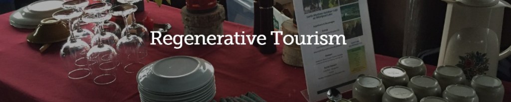
Heather and I used this trail to conduct guided walks through the property (See post Preparing for Experiential Tourism). This was organized in conjunction with Celes Davar, Earth Rhythms. There is a short piece in the September issue of the Grapevine on his work on Regenerative Tourism in the Annapolis Valley.
Given the logistics of the house move, I have had little time for reading. This week, I did manage to finish Paul Colville’s Return to Belleisle. Paul had given me a copy a few weeks ago. In particular, I was intrigued by the historical fiction, where he had added a cast of characters to historical events in the Belleisle region. It made me want to understand in more detail the changes in the population and the landscape and to see a map of those changes over the last 250 years. Today, I see evidence of the earlier Acadian presence, but also the livelihood of Rob Warren and his maple syrup business.
I think our next walk will be from our property on Highway #201 up the mountain to the Inglisville Road. That is for another day. And keep ‘walking the talk’.
References
Paul Colville, 2024, Return to Belleisle, Printwright Printing Services, Bridgetown.
On the weekend, Heather and I walked down through the marsh below our new house to the Annapolis River. We were interested to check out the riverine vegetation species.
Yesterday we were surprised to hear the sound of a tractor. They were cutting the marsh grasses for the hay. This reminded us that it is that time of year for the farming community.
With good intentions, we are increasing our daily walks. Today, it was back to Valley View Park. At our regular parking spot on the Hampton Mountain road, we found the entrance to the Chalet Road trail. Previously, we had hiked this trail to the communication tower.
The trail had not been maintained, however we did locate new chalets, as part of the Hampton Mountain Chalets. We came back to Hampton Mountain Road via Dragonfly Lane. This proved to be about an hour-long walk.
Invigorated, later in the evening, we loosened up the legs with a short fifteen-minute stroll around the CARP Marsh Trail.
Edward sent me a link he judged to be a challenger to Esri’s StoryMaps in Newfoundland and Labrador.
“Create a digital book and share your story with the world.” These are the words of Newfoundland’s storyexchange.com
This platform may be an effective way of sharing place-based perspectives that are not “map-centric”.
Today, we went to Kings County Honda in Kentville. On the information panel for our 2021 HR-V we previously received a notice that we needed a B1 service. We made an appointment. It was three weeks away. Meanwhile the notice changed to a B13 service.
After arriving at 8 am, we were offered a shuttle ride to downtown Kentville. We declined hoping the service would only take 1-2 hours. In fact, it took three hours.
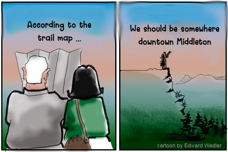
After we left Kentville, we noted the following message. Turn by Turn. Waiting for Smartphone Guidance.
By the time we arrived home for lunch , we were exhausted. What had started as a routine service at the Honda dealer, had turned into a confusing conversation with automobile technology.
Who had turned on the requirement for Smartphone Guidance ? Do we need to return to the dealer to answer the question? What happens, if you are not ‘smartphone savvy?’
Even though, we have owned the HR-V for almost a year, we still have problems with the START/STOP button. It can be far too easy to leave the car running. What used to be a satisfying/ personal visit to your friendly car dealer has turned into a marathon exposure to ‘controlling technology’.
On a very different note, yesterday, we walked the road to the communication tower above Valley View Park. En route, along the roadside, we noted a couple of patches of Agalinis neoscotica (see previous blog on this species).
Postscript
It really is time to thoroughly read the Owner’s Guide for Quick Reference 2021 HR-V.