Somehow, this discovery seems to bode well for the collaboration between Christian and myself (see Mapping the Geography of Places) Christian Gastmeier and Bob Maher.
Postscript
While no picture of the commemoration stone from the family could be located, a description of Gerard Manley Hopkins’ poetry was found, described in Frances Cafferata’s MA Thesis Dissertation from the University of British Columbia, “Gerard Manley Hopkins’ use of nature in his poetry“.
This weekend, I made contact with Christian Gastmeier. He is a student at COGS working under the supervision of David MacLean. He is working remotely from Sudbury, Ontario. It is a capstone project: developing an AI-driven NLP pipeline for Spatiotemporal extraction.
I have included two paragraphs from his proposal:
“ Background
Since 2013, Bob Maher has maintained an extensive digital record of geographic observations through his blog ‘The Ernest Blair Experiment’. This body of work contains over a decade of high-fidelity local knowledge regarding the Annapolis Valley. However this data is currently ‘unstructured’, existing as a narrative text rather than a spatial database. Transforming this narrative into a Geographic information System (GIS) requires Natural Language Processing (NLP) to bridge the gap between human story telling and provincial resource management.
Purpose
The purpose of this project is to develop a reproducible cloud-based AI pipeline using ArcGIS to extract geographic themes from unstructured text. Leveraging the full ArcGIS online (AGOL) suite this project will:
automate extraction
Geocode and Validate
Cloud- Native Visualization
Multi-media Integration
System Scalability
Where things stand today (Monday, May 4,2026) ?
Christian emailed his Capstone project proposal
We had telephone conversation
Bob agreed to provide hard copy ( 13 volumes of his ernestblairexperiment blog
Christian is working remotely from Sudbury, Ontario.
Deliverables:
Spatiotemporal Cloud Database
Automated Extraction Pipeline
The Ernest Blair Digital Atlas
This blog will be sent to a wide range of industry/academic partners.
If you are interested in the full project proposal, contact Christian at W0529818@nscc.ca Future blog posts will track our progress.
Edward is unavailable for a few days. He suggested that I post this blog, as is.
We arrived in Annapolis County in 1980. I had accepted a teaching position at the Nova Scotia Land Survey Institute (NSLSI). It was to teach applications of mapping software in an intensive one year program (48 weeks) in Scientific Computer Programming. Heather and I, with two young boys (Patrick and Andrew), moved from Ottawa (National Museum) to West Dalhousie. We rented what was known as the Ernest Buckler house from Bill O’Neill. He and I commuted down the Morse Road to Bridgetown, and on to NSLSI in Lawrencetown.
After a couple of years, we moved to Clarence East, neighbours to the Barteaux, Elliot and vanRoestel families. In 1988, we moved to Indonesia, California, Ontario (Peterborough) and BC (Victoria) before returning to accept the position of Senior Research Scientist with the Applied Geomatics Research Group (AGRG) at the NSCC in 2000. At that time we purchased a house in East Paradise on Highway #201. Now, in 2026, we have relocated to Middleton.
Throughout our time in Annapolis County, we explored the Bay of Fundy coast, the Annapolis Valley and, to a limited degree, North and South Mountain. Despite our familiarity with the local Geography, we had never been to East Dalhousie.
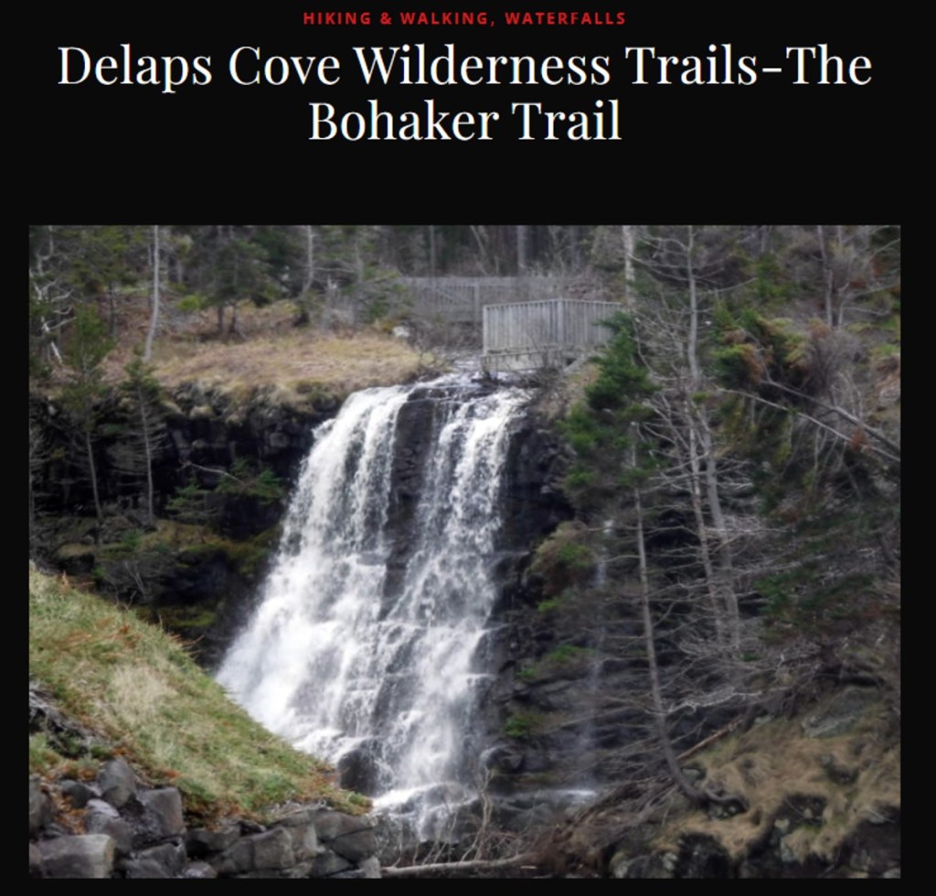
Given the forest fires last year (see Trial by Fire), I wanted to visit Lake George and Lake Paul. We started out, gassing up the car in Berwick. Moving up onto South Mountain, it is very evident why Berwick is considered the “Apple Capital” of the Valley. From Morristown, we passed through Lake George and Lake Paul reaching the Dalhousie Road, where we turned west to East Dalhousie at the Kings County/Annapolis County line. At East Dalhousie, we turned South on the Cherryfield Road. The Cherryfield community is on Highway #10. Afterwards, we headed North, back to Middleton.
Three significant observations were made on travelling the backroads of Annapolis County
Access to good maps is essential. We always have a copy of the Nova Scotia Atlas in the car. In this case, the seventh edition.
The forests of South Mountain are remote and relatively inaccessible. Given the nature of climate change, there is a high probability of forest fires by lightening strikes. This happened in 2025. The management of these forests is critical, not only for remote communities, but also the proximity to the communities along the mountain slopes — not a time to reduce the resources and capacity of NS Lands and Forests.
It is very evident from the signage on individual driveways that the public, individual land owners, are concerned about the mining of uranium. Without travelling these back roads, the average politician/ civil servant would not understand the public concern.
A final comment.
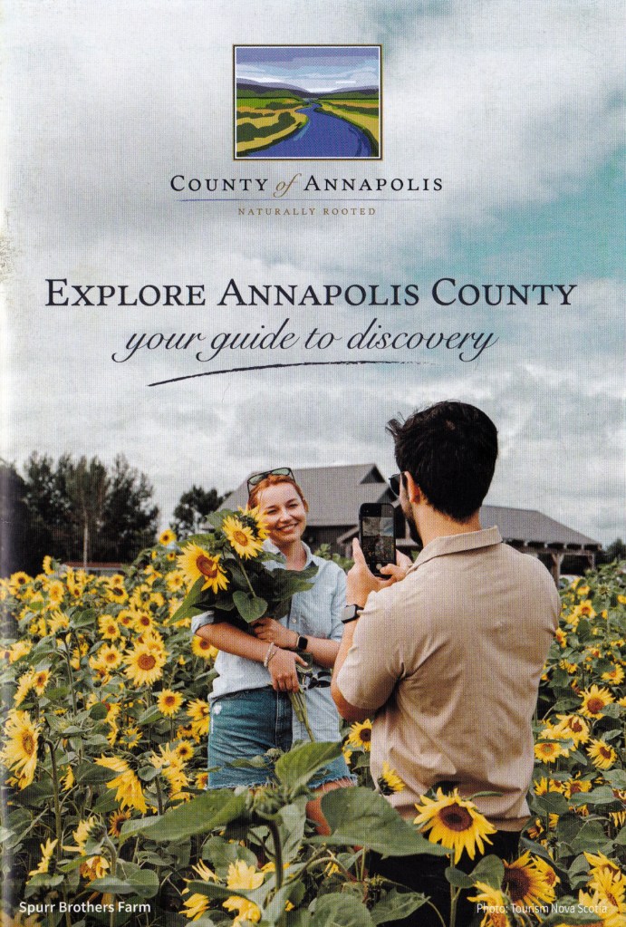
The county provides in the mail, “Explore Annapolis County: Your guide to discovery” an excellent publication – BUT NO MAPS ENCLOSED.
The drive through the back roads of Annapolis County was a revelation. And yet, we have known the geography since 1980 (approaching fifty years) on and off, and have been part of the history of the College of Geographic Sciences (COGS).
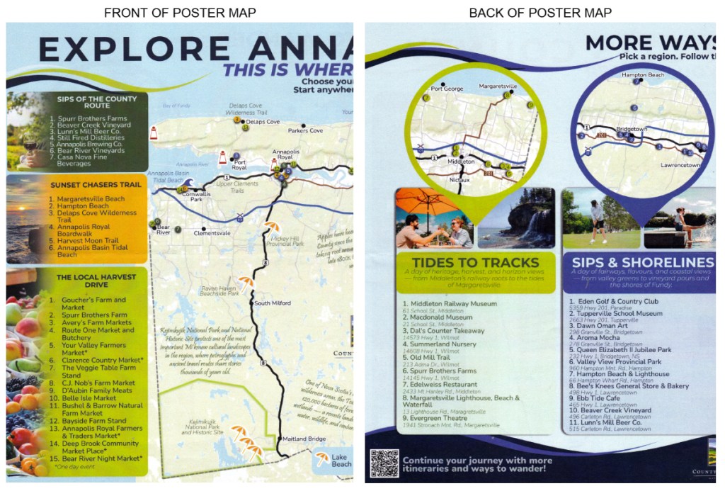
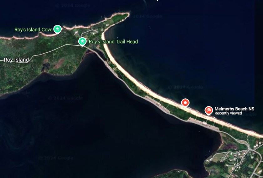
Edward visited the Annapolis County booth during the recent Saltscapes Exposition in Halifax. At the booth he did get a poster map, “Explore Annapolis County: This is where you wander”. The County marketer told him that the map promoted exploration “Choose your own adventure. Start anywhere. Go everywhere”. In essence it was thematic in nature.
A portion of the poster map is shown, above. A couple of QR codes on the back invite explorers to “Continue your journey with more itineraries and ways to wander”.
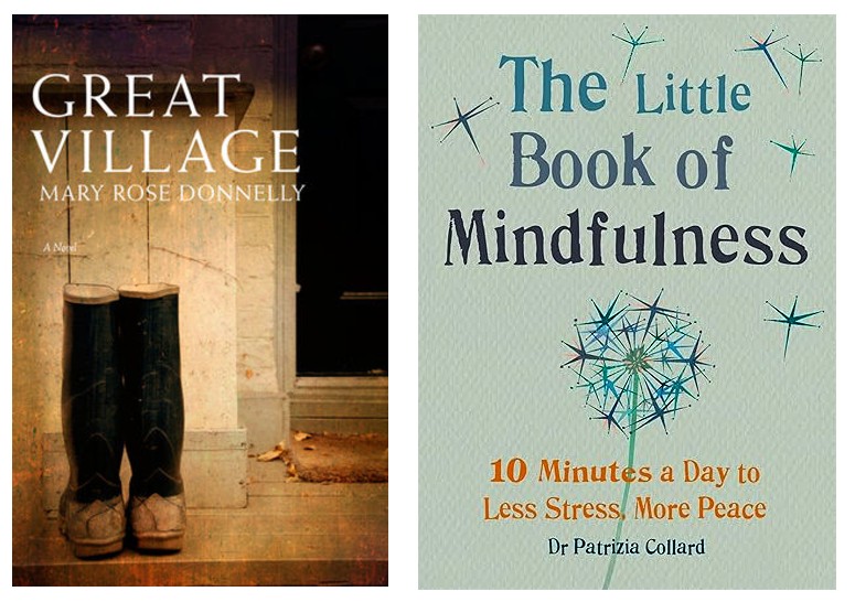
In response to my blog, Sandra Barry had referenced Mary Rose Donnelly’s ‘Great Village’. I am also aware that Sandra is a resident too of Middleton, and has written extensively on the life and times of Elizabeth Bishop (see Eccentrics in Paradise and One, Two, Three).
First and foremost, Tatamagouche and Lunenburg are very different communities. One is a university town; the other is a historic, sailing and tourism community.
Yesterday morning, we took Highway #10 across to the South Shore. The road was empty. The landscape is forested with evidence of fires and tree harvesting. Through New Germany to Bridgewater; on Highway #102 to Blockhouse and Lunenburg, our destination was Lunenburg Bound, the bookstore and the bakery/coffee shop next door.
The bookstore is excellent, both new and used books are well catalogued.
What did we find?
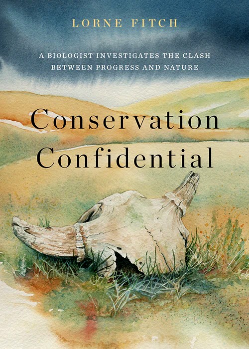
For Heather, Lorne Fitch ‘Conservation Confidential’. ‘A biologist investigates the clash between progress and nature’. Praise from Sid Marty(back cover)
We also took advantage of our geography — time spent in Antigonish. We had been recommended to stop at the Curious Cat Tea and Books in the mall. We found four books; three for Heather and one for me. Still looking to find the fourth for our luggage.
My knowledge of St Francis Xavier University goes back to awareness of the Coady Institute.
The book starts with an excellent quote from Rumi. “Yesterday I was clever, so I wanted to change the world. Today I am wise, so I am changing myself.“
At the Highland Mall in New Glasgow, I found a copy of Donald Savoie’s biography of John Bragg, The Rural Entrepreneur. It details his efforts with Oxford Frozen Foods and EastLink. Savoie provides an excellent description of the creative rural economy in Nova Scotia.
While in Pictou, we stopped at the deCoste Arts Centre and the accompanying library. I signed out Edward MacDonald’s, The Geography of Home: Poems for a Lost Time. A different example of the creative rural economy; in this case, the setting is rural PEI.
Today, I received online, the March newsletter of Atlantic Books entitled ‘Defend Nova Scotia Books’.
“One of the biggest clouds on the horizon this month has been the looming threat of planned cuts to Arts, Culture and Tourism funding by the government of Nova Scotia”.
Yesterday, we were at the grocery store in Kingston. At the checkout, I noticed a special edition of Time magazine: The Science of Memory. The Story of our Lives. Building a Sharper Mind, Erase Bad Memories. A New Understanding.
I decided it was time to go down ‘Memory Lane’. First stop was the COGS Library. Even though it was March Break, Andrew Hannam was on duty. He allowed me to preview recent additions to the collection. I signed out.
Afterwards, we determined that it was time to go down ‘memory lane’. We parked on the Hwy #201 at the Lawrencetown Tree Nursery, opposite Peter Redden’ property. We walked through the Nursery to the Annapolis River. Down stream towards Bridgetown. At the property line of Andrew’s property (now owned by Rob and Sinead) we headed, back to Hwy #201. Checking my watch back at the car,the total loop took an hour.
We lived at #6326, Highway #201 from 2000-2024. During those years, we had a number of different dogs, inherited from our sons: Bodhi, Ukaliq and Siqsiq.
It was a pleasure to recall the flower species along the trail: orchids as well as various mosses and lichens. Not surprisingly, we were able to find the trail, even without the remnant flagging tape.
Acknowledgements
To Rob and Sinead for maintaining the land and the orchard. Andrew Hannam for maintaining the book and map collection. Edward is away in Ontario without access to the EBE site. No graphics or links this week.
References
Special Issue of Time magazine. The Science of Memory. Spring 2026
Postscript
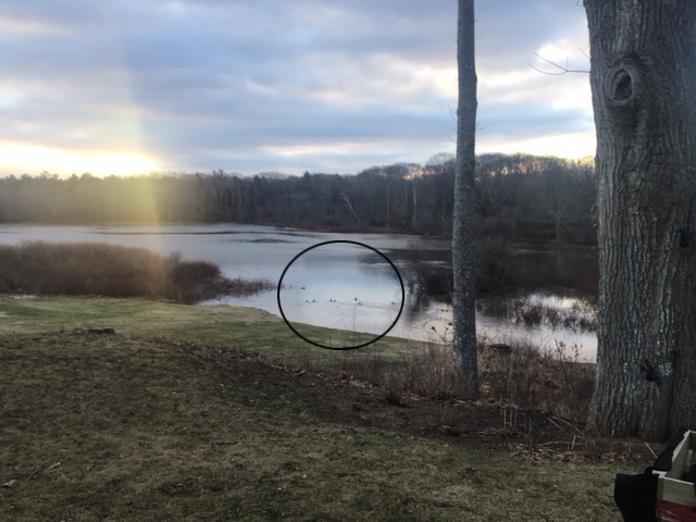
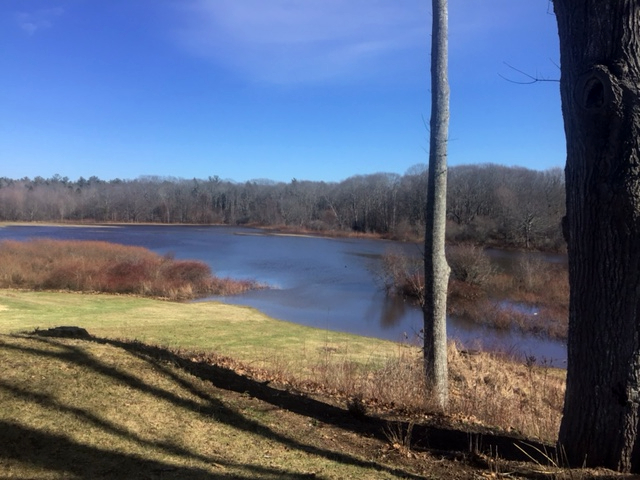
This morning, the large hay field down on the flood plain had turned into a lake. The ducks and geese entertained us, swimmingly !
This morning, I attended a workshop at CORAH, Middleton. It combined asset mapping, community and student learning. Topics included environmental stewardship, life-long learning, economic and business opportunities.
There were six stations. At each station, participants were encouraged by Ed Symons’ students to update the community map using their expertise and local knowledge. The feedback will result in a revised set of community maps.
I arrived with my iPad and a hard copy set of my blog posts over the last ten years (see my post Applying AI to Geography Mapping). Quickly, I recognised that my interest in combining two technologies (AI and GIS) was irrelevant to the workshop task at hand. Check out my blog theme in that post Community Mapping with Purpose: Identifying local resources and challenges through the lens of a geographer.
Thanks to Ed, Jennifer and Jaime for hosting the event. I look forward to seeing the revised maps in the weeks ahead.
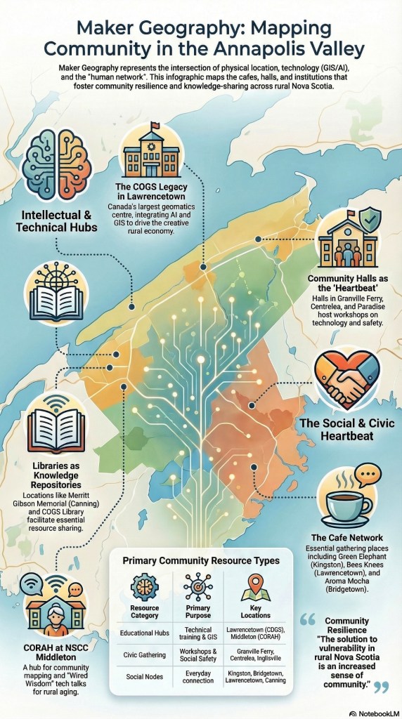
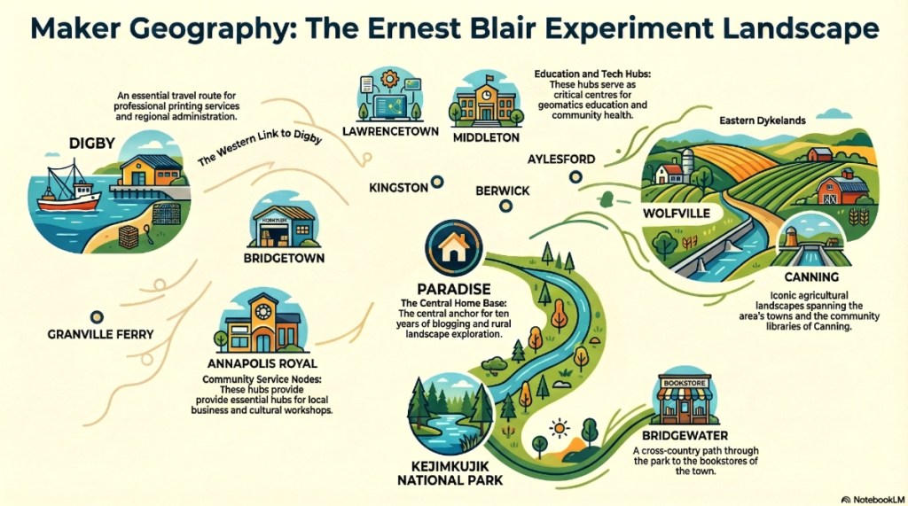
The ultimate objective of Maker Geography is the construction of a resilient human network where technology and social infrastructure overlap. Technology alone cannot solve the vulnerability of rural life; it requires a “human network” to provide context and support. When technical expertise at COGS is paired with the physical hubs of community halls, the digital divide is bridged, and regional social capital is strengthened.
“Community Mapping with Purpose” focuses on identifying local resources to build a stronger human network and address rural challenges.
Examples of local resources that communities might map include:
Participant Networks: As seen in the CORAH-NSCC collaboration, maps may also track the distribution of community participants across a region to better understand engagement and needs.
Community Halls: These are described as the “heartbeat of rural life” and essential for fostering a sense of community,. Specific examples include the halls in Centrelea, Granville Ferry, Lower Granville, Paradise, and Inglisville,.
Gathering Places and Cafes: Local social hubs such as the Bees Knees in Lawrencetown, Aroma Mocha Café in Bridgetown, The Green Elephant in Kingston, and the ArtCan Kitchen and Studios Cafe in Canning,.
Educational and Technical Institutions: The Centre of Geographic Sciences (COGS) and NSCC campuses, which provide geomatics technology and human resources to the region,.
Public Libraries: Specifically mentioned is the Merritt Gibson Memorial Library in Canning.
Recreational Areas and Trails: Local parks and trails like Middleton Riverside Park, the rails-to-trails loop, and Kejimkujik National Park (specifically the Peter Point trail),.
Local Businesses and Specialized Services: Small businesses that support the community, such as Stoney Beach Computers, Bridgetown Watch and Clock Repair, and Valley Flaxflour Ltd.,,.
Postscript
Edward is away in Ontario, checking out AI adventures in the Niagara area.Thank you, Edward, for adding the Maker Geography graphics.
Edward has been helping me understand the potential of AI in the conversion of my blogs into geographic topics and locations.
Below, he has used AI tools to identify common themes from over our ten years of blog posts. Based on a quick “digital flyover” of the ErnestBlairExperiment, ten preliminary themes were found. The AI explainer video, below, takes up, for example, the “Maker Geography” theme.
Maker Geography: The shift from passive observation to active “making” (art, maps, and community projects).
The COGS Legacy: Reflections on the Centre of Geographic Sciences and the evolution of Geomatics education.
Plein Air & Extended Memory: Your journey with art as a way of imprinting landscape onto the soul.
Connecting the Dots: How disparate ideas—like a walk in Kejimkujik and a technological shift in GIS—are linked.
Community Mapping with Purpose: Identifying local resources and challenges through the lens of a geographer.
The “Ernest Blair” Philosophy: Exploring the interplay between George Orwell (Eric Blair) and the local literary spirit of Ernest Buckler.
The Rural Creative Economy: How hidden gems in Nova Scotia (and beyond) sustain culture and economy.
Technology vs. Ground Truthing: The balance between high-tech (AI, Lidar, Drones) and the “boots on the ground” reality.
Environmental Stewardship: Reflections on climate change, the Acadian forest, and “walking the talk.”
A Shared Journey: The story of a 50-year collaboration between two geographers/artists.
The next step would be to map the post locations and perhaps add interactivity. We hope that this can be achieved in collaboration with the students in David MacLean’s GIS program at COGS.
When we interrogate the COGS LEGACY over all these posts, several defining characteristics emerge.
Technological Evolution:
The curriculum at the Centre of Geographic Sciences (COGS) has continuously adapted, now heavily integrating Artificial Intelligence (AI), GIS, and Geospatial Data Analytics to enhance the analysis of complex geographic information.
Industry Leadership:
A core component of the legacy is its Industry Expo, an annual event that connects students with major organizations like Esri Canada to address the shifting needs of the geomatics sector.
Community Integration:
The legacy is not confined to the lab; it extends into the “human network” of the Annapolis Valley. This is exemplified by initiatives like “community mapping with purpose,” where instructors and students help rural residents map local resources and identify community challenges.
Academic Stewardship:
The author’s personal connection to this history is cemented by his role as Geographer Emeritus at COGS, where he continues to document the institution’s impact on the “creative rural economy”.
By putting the AI results in the ErnestBlairExperiment blog, we hope to demonstrate the potential of combining these technologies. As usual, both Edward and I would appreciate any comments and feedback.
Time flies. Next week, Ed Symons hosts ‘ Love where you live’ . A seminar on Community Mapping with his students at CORAH.
This week, there was a rally at the Kings Theatre, Annapolis Royal on ‘Nova Scotia’s Arts, Heritage and Culture’ under threat. I was running late, but did enjoy the videos produced by MapAnnapolis.
The question for our MLA, David Bowlby, centres on the ‘creative rural economy’. In the Annapolis Valley, we are fortunate to attract artists, writers, musicians. This stems from our long history and culture. This, in turn, attracts tourists to the region.
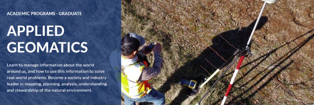
The other unique institutional feature is the Center of Geographic Sciences in Lawrencetown. This provides access to the latest technology in both AI and the Geographic Information Sciences. This should be recognized and promoted at the international level.
Esri Inc. Spring visit, February 24 and 25. Because of weather, scheduled to be delivered on Teams.
I remember well, establishing the joint M.Sc between NSCC (myself) and Acadia University (Ian Spooner). I also remember, each year Esri Redlands would send their recruiting staff to interview students in the graduating class.
As usual, I visited the COGS Library to check out new publications.
After COGS, we stopped at Bees Knees. There, I bumped into Larry Powell, retired reporter and writer for the Annapolis Valley Register. I asked him ‘what are you doing in retirement ?’. He mentioned that he had been writing blogs for MapAnnapolis. Thus I contacted Heather Leblanc. She forwarded the web site and the link to Larry’s blog ‘Mapping Matters’.
From the perspective of the ernestblairexperiment, this connection highlighted the need to go through my ten volumes of blogs, and identify the location of the resources in our regional geography. This could prove to be an excellent student project.
Final point, it is wonderful to see Bees Knees acting as a community hub for citizens in the Lawrencetown area. It also provides a close link to the people and resources at COGS.
“Most of his writing is on Facebook which is posted about three times per week. Not sure if this will open if you are not on Facebook. To date we have 6,785 followers and an average of over 225,000 views per month.” : Project Designer, Heather Leblanc.
Postscript
In walking the COGS corridor, I noted a new map by David MacLean. It is a map of the world, with pins indicating the location of known COGS graduates. Good work!
Acknowledgement
Thank you to Edward for persisting with the graphics and links. Sometimes, a bit of a thankless task.