Posted in biographical sketch

Family Matters

This weekend, we went to Windsor to see the Student Art Exhibition at Kings Edgehill School (KES), curated and organized by Sandy Stewart, Heather’s sister.

We stopped for lunch at the Schoolhouse Brewery.


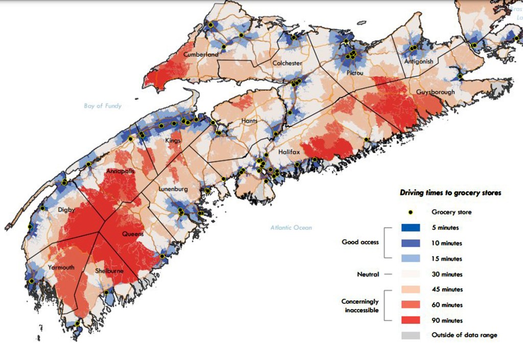
While in New Glasgow, we checked out accommodation for our family reunion this August. Traditionally, this would be at Pictou Lodge however after the hurricane, about two years ago, it remains closed.

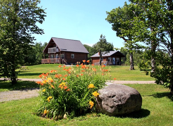
We found a replacement at Smith Rock Lodge & Chalets atop Fitzpatrick Mountain, near Scotsburn.

Again, we noted the devastation to the forests in the region. It will take a concerted effort to repair the damage.


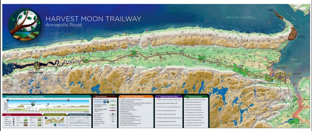
Earlier in the week, Edward stopped in, on his way back from Annapolis Royal. We were able to grab coffee at Bees Knees and take it down to the Annapolis River. It has been many months, with Edward away in Florida. It helped me set my direction for the CSRS keynote talk in June.


This week finished reading The Dome Chronicles (see post “The Secret”). I discovered that Garry Leeson’s home base is Harmony, on South Mountain, up behind the Canadian Forces Base, 14 Wing Greenwood.

This week too, I heard from Simeon Roberts. Apparently, the Valley Regional Economic Network (VREN) is exploring the application of GIS technology for site selection in the region. Simeon reminded me that we had been promoting the concept of a community information utility for several years (see previous posts “The Geographic Sciences and Regional Development” and “Community Innovation“).


Finally, Heather and I enjoyed Wednesday night movies at King’s Theatre in Annapolis Royal — Five Hundred Days in the Wild, Dianne Whelan’s six-year journey travelling the Trans Canada Trail,

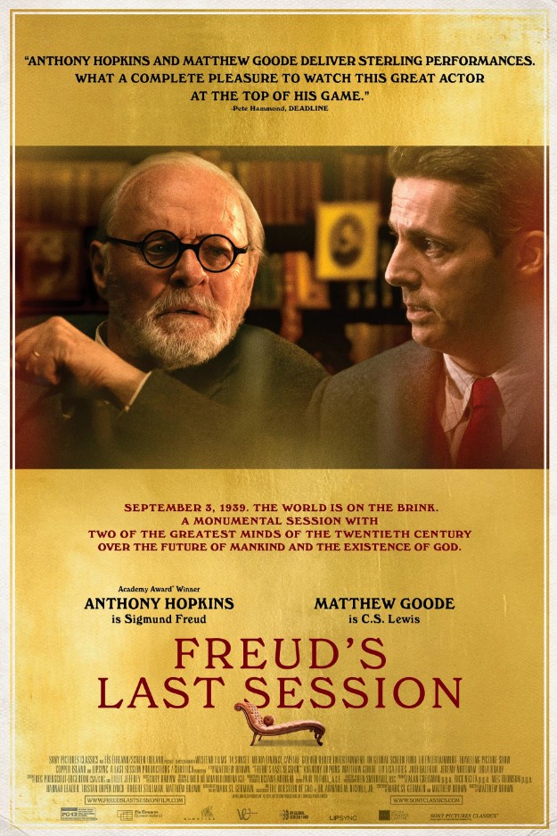
and then Anthony Hopkins, One Life about saving Czechoslovakia refugee children in the Second World War.

Acknowledgements

Heather and I enjoyed both the Art Exhibition at KES with Sandy and the drive to Scotsburn with Jay. Edward and Simeon offered useful feedback.

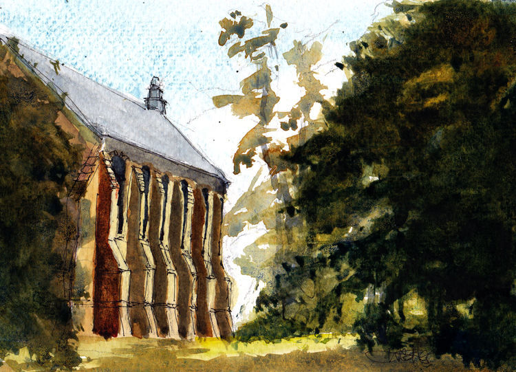
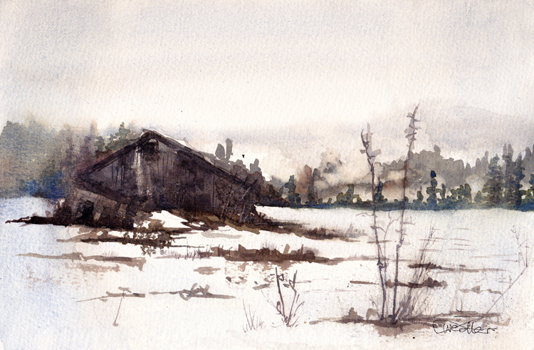
Edward once painted Convocation Hall at King’s Edgehill School en plein air, in watercolour.

References

Gary Leeson, 2019, The Dome Chronicles, Nevermore Press via Nimbus Publishing.
Smith Rock Lodge and Chalets, Scotsburn, www.smithrockchalets.com
Valley REN Site Selector Tool

Posted in biographical sketch

Back Story

Last weekend, I met with John Wightman to discuss the transition from the Nova Scotia Land Survey Institute (NSLSI) to the College of Geographic Sciences (COGS).

John reflected on the structure of the programs, and the need to fill the new building in Lawrencetown.

In 1980, there were three departments: Planning and Cartography, Computer Programming, and Survey Engineering.

John’s objective was to create a technical institute, similar to ITC in Enschede. By adding new technology and faculty, he hoped to develop a relationship with one of the universities in the region.

From a computer technology perspective, this led to programs in Scientific Computer Programming, Business Computer Programming, Computer Graphics, Geographic Information Systems, Remote Sensing, and Business Geographics. Planning and Cartography remained similar with new technology. Likewise, Survey Engineering added Marine Geomatics Engineering to Geomatics Engineering Technology.

On the weekend I met with Bruce Gillis, Lawyer. He was interested in sharing with me the Annapolis County Atlas, produced by the Annapolis County Planning Department in 1984. This proves to be a remarkable document in light of the state of county planning today, 2024 (forty years later).

Both of these meetings shed light on the trajectory of COGS over the last fifty years, and the opportunity to apply both GIS and Remote Sensing technology. Evidently, John had close ties with both the Canadian Centre for Remote Sensing (CCRS) as well as the GIS community through Roger Tomlinson.

Postscript

We went to Hampton Beach. There were a couple of local volunteers cleaning up the old rope and plastic. Apparently, there is a group from Halifax that has taken on this mission. Concern for our marine environment.

Acknowledgements

To John Wightman and Bruce Gillis for their memories of both NSLSI and COGS. Edward added the graphics.

References

Annapolis County Atlas, October 1984, Published by the Annapolis County Planning Department.

Posted in biographical sketch

Busy Wednesday

Esri visited COGS to recruit new employees. Their head office is in Redlands, California.

The three members of the recruiting team were from Halifax and Connecticut. I attended the opening session in the AV room, because of my interest in GIS education.

I worked in Redlands in 1989, after a year in Indonesia and before moving to Ontario, to design and deliver GIS training for staff at the Ontario Ministry of Natural Resources (OMNR).

Here are a couple of items that caught my attention.

  1. Esri remains the world-leading GIS software company. They have 5,000 employees world-wide. They have eighteen R&D centres, one of which is in Ottawa. Esri purchased SpotOn in 2011. Both Derek Weatherbe and Jeff Sutherland work remotely for SpotOn.
  2. Jeff gave a technical presentation on Data Pipelines. This included a video on Generative AI Assistants (HERE is the link).

In the evening, Jeannie Shoveller offered us a drive to Annapolis Royal to see Freud ‘s Last Session

— a conversation between Sigmund Freud (Anthony Hopkins) and C.S. Lewis (Matthew Goode) set in London during the Second World War. C.S. Lewis is best known for The Chronicles of Narnia, and the Lion, the Witch and the Wardrobe.

It was an evening of contrasts. Jeannie used to babysit our children when we lived in Clarence. I am not sure if C.S. Lewis was on the reading list.

It was unsettling to watch a movie set in WWII, in a small community with its own theatre, at a time when the world is in a state of turmoil, given the war between Ukraine and Russia.

Postscript

In today’s Bridgetown Reader, I noticed a call for memories of Ride the Lobster. A uni-cycle relay race around Nova Scotia in 2008.


(Members of the Singapore and Nova Scotia teams are shown in this photo taken by Edward).

The brainchild of Edward Wedler. Doug Dockrill is preparing a book on the event.

Acknowledgements

Thanks to Derek Weatherbe for the invitation to the ESRI Technical presentation. Thanks to Jeannie for the invitation to Kings Theatre. Edward added the graphics and the links.

References

Esri Generative AI Assistants video.

Posted in biographical sketch

The Impact of AI

Today (Sunday), we took another micro-adventure to Annapolis Royal. The first stop was the French Basin trail; snow-covered but passable (see the video at Walking Paths). Afterward, we stopped at the Sissiboo cafe.

There, I found a copy of Matthew Rouse’s book ‘Will AI take my job?’ Apparently, Rouse wrote the book at the cafe.

This thought intersects with my research into the future of GIS (Geographic Information Systems) and RS (Remote Sensing) at COGS (Centre of Geographic Sciences). What will be the impact of AI (Artificial Intelligence) on that world?

With the availability of new sensors, drones, etc., how will we manage the deluge of geographic information? I can envisage a day when we may need to return to a new digital photogrammetry.

In the meantime, this week Esri will be at COGS recruiting new talent for their expanding business. I plan to attend, to see what skills are in demand from the 2024 graduates, aside from AI and digital photogrammetry.

After Annapolis Royal, we ventured down to Lower Granville. We arrived home in time to take a sunset photograph.

Reference

Matthew Rouse, 2023, Will AI take my job?

Acknowledgments

Heather hiked the trail with me. Edward added the graphics. I expect to see Derek Weatherbe and the Esri team on Wednesday morning.

Posted in biographical sketch

Fifty years of GIS and Remote Sensing at COGS.

This June 10-13, 2024, Halifax is hosting the 45th Canadian Society for Remote Sensing (CSRS) annual conference. I have been invited to present a keynote talk. Below, I have a call for contributors to my keynote address.

Currently, I am preparing an abstract and undertaking background research.

I have divided the topic into three parts:
a) the history from my perspective;
b) current programs and projects at COGS;
c) speculation on future technology and their application.

I have had the opportunity to discuss history with John Wightman. For the current programs, I am able to meet with faculty responsible for GIS, RS and data analytics. For future directions, I will connect with my network of contacts in the education community, industry and applied research.

Within this context, I consider the conversations by John Wightman with researchers at CCRS, as well as input from Roger Tomlinson and Ray Boyle to have happened between 1974 and1980. In 1980, I moved to Nova Scotia, with Heather and a young family, to teach in the Scientific Computer Programming (SCP) program. My relationship with COGS continued until 2011. There were several breaks, in Indonesia, California, England, Ontario and British Columbia, I retired as Senior Research Scientist at the Applied Geomatics Research Group (AGRG) in Middleton, at the Annapolis Valley campus of the NSCC.

Since my retirement, I have maintained my life-long interests in Geography and Geographic Information Science. This includes a blog, under the title ernestblairexperiment.wordpress.com, with over 550 posts to date.

Over the next few months, I will appreciate any feedback through my blog
in particular, the trends in teaching and research, both from a Remote Sensing and GIS perspective.

My plan is to provide Amy Mui at CSRS with an abstract, later this month.

Postscript

I should be remiss if I did not mention that my colleague and blog partner, Edward Wedler. He was a Remote Sensing instructor at COGS in the ‘80’s.


Micro-adventure: West Inglisville

Heather and I snowshoed up through our property to the West Inglisville road on South Mountain. We returned back down to Paradise on Hwy #201 and home. These were excellent conditions for snow-shoeing — fresh snow on a hard crust.

Abandoned Annapolis Valley Farmland, watercolour by Edward Wedler
Posted in biographical sketch, New thinking

AI chat GPT

Jonathan Murphy, founder of GoGeomatics Canada, for fun, asked Artificial Intelligence chatGPT

I forwarded it to Edward Wedler. His suggestion was that the response should reference my over 500 blog posts spanning several years. This is interesting, since the blogs are published under ernestblairexperiment.wordpress.com. The name comes from Ernest, for Ernest Buckler, and Blair, for Eric Blair (aka George Orwell) . Experiment – life is an experiment.

Today, I visited Integrity Printing in Bridgetown to request a hard copy of my 2023 blogs. Volume 8. This blog post will be #550.

Jon’s response from AI chat GPT raises a number of interesting questions about the impact of AI on Geography/ Geographic Information Systems.


In the mail, on our return from BC, I found the 2024 Esri Canada calendar.

In the letter from the President, Alex Miller, he describes the founding of Esri Canada in 1984. Forty years ago. I remember well; Alex’s visit to COGS

From COGS, he hired David Roscoe, John Houwelling and Eric Melanson. It has been an exciting journey.

In the Esri 2024 calendar, the map for July shows the Harvest Moon Trailway through the Annapolis Valley (see Tourism Nova Scotia’s Harvest Moon Trailway LINK). The Map was designed and produced by Marcel Morin, Lost Art Cartography — another COGS graduate, living and working in Grand Pre, Nova Scotia (see the Recording of Marcel’s December 2023 meeting of the Blomidon Naturalists Society).

Acknowledgements

Jon Murphy, a COGS graduate, initiated the inquiry. Edward Wedler, retired COGS faculty, added value to the query.

Reference
ESRI Canada 2024 Calendar, Forty Years, The Science of Where.

Posted in biographical sketch

A Day in the Life

Monday night, we had heavy rain and winds. Consequently, the power was out in Annapolis Royal on Tuesday. At the junction of the town and along the Granville Ferry road several poles were down.

After lunch, the sky was misty. We decided it was time to walk up from our house on Highway #201, up South Mountain to the Inglisville Road. The circuit takes about two hours. The light was amazing. The Forest floor was a vibrant green of mosses, lichens and fungi.

Mosses from Cornell University Press

Heather had recently purchased Mosses of the Northern Forests and Mosses and Common Liverworts of the Northeast (both published by Cornell University) at MareGold.

We could imagine a profile of species from the Annapolis River to the top of South Mountain.

Yesterday, I received some poems from Sandra Barry. Sandra is well-known for her work on Elizabeth Bishop, Nova Scotia’s ‘Home- made’ poet.

From the Lawrencetown librarian, Caleb Miles, I received notice of an inter-library loan and a second book, by James Bridle, New Dark Age: Technology and the End of the Future.

With these materials in our hand-baggage, we can depart for Vancouver on Boxing Day.

Acknowledgements

Thanks to Sandra Barry for the poems, The Singing Bowl and Sky. Thanks to Edward for his graphics and links. Heather added to our botanical library.

References

James Bridle, 2018, New Dark Age: Technology and the end of the Future, Verso.
Sandra Barry, 2011, Elizabeth Bishop: Nova Scotia’s ‘Home-Made’ poet, Nimbus.
Jerry Jenkins, 2020, Mosses of the Northern Forest: a photographic guide, Cornell University.
Sue Alix Williams, 2023, Ecological Guide to the Mosses and Common Liverworts of the Northeast, Cornell University Press.

Postscript

View from Shorefast, Putting Leadership in its Place, Short online video of a lecture by Zita Cobb.

Posted in biographical sketch

A Sense of Agency

Every weekend I receive Emergence Magazine. Last Sunday, there was an interview with James Bridle, entitled An Ecological Technology.

The podcast references his latest books: Ways of Being and New Dark Age. The podcast was a refreshing alternative to the discussion of AI in the popular media.


Before the snowfall, Heather and I increased our exploratory walks. In Middleton, we connected the CARP marsh trail to the old railway trail between Middleton and Nictaux.

Later, we went to Valley View Park and the radio tower.

Again, we extended the walk down to the Hampton Mountain chalets, to Dragonfly Lane. Then back on the Hampton Mountain road to the parking lot.

With the fresh snow, I would not recommend this trail. You need to see the ground to negotiate the brush and recent cuts. Even the ‘TOWER’ signs are starting to disappear from the trees.


This week, I shall be attending Maclean’s Fundamentals of GIS class (FunGIS). While the detailed technical information is challenging, it does provide an entré into the current technologies.

My plan, in the months ahead, is to understand the current remote sensing technologies (e.g. the use of drones, the availability of online imagery).

Acknowledgements

Heather has shared both the reading and the walking. Edward added his graphics touch.

Reference

Emergence Magazine, Shifting Landscapes, December 3, 2023, An Ecological Technology: An Interview with James Bridle.

Posted in biographical sketch

Community Health

ESRI Canada offered an online seminar “Where community matters: new horizons in Canadian Public Health using GIS“. I was unable to attend online but could share the recording.

My interest stemmed from two perspectives:
a) we have a health services crisis in rural Nova Scotia;
b) we have access to GIS technology at COGS.

Specific questions in Annapolis County would be:

  1. What are the demographics in the region (i.e. age distribution and geography)?
  2. What access to health care services exist (e.g. hospitals, family doctors, travel times to Kentville, Digby etc.)?

The application of GIS to these health questions would make excellent co-operative projects for COGS students.

Given our circumstances, it is critical that the population is proactive, in terms of health.


This week, we completed two, relatively short walks.

We went down to Mickey Hill Provincial Park. This is a loop trail near Graywood on the road to Kejimkujik National Park (see also AllTrails link).

The second walk was the new CARP Marsh Trail in Middleton. This suggest that our communities recognize the need for citizens to take local walks for health. Every community needs access to both short and long trails.


Last Saturday, at the Paradise craft market, I was able to pick up Barbara Bishop’s “Promises to Keep: A Story of Nova Scotia” (see Saltwire link). This traces stories of the Leonard family, going back to Wilmot, 1789.

From the back cover:

All were touched by the Landing at the Head of the Tide in a place known as Paradise. To step into this book is to see how our common humanity is changeless – that we can face the worst, sacrifice everything, and still find our way.’

Acknowledgements

ESRI Canada offered the online seminar. Heather joined me on the two short walks. Barbara Bishop signed my copy of her book.

References

Barbara Bishop, 2016, Promises to Keep: A Story of Nova Scotia, etc Press Ltd. (see Saltwire link)

Posted in biographical sketch

Two Walks

This morning (Saturday) I visited COGS. I was interested in reading the details of one of the cartographic displays. It was the winner of the 2023 President’s prize at the Canadian Cartographic Association (CCA). The work was by cartography student Hannah Genosko on food deserts in rural Nova Scotia and also in urban Halifax and Dartmouth — deserts, not desserts. It is located in the corridor (northwest corner/ Cartography).

from FoodDesertsNS Map by Hannah Genosko

This display encouraged me to think about ‘financial deserts’ and the associated methodology. Interestingly, in the COGS cafeteria, I did notice a Triton ATM machine.


Yesterday, Heather and I walked the Delaps Cove Wilderness Trail. On the Bohaker trail, at the shoreline, there is now a monument to a fishing boat that disappeared with all crew on board, a few years ago.

We have yet to try Charlie’s trail which adds a few more kilometers. Afterwards, we took the coast road to Hampton. Then over North Mountain and down to Bridgetown.

This trip reminded me , not only of The Mountain and The Valley (I.e. South Mountain and the Annapolis River Valley) but also the Mountain and the Bay of Fundy ( i.e. North Mountain and the Fundy Shore).

So many different landscapes and economies, all compressed into a small geography.

Postscript

Later in the day, Edward forwarded a link to a W5 article on the Haunted House of Hampton including an distressing video.

Acknowledgements

Heather joined me on the Delaps Cove Wilderness Trail. Edward added graphics and the links.