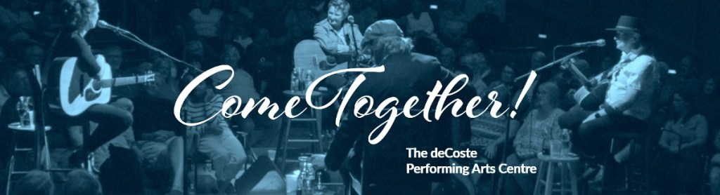
This weekend, we were in New Glasgow, visiting Heather’s family. On Saturday afternoon, we joined Sandy and John on a visit to the deCoste Performing Arts Centre on the Pictou waterfront. This Summer is the Grand Reopening.
A new cultural hub combines the Pictou-Antigonish Regional Library (PARL) and the deCoste Performing Arts Centre. We enjoyed the new library facilities, the indigenous paintings, and the sculpture on the waterfront by Alan Syliboy.
Driving up from the Annapolis Valley, Pictou demonstrates what is possible for other small towns in Nova Scotia.
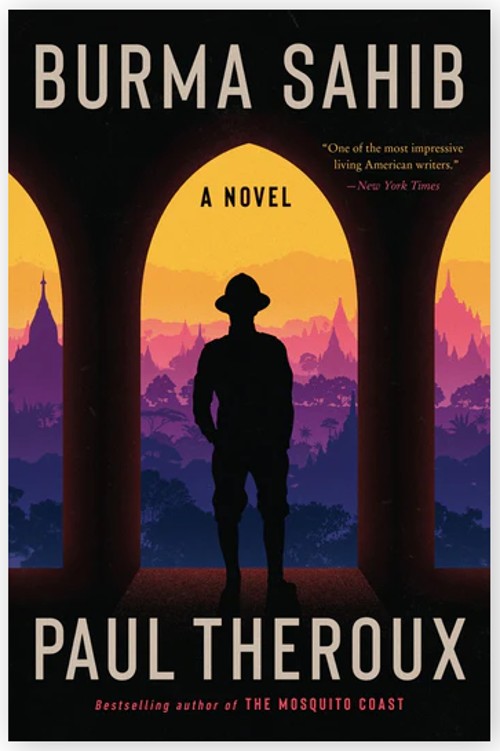
At the Library I was able to sign out David Suzuki’s ‘The Sacred Balance’. Heather picked up Paul Theroux’ ‘Burma Sahib’.
Returning to New Glasgow, the day was completed with homemade shepherds pie, beets and chard from Sandy’s garden, PBS’ Maine Saturday night fare ‘As Time Goes By’ and ‘Doc Martin’.
Sunday.
Time for the beautiful three hour drive back through the Rawdon Hills. At home, we were immersed again in the challenges of real estate sales. But we took time out for a stroll around the French Basin Trail (view my post Walking Paths). It was deserted, on a holiday weekend.
Acknowledgements
Sandy suggested the visit to the Pictou waterfront.
Pictou Library offers special programs. They also offer Virtual Care and have a Virtual Care Navigator. The Library is a ‘Community Information Utility’, combined with the deCoste Centre. Together they continue to support the Creative Rural Economy of the region.
In 2011, I proposed the concept of a Community Information Utility. The concept came originally, I think from Paul Beach in Sault Ste Marie.
Now, 2024, in my retirement, there have been many changes in the planning process in Annapolis County. Today, I am a resident of the Town of Middleton. As a retiree, I become more aware of the needs of the local population. In Middleton, there is CORAH, (Centre of Rural Aging and Health) to meet the needs of our population (read also Antiques Map Tour and Applied Geomatics/CORAH Presentation).
We should review the CIU concept.
What is needed from a CIU? Who determines the content? How is it maintained?
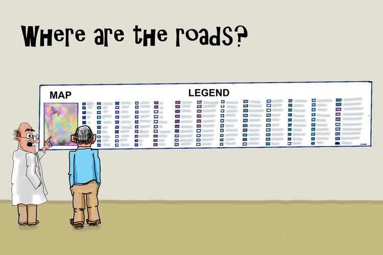
Cartoon by Edward. Lots of community information, but we always miss something.
Throughout my career at COGS I have been a proponent of understanding our geography and its relationship to both physical and mental health. This means access to information, for example:
Walking, bicycle and canoe trails. Maps and description
Access to businesses and services in the landscape: location, hours, services
Health services, education/library resources
Voting, community planning services
What is needed to make this a reality?
Access to the resources at the NSCC, Annapolis campus:
courses, workshops, seminars:
Information on self-guided tours
Material in both electronic form, and printed hard copy
The bottom line is that members of our rural society (in Canada) need access to geographic information to keep healthy.
PROPOSAL Expand the capabilities of CORAH to include access to geographic information related to the resources that support an ageing population and their mental/physical health.
What does that mean? Information related to our current landscape and information on how to access these resources (both electronic and hard copy).
If we implement a CIU, it must be portable, and the concept transferrable to other rural geographies.
Acknowledgements
This morning, I met with David MacLean at COGS. He helped me troubleshoot the WordPress software. He also offered helpful feedback on the CIU concept. Part of the problem is that access to geographic information does not arrive in the form of a ‘utility’ — just turn on the tap, or switch on the light.
Thanks to Brian Arnott and Edward Wedler for their encouragement in this pursuit.
EMAIL NOTES FROM EDWARD During the writing of this CIU concept, Edward offered some observations and views. Food for thought.
ESTONIA You have a great opportunity to advocate your “Community Information Utility”. Like having on-demand access to water when we turn on the tap or to electricity and light when we flip the switch, we should have ready access to [data] and to what is happening in our backyards.
I would argue that one of the most plugged-in countries in the world is Estonia; a potential CIU role model.
“Over the last decade, Estonia has constructed a system of digital infrastructure that made nearly all of its government services available online. 99.9% of Estonian public services are digitally accessible. This includes everything from filing taxes to viewing healthcare records to voting in federal elections.” (Wiki)
THE CIU IDEA
I do take issue with [your colleague’s] sentiment, “Part of the problem is that access to information does not arrive in the form of a ‘utility’. Just turn on the tap, or switch on the light.“
I couldn’t disagree more. The fuel for this information utility is US; as in you, me and others — in the form of social media, the internet, big data, AI, “Hey Siri …”, “Hey Google …”, etc. We “turn on the tap” daily when we go to YouTube, request auto-route directions when we travel, or click on the weather button. WE are the utility. It’s a matter of feeding the utility (like rain), storing the utility (like dams), and distributing the utility (like pipes and taps). Look at Google Maps and Street View. As I travel the Google terrain, I discover the coffee shops and restaurant locations. I click on one and find their hours of operation, their contact info and much more.
Check out the Fisherman’s Cove Gallery where I post my art, for example. https://tinyurl.com/2yy99p3h or the painting locations for artists in the Annapolis Valley and HRM tinyurl.com/PleinAirMap (clicked now 30,000 times).
Isn’t that Community Information?
What we need to develop is a common way to access that information. Maybe this is where search engines and AI voice inquiries play a role. Maybe … we already HAVE a community information utility. We just need to feed the utility for it to be of value to our communities.
Maybe we are asking the wrong question about CIU.
Let’s not ask, “Do we have a CIU?” (because I think we already do) but “Do we have a CIU that best serves our [local] communities’ interests?“
Both Jeff and David worked at COGS/AGRG. Besides teaching, David was responsible for a network of climate stations. David has retired. Jeff works for the NS Department of Agriculture. Both Jeff and I left COGS in 2011.
Part of the conversation was about the status of agriculture in the Annapolis Valley. Anyone driving through Clarence will have noticed the increase in vineyards on the slopes of North Mountain.
Talking with David, I was interested in the region’s microclimate network status (see the post COGS Weather Network). Talking to Jeff, I was interested to hear about the use of technology in support of resilient agriculture.
In recent years the college has introduced a Forestry Geomatics program. Both of these Agriculture and Forestry programs would demonstrate the application of a suite of geo-technologies to different parts of the landscape.
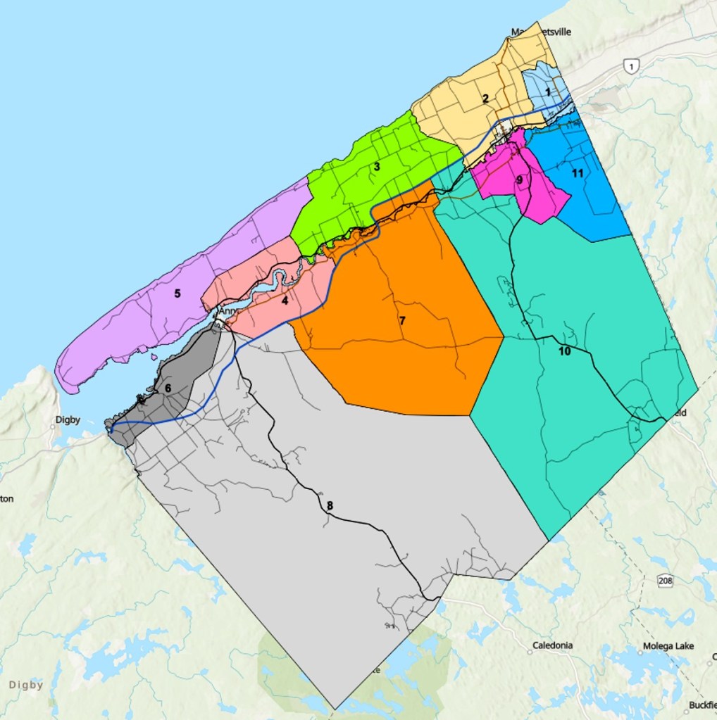
In my previous blog post, I noted the lack of district maps for the town of Middleton. I stand corrected there are no districts within the town. The town’s administrative structure is a Mayor ( Gail Smith) and six council members. In Annapolis County, we have eleven districts. If you wish to discover your district, you can go online, Google search Annapolis County Election District Map and enter your civic address.
Annapolis County Municipal Districts
Acknowledgements
I want to acknowledge the creativity of Edward Wedler. Edward added the links and graphics. He also transformed the original title ‘Agriculture Geomatics’ into ‘In-Cider talk’.
Now, I’m not one to gloat but almost 25,000 map views are the latest counts on my interactive plein air art map at tinyurl.com/PleinAirMap.
Not bad for a niche map focused on Nova Scotia. I should see the numbers rise soon since I have recently posted this map link to several Facebook Groups in Canada, the USA, Europe and beyond. It’s also a great way, to attract visitors from away who are looking for activities to do in Nova Scotia. Artists as far away as New Zealand are sharing my map. Think experiential tourism! (see Preparing for Experiential Tourism, Rethinking Tourism, and A Question of Scale)
I’d love to attract a COGS student and challenge them to scale the map globally where there are hundreds of thousands of interested plein air artists, urban sketchers, art lovers and experiential tourists. Maybe I have yet to attract any because I want them to use the Google Suite of software and have COGS students working with Google Map developers.
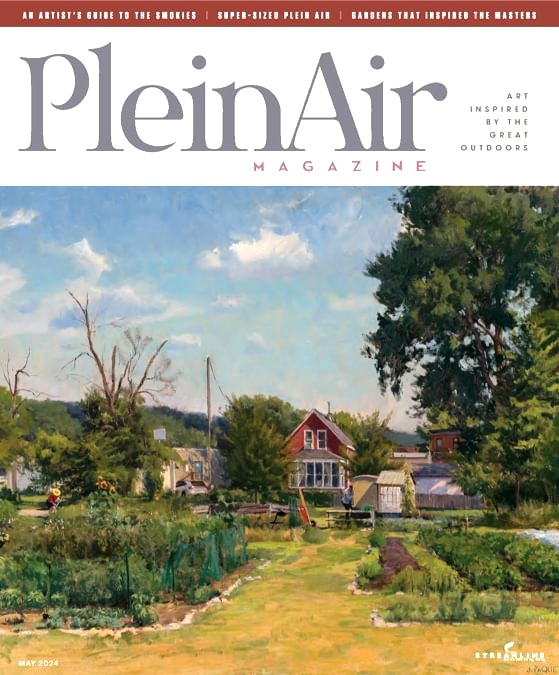
I once emailed back and forth with Eric Rhoads, the publisher of Plein Air Magazine out of the USA. While he couldn’t spare his resources, he thought the map was a great idea.
Terpstra is published locally by Gaspereau Press, Kentville.
Humphreys is a British writer who is giving a talk at FOLDE in Dorset, UK next month (image taken from website).
COGS has been around since the end of the Second World War (initially as NSLSI). My connection goes back to 1980. Over the decades we have created a very intensive learning environment in a very rural setting.
What I want to do is produce a book (hard copy and online) that provides students with the opportunity to explore the local landscape. The content of the book would come from the literature, previous faculty and students, and current residents. In Humphreys terminology, a ‘suite of micro-adventures.’ Each microadventure would include an author, a map, details of the reason for the adventure, GPS points, photographs.
Here are ten plus, microadventures (off the top of my head).
Konrad’s mountain bike ride
Heather’s hike up to the Inglisville road
Mike Goodchild’s bicycle trip from Annapolis Royal
Peter Wyman’ s story about Delaps Cove
Dave Whitman and the Roxbury cycle ride
Valley View Park and beyond
Debby’s ride to Middleton
Canoeing the Annapolis River
The Big Chill Snowshoe Marathon
Walking from Bridgetown to Middleton along the crest of North Mountain
Bob’s nostalgia for Ernest Buckler and West Dalhousie
Lunn’s Mill loop through the Lawrencetown tree nursery.
Bridgetown WALKS
How would this work ?
I would collaborate with Edward to create a general template i.e. text, map, photographs, art, GPS points.
We would work with COGS faculty and students to ensure standardization of information, quality control, online version.
We would ask COGS to consider publication costs. Every student at COGS would gain an understanding of the history of the institution, information needed to initiate their own micro-adventure, away from the computer screen.
Initially, the focus would be on Annapolis County and outdoor activities. If the model is successful, we could expand beyond the county boundaries and include other aspects of ‘local’ e.g. museums, bookstores, food suppliers, restaurants and pubs.
I am looking for reaction/comments/ other examples. In a ‘perfect world’ , we would have a ‘Geography of Annapolis County’ centred on COGS in Lawrencetown.
Acknowledgements
Edward and Heather have both shared in these ‘micro-adventures’
Jonathan Murphy, founder of GoGeomatics Canada, for fun, asked Artificial Intelligence chatGPT
‘who is Bob Maher’?
Below is the response.
Dr. Robert Maher is a significant figure in the Canadian geospatial community, particularly known for his contributions to the College of Geographic Sciences (COGS) and the Applied Geomatics Research Group (AGRG). His importance to the geographic community stems from his extensive work in education, research, and application of geographic sciences.
Dr. Maher obtained his Ph.D. in Geography from the University of Western Ontario and later taught at Memorial University of Newfoundland in the Department of Geography, covering areas like Quantitative Methods, Computer Mapping, and Biogeography. In 1980, he joined the faculty at the Nova Scotia Land Survey Institute, which he helped transform into COGS. This transformation played a crucial role in developing the institute’s focus on geographic sciences, including Computer Programming, Cartography and Planning, and Surveying.
Between 1988 and 1999, Dr. Maher worked as a GIS consultant in Indonesia and for ESRI in the United States. He also collaborated with universities and government agencies across Canada. He returned to COGS in 2000 as the Senior Research Scientist in the AGRG, retiring from this position in 2011.
His work at COGS and AGRG involved significant developments in geographic education and applied research. During his tenure, the focus at COGS shifted towards applied geomatics research, highlighting the practical application of technology to real-world problems. This included cooperative projects with industry and government partners in various sectors like Forestry, Geology, and Health Sciences.
Dr. Maher has also been involved in writing “The Story of COGS,” a project documenting the history and development of the College of Geographic Sciences. This work includes research, interviews, and the compilation of materials and experiences from COGS’s inception as the Nova Scotia Land Survey Institute to its evolution into a hub for geographic sciences education and research.
In recognition of his contributions, Dr. Maher was appointed as Geographer Emeritus at COGS. This role reflects his ongoing commitment to geography and his efforts to maintain connections within the geographic community, emphasizing the importance of geographic education and the application of geographic sciences in various fields.
Dr. Maher’s work, particularly at COGS and within the broader geospatial community, has been instrumental in advancing geographic education and research in Canada. His contributions have helped shape the landscape of geographic sciences, making him a notable and respected figure in the field.
— ChatGPT
I forwarded it to Edward Wedler. His suggestion was that the response should reference my over 500 blog posts spanning several years. This is interesting, since the blogs are published under ernestblairexperiment.wordpress.com. The name comes from Ernest, for Ernest Buckler, and Blair, for Eric Blair (aka George Orwell) . Experiment – life is an experiment.
Today, I visited Integrity Printing in Bridgetown to request a hard copy of my 2023 blogs. Volume 8. This blog post will be #550.
Jon’s response from AI chat GPT raises a number of interesting questions about the impact of AI on Geography/ Geographic Information Systems.
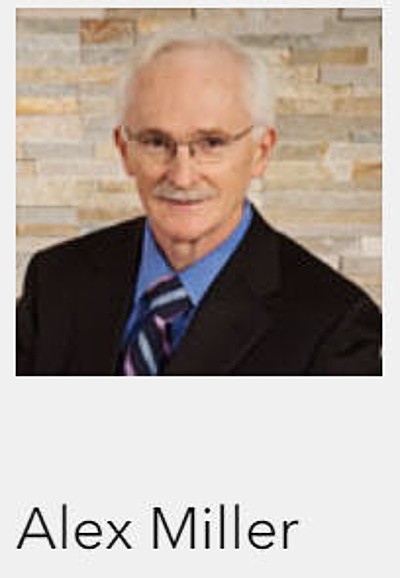
In the letter from the President, Alex Miller, he describes the founding of Esri Canada in 1984. Forty years ago. I remember well; Alex’s visit to COGS
From COGS, he hired David Roscoe, John Houwelling and Eric Melanson. It has been an exciting journey.
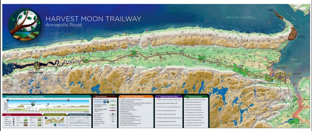
In the Esri 2024 calendar, the map for July shows the Harvest Moon Trailway through the Annapolis Valley (see Tourism Nova Scotia’s Harvest Moon Trailway LINK). The Map was designed and produced by Marcel Morin, Lost Art Cartography — another COGS graduate, living and working in Grand Pre, Nova Scotia (see the Recording of Marcel’s December 2023 meeting of the Blomidon Naturalists Society).
Acknowledgements
Jon Murphy, a COGS graduate, initiated the inquiry. Edward Wedler, retired COGS faculty, added value to the query.
Reference ESRI Canada 2024 Calendar, Forty Years, The Science of Where.
“East Side Port L’Hébert” plein air oil painting by Anne Wedler
As Geographer Emeritus, I have had the opportunity to review these potential projects. There are always a couple of fundamental challenges:
a) the technology evolves year by year. This is often reflected in the user interface.
b) wherever possible, the college does not want the responsibility of ongoing maintenance of the database and the access tools.
If we are dealing with government datasets, e.g. GeoNova, the data can be managed by the collecting agency. If the partner is AGRG at COGS, then this presents less of a problem. Looking at the list of potential projects this year, we can see projects with other geographic partners e.g. East Port L’ Hebert, Truro Cemetery, Oxford EODG, Heritage Trust.
At COGS, I noticed a map display showing ‘food desert’ (e.g. access to grocery stores) (see also The Grocery Map). Given the current bank rationalization, I believe the same concept could be applied to ‘financial desert’ (e.g. access to banking services).
Another co-operative project could be the application of GIS technology to our utility networks (e.g. power grids, telephone and Internet).
These types of co-operative project provide input into issues of concern to Nova Scotians. At the same time, they require research into the application of GIS technology in other jurisdictions.
Postscript
Following up on Bob’s “desert” mapping note, ten years ago I blogged about opportunity mapping” in rural areas (see “Are We mapping Opportunities?“) and noted examples in Texas, Brisbane, and Dublin. We need to map Nova Scotia’s rural opportunities.
Acknowledgements
Thank you to David MacLean for access to the current potential project list. Edward added the links and graphics. He also reminded me that through the joint Masters degree in Applied Geomatics, COGS collaborates with Acadia University. One year, learning the technology, followed by a second year, applying it to a research project, of interest.
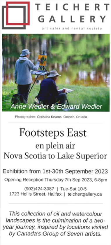
Anne and I are back from our two-year project. Footsteps East took us to places throughout Nova Scotia, Quebec, and Ontario.
This June 2023 started out rocky. Storms greeted us near Québec’s Lac Témiscouata.
While painting at Petite Saguenay, a sudden storm thundered 20 km away at our campsite at Baie Eternity. Multiple road washouts trapped over 200 people at the campsite. Many were airlifted out and escaped by boat. Overland flooding, tragically, washed two people to their deaths. It took us over a week to be able to follow a Saturday convoy to our site and recover our belongings. More heavy rains prevented further recovery of cars, RVs, and camping gear for 2-3 weeks.
Over twenty times we set up and broke camp during our journey — only a few times, thankfully, in the rain.
A typical rainy end in this short video.
Our journey was filled with adventures — tenting, painting, hiking, canoeing, riding the rails, and visiting art galleries. We filled two sketchbooks and submitted over 40 original paintings to the Teichert Gallery, adjacent to the Nova Scotia Art Gallery in downtown Halifax for our exhibition in September.
So, what’s next? What can grow our love of art and geography in Canada?
We figured an artist residency where we could explore the boundaries between spatial technologies (GIS, remote sensing, drones, etc.), the visual arts, and the culture of Place, would be a fruitful challenge. I’d love to develop a project, say, on “The Nooks and Crannies of Fogo Island”. Maybe you could help me out here.
This time of the year holds immense significance for me.
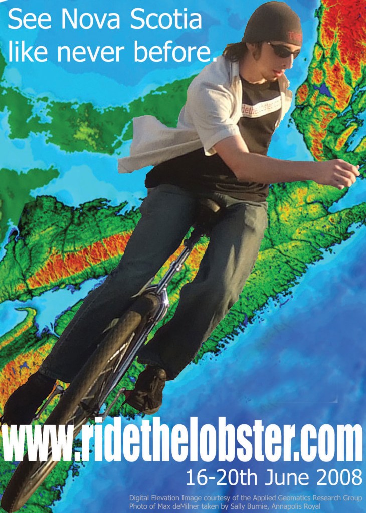
Fifteen years ago, almost to the day, we held Ride The Lobster — the world’s longest unicycle race in history, run in Nova Scotia — 500 miles and 5 days with the support of COGS, AGRG, Britec, the Government of Nova Scotia, and many, many other groups and individuals. Heather LeBlanc, Andy Cotter, Nathan Hoover, Brian Reid, and Bob Maher were instrumental in believing in this wild adventure and in convincing others to join. Max deMilner’s (Unicycle Max) New England trip triggered the idea.
Starting next week, Anne and I enter the Parrsboro International Plein Air Festival (PIPAF) alongside 28 talented artists across North America. This is our third juried entry into this prestigious event. Our painting colleagues are world-class. Not only are we in awe of them but are honoured to be participating with them.
Immediately following PIPAF, we embark on FootstepsEast (FSE), our 5,000 km tenting and painting trip through Nova Scotia, New Brunswick, Quebec, and Ontario to Lake Superior, and back. For two months, we log our journey that culminates in an exhibition of 40+ original works from our trip at the Teichert Gallery in Halifax through September.
The next few months will be hectic but exciting. Yes, this time of the year holds immense significance for me.
Acknowledgments
To Bob Maher for his continued moral support and geographic advice. To Anne for both tagging along and leading the way. To the many artists who send their best wishes and who will follow us on our journey. To those at the Teichert Gallery who believe in us. To all those who helped make Ride the Lobster work many years ago.
Yesterday, we attended the hospital information session at the Middleton Fire Hall. There had been various rumours in the media about closure of the Emergency Room (ER). This was one of three sessions. While the emphasis was on the different services available through the Middleton hospital. My concern was the lack of family doctors in the region. With a shortage of family doctors, many citizens end up at the ER.
After the information session, I met with Carman Kerr, MLA Annapolis County, at his office. I wanted to understand his perpective, representing Annapolis County.
This gave me the opportunity to question the provision of doctors in the Lawrencetown area. I was well aware of the efforts of Brian Reid, Lynne Roscoe and Kurt, the pharmacist to attempt to find a family doctor for the village. Carman confirmed my understanding,
This included a panel discussion with diverse, active members in the community. While this presented a different definition of Sustainable Development, it offered insight into community outreach.
Driving home, I listened to CBC Ideas in the Afternoon. The topic was Wallace Stegner, The Geography of Hope.
It was a documentary on his writing and life, and his role in documenting the disappearing west, especially around the Cypress Hills.
This set off the following train of thought. Less than a week ago, we returned to rural Nova Scotia. In order to understand the present initiatives in the Annapolis Valley, we attended the three meetings: hospital information session, MLA, Sustainable development goals.
My reaction. I turned the Stegner quotation upside down. Instead of ‘geography of hope,’ let’s talk about ‘Hope of Geography’.
Individuals come to live in the Annapolis Valley because of the hope of Geography. The landscape offers a microcosm of variety: fishing, forestry, agriculture plus the opportunity to interact directly with the natural environment.
In addition, we have an education institution here dedicated to the geographic sciences. It is not only possible to enjoy the landscape diversity but also to obtain an education in the relevant technologies and sciences.
If we package up this story, work together, we can attract family doctors who would want to be members of this larger community.. There is an alternative to the ‘geography of Hope’. It is the HOPE OF GEOGRAPHY.
Acknowledgements
For Heather and myself, it was a busy day. And yet we need to evaluate the sustainability of our Geography. Edward, thanks as always for your contribution.
POSTSCRIPT Here is the Geography of “Last Hope Camp” as noted in a previous blog post.
References
CBC Ideas in the Afternoon, February 6th 2023, Wallace Stegner: The Geography of Hope.