Posted in Opinion

Pipe Dreams

In our bedroom, through the skylight, I can see the wind blowing the tree branches, and the puffy white clouds racing across the blue sky.

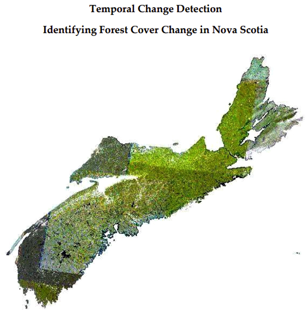
In the world of GIS, this reminds me of a polygon overlay: the roof, the vegetation, and the atmosphere all interacting with each other.

It is over fifty years since I was part of a wave, leaving England to start again with graduate studies in Canada. Later in Nova Scotia, when we were offering advanced diplomas in Scientific Computer Programming in the 1980’s we experienced another wave of students from Poland, Greece and Indonesia, as well as from across Canada.

Contemplating the situation in the Ukraine, makes me wonder if we could again help refugees to come to Nova Scotia.

If we are to address the global climate issues we need to increase the percentage of the population who are familiar with the next generation of geographic technology, and to effectively apply them to our resource management issues.

Can our post-secondary institutions step up to the challenge? They have done so in the not too distant past. Can our governments work with the post-secondary education institutions, as well as the immigration agencies?

Or is this simply a ’pipe dream’?


Wednesday, Heather and I escaped from the Valley. We met with Brian Arnott and Leslie Wright in Lunenburg. The topic for discussion was Agriculture/ GIS in Annapolis County. While in town,we visited two bookstores. Brian and Leslie kindly loaned us two books (see below). On our return, I received email from AIRO, to reflect on Annapolis County, forty years from now (online Survey Link).

Acknowledgements

Brian and Leslie provided a wonderful Sri Lankan take-out lunch, mixed with great discussion. Edward added graphics from Florida. Heather encouraged the detour along LaHave to Bridgewater, and home.

References.

Lena Lencek and Gideon Bosker, 1998, The Beach: The History of Paradise on Earth, Viking Penguin.

Daniel Stone, 2018, The Food Explorer: The true adventures of the globe-trotting botanist who transformed what America eats, Dutton.

Posted in New thinking, Opinion

Summer Institute

Saturday evening, I shared a beer with John Wightman. Brickyard Red, of course.

We talked about our time at COGS. This brought up the topic of the Summer Institute, an event sponsored by CANMAP (see “Shifting Gears“. It set me thinking.

COGS, along with other educational institutions, has had to adjust to a different teaching model as the result of COVID. Rather than sit around waiting for change. Let’s revisit the Summer Institute. Show leadership.

From my conversation with David Colville, it seems that faculty are managing a combination of on-line students, on-site students, as well; in his case, graduate students at Acadia. What would the new model look like? Could this be a theme of a Summer Institute in 2022 and beyond?

We could include participation from

  • Canadian Cartographic Association
  • The Applied Geomatics Research Group
  • Esri and Esri Canada
  • Novita Interpares
  • Shorefast Foundation
  • Chris Hopkinson and Laura Chasmer, University of Lethbridge.

Besides new approaches to teaching, we could look at new approaches to resource management: agriculture, forestry, fisheries, mining.

We could look at new approaches to community-centric engagement with: Bridgetown, Lawrencetown, Middleton, Annapolis Royal, Annapolis County — such as different age cohorts in the community: school age, workforce, retirement age. Perhaps there is room to explore technical tourism and creative, technical workshops.

We have a choice. We can wait until politicians determine COVID is over. Or we can design a Summer Institute, with a particular format and content. Place a stake in the ground, mark a date on the calendar, and plan for post-COVID living.

We should look at previous Summer Institute events. Decide on the audience, the presenters, location and timing. I am confident that CANMAP would be supportive.

Image Source: https://www.flickr.com/photos/wessexarchaeology/49141082227https://www.flickr.com/photos/wessexarchaeology/49141082227

Anyone interested, besides John and myself?

We could look at and attract new technologies and their leaders; for example, working with GoGeomatics on new directions/new relationships.

Acknowledgements

Enjoyed an excellent conversation with John Wightman at his home in Bridgetown. Edward, another COGS faculty alumni, added the graphics. Heather continues her vigilance to help birds survive in this unusual Winter.

Posted in Opinion

Exploring rural Nova Scotia

At the Flying Apron ’they do local’.

This includes providing guests with a handout ’Exploring the Rising Tide Shores’. It is a map of part of Hants County showing a list of things to do in the area, within a short drive of Summerville. Activities are divided into Beer, Cider and Wine; Hiking and Recreation; Golf; Arts, Culture and Heritage.

A similar map could be developed for other parts of rural Nova Scotia. For example, the Bridgetown Motor Inn could sponsor a similar initiative for Annapolis County. This could be supported by the cartographic/ geographic skills at the Centre of Geographic Sciences (COGS). It makes sense that these initiatives focus on a business that offers access to both accommodation, as well as access to local food and beverage suppliers. Other partners could come from outdoor recreation, arts, culture and heritage.

From my personal perspective, I am interested in the stories from the landscape. For example, in Hants County we have the writers Donna E. Smyth and Peter Sanger. Elsewhere, you find Harry Thurston, Silver Donald Cameron, Elizabeth Bishop. In Annapolis County, it would include Ernest Buckler, David Manners and Kent Thompson. Certainly, the reader can add additional names, some living and others from a previous era. In addition , Nova Scotia has a rich collection of publishing houses e.g. Gaspereau Press, Moose House Publishing.

I am also sure that Edward, with his plein-air art interests could identify artists and craft persons who describe the landscape, or produce products inspired by the landscape.

LINK to Nova Scotia Plein Air Map

Another feature of the Flying Apron, besides the Inn and Cooking School, is a second-hand book store. This appears to be a feature of many small towns, nestled in rural Nova Scotia.

Acknowledgements

Edward contributed his knowledge of the artistic culture. My focus has been the literary culture and geography. Heather would add the biological sciences and outdoor education.

Reference

The ’Explore the Rising Tide Shores’ brochure produced by the Flying Apron Inn.

Posted in New thinking, Opinion

Shorefast

From the Shorefast Foundation web site:

A shorefast is the line and mooring used to attach a traditional cod trap to the shore. It is a strong symbol of Fogo Island’s cod fishing heritage, and we chose this name because it symbolizes a belief in the importance of holding on to community and culture and in the power of authentic connections between individuals, their community, culture and place.

What can you do?

Our mission is to build cultural and economic resilience on Fogo Island and to serve community well-being by sharing place-based models of economic development.”

I would like to see the Annapolis Valley join the list of communities sharing place-based models of economic development. We are well-positioned. We have a strong history of place.

The work of AIRO has demonstrated this type of initiative.

In addition, the Centre of Geographic Sciences (COGS) gives us access to skilled practitioners in geographic information technology.

On Fogo Island, the heritage has been on the fishery. In the Annapolis Valley, the heritage has been more on agriculture.

Just looking at the Reading List, non-fiction illustrates compatibility:
EF Schumacher Small is Beautiful;
Peter Senge The Necessary Revolution;
Barry Lopez Arctic Dreams;
Mark Roseland Towards Sustainable Communities.

I first met Zita Cobb at the Georgetown conference in PEI, Rural Redefined (2013). Our paths crossed again at the Esri Canada virtual conference in November 2021.

If we were to establish a foundation in the spirit of Shorefast, what would it look like?

Given the importance of apple orchards, perhaps it should be called the Honeycrisp Foundation.

Finally, from Zita Cobb again:

We exist in relationship to the whole planet, the whole of humanity, the whole of existence. It is our job to find ways to belong to the whole while upholding the specificity of people and place.

Check out “cauliflower thinking” and the “floret videos” on the website.

Acknowledgements

Thanks to Zita Cobb for the inspiration. Edward joined Heather and me on the Road to Georgetown in 2013.

Reference

The Shorefast Foundation at shorefast.org

Posted in New thinking, Opinion

Reaching Out

Christmas is the time when you hear from friends and relatives across the globe. In my case, this includes colleagues from both the academic and business community. At the local level, besides COVID, we were able to get through a multi-day power outage, caused by the latest snowstorm.

With the New Year, there is time to recall graduate studies at the University of Western Ontario, teaching Geography at Memorial University, and then teaching GIS technology at the Nova Scotia Land Survey Institute (1980). It is over forty years since we graduated our first GIS graduates. Many of these individuals are likely retired.

I contacted Jack Dangermond, President, Esri about the ongoing need for a Geographic approach. He responded with advice on ’StoryMaps tech and ArcGis hub for community engagement. That is my challenge for 2022.

Is there a mechanism to link my blog (map stories) to story maps or is that simply my play on words?

After talking to David Colville at COGS, I also tend to agree with Alex Miller, President, Esri Canada (shown here) that I cannot ignore the three pillars of our world – Society, Economy, Environment.

Edward suggested that if I wanted to start a ’geographic-mindset movement’ check out this short Youtube video.

There’s a lesson to be learned, here, as to who is most important for a leader to realize their ambition’, Wedler January 2022. He found that important person, for example, when he initiated “Ride the Lobster” back in 2008.

Listen to ESRI Podcasts on “Geographical Thinking”for inspiring stories from thought leaders and GIS users across business, government and education in Canada.

Acknowledgements

Sincere thanks to Jack Dangermond, Alex Miller, David Colville, and Edward Wedler for their comments and feedback.

Reference

Derek Sivers, “How to Start a Movement“, April 2010, YouTube Video.

Posted in Event Review, Opinion

Almost fifty years of earth observation

NASA just launched the Landsat 9 satellite this past Monday, 27 Sep 2021.

For me, this is exciting since my engineering career began with Landsat back in 1975, three years after the launch of the first Landsat satellite.

Later, between 1982-1989, having joined NSLSI (Nova Scotia Land Survey Institute), later known as COGS (College of Geographic Sciences), my job was to train students in Remote Sensing. Landsat was an important platform for monitoring the earth. Some of the student co-op projects were memorable for me for their cutting-edge research and implications; such as measuring farmlands in Saskatchewan for tax evaluation, mapping forest clear cutting, and monitoring the impact of human activity on water availability and conditions.

I’m now retired but still follow developments in this field. Much has changed and much has been learned. We now have a range of extremely high resolution and spectrally sensitive sensors. Platforms range from satellites to drones. We mash data to extract new insights, and more developments lie on the horizon — artificial geo-intelligence, for example.

While I fondly look back on my first teaching class (a class, by the way, that inspired an award-winning humorous speech), I am in awe of the legacy NASA’s Landsat series has given to us on earth and the continuing opportunities we have to be responsible stewards of our planet, our home.

FURTHER READING/VIEWING

https://landsat.gsfc.nasa.gov/landsat-9/interactive/

Posted in Opinion

Climate Change

I heard on the CBC that Annapolis Royal is looking to hire a Climate Change Coordinator.

See video link of Annapolis Royal

This is good news. It brings to mind the work that Tim Webster, and others conducted at AGRG. With LiDAR it is possible to obtain an accurate three dimensional representation of the topography and, to a degree, the height of the forest canopy.

If there is co-ordination, it should include all the communities within the Annapolis watershed. Decisions in Annapolis Royal impact the ecology of the river e.g. the hydro dam. At the same time, it should engage with existing institutions and stakeholders in the watershed. To my mind, this includes collaboration with educational institutions and research groups. Any solution will require computer modelling based on our understanding of the hydrology, land use, climate and tides. It is a complex problem, demanding the best expertise in the region, as well as technical knowledge from other research groups.


Outside of Bridgetown, I have noticed a small herd of alpaca. This species of South American mammal is more commonly found in Peru- Chile. An interesting sign of the times.
(cartoon by Edward)

I am still reading Lesley Choyce’s, Nova Scotia Shaped by the Sea, Chapter 4, The Land of the Mi’kmaq — a compelling statement based on Daniel Paul ’s book We were not the Savages.

Acknowledgements

Edward and Heather remain supportive.

References

Lesley Choyce, 2007, Nova Scotia Shaped by the Sea: A Living History, Pottersfield Press.

Daniel Paul, 1993, We Were Not the Savages, Nimbus Press (later editions by Fernwood Publishing)

Posted in Opinion

Historical Image Analysis

In 1980, the Nova Scotia Land Survey Institute (NSLSI) had programs in Surveying, Cartography, Planning, Photogrammetry.

The arrival of the Scientific Computer Programming (SCP) program brought access to modern computer technology. It included mini-computer systems from Prime and DEC. Shortly thereafter, the Remote Sensing program was applying Dipix image analysis technology, the GIS program was applying Esri Arc/Info technology. Programming students, whether in the SCP program, the Business Computer Programming program or the Computer Graphics program were able to customize these systems to meet the needs of both government and industry partners.

In the world of GIS, digital objects were identified as points, lines, polygons. In the world of Image Analysis, digital objects were identified as pixels and rasters. Digital photogrammetry allowed for the manipulation of aerial photographs. Digital image analysis gave us the same capability with satellite imagery.

As we move forward from the AF Church maps, we can add images/photographs of the changes in the landscape. We can identify changes in forest cover. How much clear-cutting has taken place on crown land? When, and where? (Image taken from HERE)

We can identify changes in agricultural practices. The removal of Apple orchards in the Annapolis Valley. The increase in the acreage of vineyards.

Or we can obtain historical imagery for Sable Island. And identify the changes in the shoreline over the last sixty years. (Image taken from HERE)

The task at hand is to go back to the aerial photograph and satellite imagery libraries whether in Halifax or Ottawa, and to undertake change analysis and marry these changes with settlement patterns and census information. These types of analyses can be undertaken in today’s Geomatics environment.

With the availability of LiDAR and other sensors, the results can be analyzed and displayed in three dimensions. In a perfect technological world, we would be able to use a calendar slider that allows us to view the landscape at any particular moment in time, given the appropriate imagery, and the corresponding base maps. (Image extracted from HERE)

Acknowledgements

David Colville provided the link to the Sable Island project. Edward Wedler and John Wightman advised on Remote Sensing.

References

David Colville, Sarah-Marie McDonald, and Suzanne Monette, 2013, (PDF) Temporal Change Detection: Identifying Forest Cover Change in Nova Scotia.
David Colville, Brittany Reeves, Bill Livingstone, Heather Stewart, 2019, (PDF) Mapping the Landscape of Sable Island.
CBC Sable Island undergoing coastline retreat.
AGRG TopoBathy LiDAR website

Postscript

The Truro workshop on the AF Church Historical Maps, Truro, August 14, 2021, includes presentations on Map Conservation, Map Digitization, Geomatics, and Programming.

Posted in Book Review, Opinion

Map Stories

If you want to discover stories about maps, a good starting point is the Library at COGS. Speak to the Librarian, Andrew Hannam. In my case, I recalled a book on the History of GIS. Instead, I found two other books.

Joan Dawson, The Mapmakers’ Legacy.
Anne Knowles, Placing History

The book by Dawson provided me with a context for the Church maps. Chapter 4, Natural Resources : minerals, wood and water, highlights the geology of Gesner and Dawson, as well as Church’s mineral map.

The second book, edited by Anne Knowles for Esri Press, contains essays in historical GIS.

Brian Donahue ‘Mapping husbandry in Concord: GIS as a tool for Environmental History’.
GIS mapping can help build a complex, productive engagement between people and the places they inhabit. It can pull together the layers of environmental history to inform how we care for our land today.” p.175.

Michael Goodchild ‘Combining space and time: new potential for temporal GIS’.
In short, the transition to object-oriented data modeling in GIS has solved some basic problems, allowing a rapid expansion of interest in the use of GIS to improve our understanding of historical and other time-dependent phenomena.” p.196.

While at COGS, I wanted to check out the Walter Morrison Map Collection.

Because of COVID, things were closed up, however I was able to find a listing of the maps online. I will have to return another day to take a closer look at the Church maps.

It remains remarkable that I can find these resources, locally available in Lawrencetown, and to find Cartographer Monica Lloyd responsible for the site.

The Church maps give us a picture of settlement in Nova Scotia from the mid-nineteenth century. What we need is a picture of the landscape from the pre-settlement (colonial) period to the twenty-first century (2021).

If we could look at landscape change, in Nova Scotia, in terms of forest cover, agricultural land use, mineral exploitation over time, we would have a better understanding of the impact of today’s land use management decisions.

What resources exist to map these changes? Within a historical GIS (see an upcoming blog post)?

Postscript

The Esri Press book was published 2008. What is the status of Historical GIS in 2021? We shall find out!

Acknowledgements

Andrew Hannam and Monica Loyd at COGS. David Raymond, Michael Goodchild and Brent Hall for their intellectual companionship. Edward Wedler added the graphics and links.

References

Joan Dawson, 2007, The Mapmakers’ Legacy. Nineteenth-century Nova Scotia through Maps, Nimbus Publishing.

Anne Knowles (Ed), 2008, Placing History. How maps, spatial data and GIS are changing historical scholarship, Esri Press.

The Walter Morrison Map Collection.

Posted in Opinion

Tour de COGS

Thursday, I met with the new Principal, Gord MacKenzie, for the NSCC Annapolis Valley campus (Middleton and Lawrencetown). He follows on from Wayne St.Amour. At the same time, Monica Lloyd has replaced Michael Purcell as the Site Manager for the Centre of Geographic Sciences (COGS).

My objective was to make sure Gord, who had responsibilities for Trades at the IT campus in the City, had an appreciation for the history behind both COGS and AGRG. Some of the background is available at the Story of COGS website, managed by Ted MacKinnon. A second objective was to discuss the need for a new relationship between the broader community and the college in post-COVID times.

In return, Gord gave me a tour of the new addition to the COGS building. It is a three story structure. On the ground floor, the two innovation spaces are labelled the Drone Makers Space Lab and the Industry Access Lab. The other two floors provide accommodation for a total of 40 beds: a double, three four-bedroom pods and six single bedrooms. Twenty bedrooms on each floor. The expectation is that the accommodation can be rented by industry partners engaged in technical education , through short courses.

Gord anticipates a formal opening of the Innovation Centre in September, or soon thereafter.

In my conversation, I stressed the importance of community involvement. This has several dimensions:

  • the academic community, including current and retired faculty living in the region
  • graduates of COGS since its renaming in 1986
  • the business community which uses similar or compatible technology
  • the local community, businesses and residents working in Annapolis County, and beyond

My vision, post- COVID, is of a much broader definition of community and, yet, at the same time, emphasizes both the technology, and the geography of rural Nova Scotia. This includes resource management in an ecologically sustainable manner of our forests, geology, agriculture, fisheries, within the changing global climate.

Certainly, I would be willing to assist in the identification and inclusion of these ‘communities of interest’ and ‘communities of place’.

We enjoy a remarkable landscape. We have the potential to redefine a much more inclusive culture.

Acknowledgements

Thanks to Gord Mackenzie for the tour. Thanks to Wayne St.Amour for finding the funding for the new extension. Thanks to past faculty and researchers who believed in the technology. Current faculty support student projects, with both industry and the community. Edward added the graphics. He was instrumental in Ride the Lobster, and shared the Road to Georgetown.

References

The Story of COGS go to thestoryofcogs.ca

MapAnnapolis blog go to mapannapolis.ca

MapAnnapolis: a community of interest and place