Posted in Art, Event Review

Plein Air Paint-Out Map for 2023

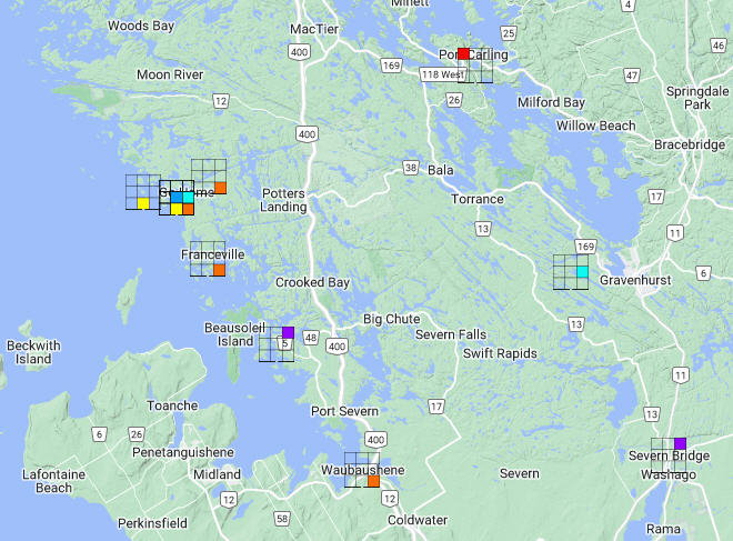
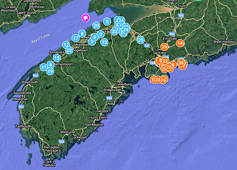
Our Nova Scotia plein air art map grows with community user input. It currently has 19,000+ map views.

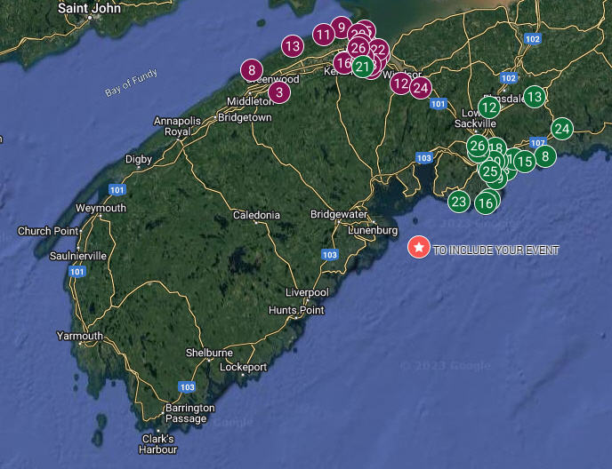
The map shows paint-out locations for the upcoming, outdoor (en plein air) painting season.

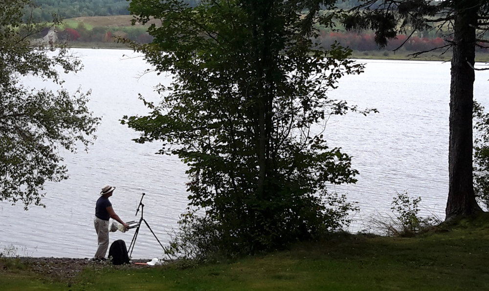
According to Plein Air Magazine, the plein-air painting movement is the fastest-growing movement in the art world today.

Editor, Eric Rhoads, calls it “the new golf”. Many tens of thousands of artists, worldwide, are involved in this movement.

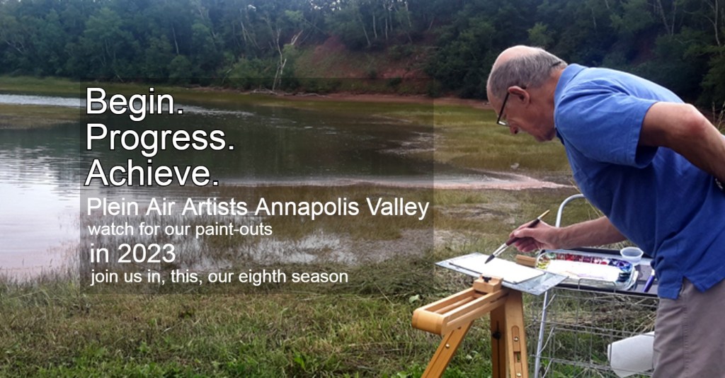
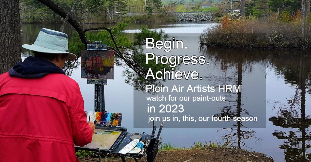
Anne and I have founded two groups in Nova Scotia (Plein Air Artists of the Annapolis Valley, PAAAV in 2016, and Plein Air Artists HRM, PAAHRM in 2019).

We participate in a third group, Halifax Urban Sketchers, HUSk, and have collaborated with the Nova Scotia Association of Architects to hold sketch-outs.

The map, and associated schedules, keep member artists, event organizers, art lovers, collectors, residents, and out-of-Province tourists aware of what, when, and where events are held. We have had visitors from Europe, across Canada and the USA join us based on this knowledge. Last year I created an icon on the map to allow others to place their event on the map. It’s crude (using Google Forms) but it works.


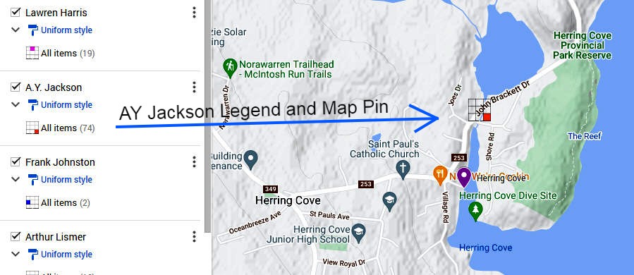
I use the Google Map platform because it is popular, and well-integrated with its suite of products (Google Sheets, Google Docs, Google Forms, Google Calendar, YouTube, etc.). Such a platform forms the basis of another map I am building for “Footsteps East”.

Our Footsteps East map tells the story of our 6,000+ km tenting and painting trek that Anne and I are undertaking from Nova Scotia to Lake Superior, and back. This organic, interactive map grows with text, and links to YouTube, Spotify, a Calendar, and sketches as we camp at each paint-out site. Anne looks after Instagram, Facebook, and Google Calendar.

On a final note, I’d like to say there are a number of improvements that would make such maps more valuable and scalable (and be monetized). If there is anyone out there who’d love to work with me on this let me know or refer me to some Google Map developers.

References

Link: Plein Air Map (tinyurl.com/PleinAirMap)
Link: 2023 Paint-Out Schedule PAAAV (https://bit.ly/3ZvR5Zz)
Link: 2023 Paint-Out Schedule PAAHRM (https://bit.ly/3ZvR5Zz)
Link: “Footsteps East Launch Pad(https://www.wedlerfineart.com/page/36519/footsteps-east-launch-pad)

Acknowledgments

Dr. Bob Maher as our Footsteps East Geographer Mentor and Advisor
Jesse Millican as our Footsteps East field video and audio recording Advisor
Techert Gallery as our host venue for the Footsteps East original art exhibition, September 2023
A global community of artists supporting and following us on our Footsteps East trek.

POSTSCRIPT
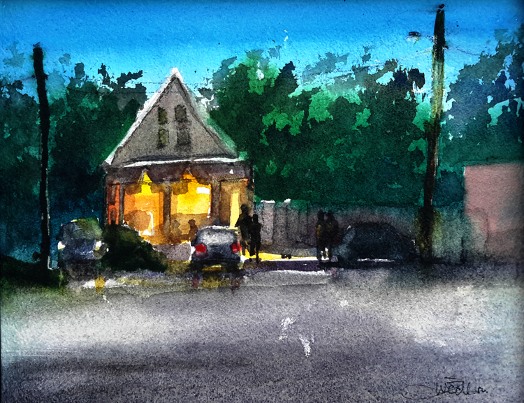
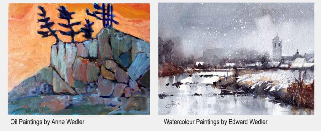
A recent plein air oil painting created by Anne in Florida.

Posted in Art, Nature

Fiona

As of this writing, I am awaiting the approach of Hurricane Fiona.

Even after driving for about five hours yesterday, away from our Cape Breton paint-out base at Margaree Harbour to Halifax, we still seem to be headed for a difficult time. This is the second time a hurricane has affected our plein air plans; the previous storm was named Dorion.

We still got in two days of painting at the coastal community of Margaree Harbour and Inverness and on the gravel bars of the salmon fishing Margaree River. These paintings will form the early part of our Footsteps East project (see our current map at tinyurl.com/FootstepsEast).

For those in Fiona’s path, stay safe.

Posted in Art, Event Review

Brush with Nature

Kings County is large — stretching from the Bay of Fundy and Minas Basin to the deep interior of Nova Scotia. That’s over 2,000 square kilometres of territory.

Beginning in August, artists will be spread out across the county painting landscapes as part of “Brush with Nature” — an inaugural event hosted by King’s County Museum.

Anne and I have been collaborating with the Museum in the design and operation of this three-week plein air painting event.

The goal is to support both the museum and regional artists while celebrating the natural and historic features of the County. Artwork will be available for sale, auction and draw.

Any time between the 1-18th of August, artists can paint outdoors, anywhere within the County. We call this the “LONG BRUSH”. On Saturday the 20th of August the Museum hosts the “SHORT BRUSH” at Miner’s Marsh in Kentville. This is where artists will congregate to paint in and around the picturesque marshlands within a 2-3 hour window.

An early “Call to Artists” has already attracted some serious local talent.

Anne and I belong to six plein air art groups, three in Nova Scotia (founding two) and three in the USA (co-founding one), and have participated in many plein air events. We believe Kings County Museum and artists in “Brush with Nature” will have a successful and enjoyable event.


The size of Canada’s Northwest Territories dwarfs Kings County. This, I learned, is the location of Canada’s 44th Remote Sensing Symposium, 19-22nd June, 2023.

LINK to Yellowknife promotion.

How time flies. I recall the early days of these RS conferences when conference images were printed out via typewriter overwriting symbols. Now we have hyperspectral imaging from drones (UAVs) and satellites delivered to mobile devices that complement GIS and AI systems (I could deliver a stand-up comedy routine on these changes).

The more I learn about co-chair Chris Hopkinson, professor at the University of Lethbridge and Google Scholar, the more I fathom his teaching and communication skills (he does reveal a sometimes awkward and dry sense of humour). He has built a potent remote sensing program. I could spend (and have spent) hours watching his YouTube Playlists.

Such as his “Airborne Lidar Field Operations Lecture“. Lucky students!

I wish Chris Hopkinson, his colleagues and students, along with attendees from across the country, all the best and much success at Canada’s 44th Remote Sensing Symposium.

While this symposium is taking place I will be preparing for my art trek with Anne, Footsteps East, through New Brunswick, Quebec and Ontario.


Bob kindly sent me a reference to nature writer, Richard Mabey’s audiobook, “A Brush with Nature“. This represents 25 years of personal reflections on nature —  from observational reflections on nature to questions about its relationship with language, art and life.

Acknowledgements
To Bob Maher for his continued encouragement to write about my art experiences and reflections on RS. To Chris Hopkinson for his engaging online videos and promotion of ULethbridge and Canada’s 44th RS Symposium.

Posted in Art

First Steps

About two weeks ago, Anne and I began our two-year FootSteps East journey in Herring Cove, Nova Scotia — the area in which artist A.Y. Jackson painted back in 1919. We logged this paint-out to our newly-created FootstepsEast Facebook Page, to our ESRI Footsteps East StoryMap and to our Google FootSteps East Map.

Here is an excerpt from the first map I have created in preparation for Footsteps East. The map pins look a bit strange, but let me explain.

The pins sit over some of the paint-out locations of members of Canada’s Group of Seven Artists. Each coloured square represents a different member. I experimented with several different pins and ended up with this design in order that multiple artists could be shown at the same location, without overlapping/obscuring map pins.

This map will help plan a travel route through Eastern Canada.

Zeroing in on Herring Cove (our first step), you can see that I have included our journey’s log and sketch on the map.

Also shown at Herring Cove is the A.Y. Jackson map pin.

Once we have painted at three locations, I will make the map and social media links public.


This coming week (21-26th June 2022) we get to meet plein air artists from across Canada and the USA, in a competition to paint the landscapes around Parrsboro, Nova Scotia (Parrsboro International Plein Air Festival). We are up against some seriously talented pros.

For August, Anne and I have collaborated with King’s County Museum to design “Brush with Nature“. This is where regional artists come to paint features of natural/historical interest in a LONG BRUSH event (01-18th August 2022) within Kings County and a SHORT BRUSH event (Saturday, 20th August 2022) at Miner’s Marsh in Kentville. The first Call to Artists has already attracted some great local talent.

ACKNOWLEDGEMENTS

Anne is my painting buddy and we share this Footsteps East journey. Bob is my Geographic Mentor sharing his wit and wisdom.

REFERENCE

McMichael Gallery, Group of Seven website
https://mcmichael.com/collection/group-of-seven/

Posted in Event Review

Lawrencetown Event

Last night, I attended the Plannapolis meeting at the Lawrencetown Fire Hall, hosted by Annapolis County and by Stantec.

Attendance was excellent, with over seventy community members. This was my second meeting, as I also attended the one in Centrelea.

What did I learn?
What questions remain?

The format was similar between Centrelea and Lawrencetown. The only difference was the attendance of Stantec Senior Planner, John Heseltine.

My impression was that the municipal planners would be responsible for the six coloured areas on the map and Stantec would look after the rest of the county. Coloured areas include Cornwallis, Habitation, Upper Clements Park, East End, Bridgetown and Water Supply areas. Also on the map was a large area of South Mountain designated as a ’wind resource’.

Future Use Land Use Map (web LINK)

It was a lively session, with many perspectives from the agricultural community. At one level, it is positive that the province has determined there is a need for a review of municipal planning. On another level, it does beg the question, what has happened over the last twenty-plus years.

A long time ago, there were identifiable planning staff. There was a vibrant planning program at COGS. Certainly, I can recall Nick Lasch, Phil Hore, Mike Donnelly and, more recently, Ed Symons.

Fundamental to the planning process is understanding and mapping the land use. This includes agriculture, forestry and other resources. There was a time when GIS technology was used to provide this baseline information. Is that still the case today?

In Annapolis County, what is the separation between lands managed by the province, (e.g. crown lands) and those managed by the county? Within the county, why is Bridgetown a separate entity, but not Middleton, Annapolis Royal etc? I think the answer, was that Bridgetown found itself in financial difficulty. Should that impact the planning process?

Is the situation in Annapolis County similar or different from Kings County or Queens County? Are there province-wide standards for planning? If you do not know the resource, where and how much, how can you plan?

There should be sufficient residual resources at COGS/AGRG to develop a current county-wide map of land uses. Or does that infringe on the rights of citizens and communities? or COGS?

The citizens have shown initiative and direction with MapAnnapolis, perhaps a somewhat similar approach could be applied to Plannapolis.

Acknowledgements

These are the personal view of a long time, Annapolis County resident, on and off, since 1980. They have been influenced by students and colleagues at both COGS and AGRG. Edward added the graphics. For more details on the current process, check the Plannapolis website.

Postscript

I wonder whether the reaction to ’resource planning’ is a characteristic of rural Nova Scotia. Edward tells me that Beavercreek Winery has been sold, presumably, with the Tavern too. Hope new owners will maintain their investment.

I share with you the large Horse Chestnut tree across the road.

Posted in Event Review, Opinion

Almost fifty years of earth observation

NASA just launched the Landsat 9 satellite this past Monday, 27 Sep 2021.

For me, this is exciting since my engineering career began with Landsat back in 1975, three years after the launch of the first Landsat satellite.

Later, between 1982-1989, having joined NSLSI (Nova Scotia Land Survey Institute), later known as COGS (College of Geographic Sciences), my job was to train students in Remote Sensing. Landsat was an important platform for monitoring the earth. Some of the student co-op projects were memorable for me for their cutting-edge research and implications; such as measuring farmlands in Saskatchewan for tax evaluation, mapping forest clear cutting, and monitoring the impact of human activity on water availability and conditions.

I’m now retired but still follow developments in this field. Much has changed and much has been learned. We now have a range of extremely high resolution and spectrally sensitive sensors. Platforms range from satellites to drones. We mash data to extract new insights, and more developments lie on the horizon — artificial geo-intelligence, for example.

While I fondly look back on my first teaching class (a class, by the way, that inspired an award-winning humorous speech), I am in awe of the legacy NASA’s Landsat series has given to us on earth and the continuing opportunities we have to be responsible stewards of our planet, our home.

FURTHER READING/VIEWING

https://landsat.gsfc.nasa.gov/landsat-9/interactive/

Posted in Art, Event Review

PIPAF Atlantic Edition 2021

Last week, for three days, twenty artists competed in the Parrsboro International Plein Air Festival Atlantic Edition (PIPAF).

The spectacular Parrsboro coastline offers artists great inspiration.

For the first time, Anne and I were juried in to compete alongside great talent from across the region — from Weymouth, Nova Scotia, to St Andrews, New Brunswick.

Each morning and afternoon we scattered out between Advocate Harbour to Five Islands to pick our spot and paint the landscape. One day, Anne painted inland at Newville Lake, north of Parrsboro.

I seemed to gravitate to the built (and decaying) environment. Two of my watercolours captured abandoned buildings and trucks at “Parrsboro’s Bone Yard“. Others avoided this site. Once completed, we posted our artwork online at the PIPAF website and also to our online gallery.

On Saturday evening at “The Gala”, artists’ entries were judged by the owner of Zwicker’s Gallery in Halifax, Ian Muncaster. Aside from “Best in the Show”, categories included “Best Use of Light”, “Best Seascape”, “Best Nocturne” and more.

My nocturne entry, “Late Night Donuts“, was painted at night opposite Tim’s. People claim I left Anne stranded on a dark rural road to paint Partridge Island bathed in moonlight. Not true. She insisted I leave her there to paint. Her painting resulted in, “I Might Have Heard a Bear“.

Sunday, the last day of the competition, saw these twenty artists joined by others to paint in the Quick Draw event.

PIPAF 2021 Quick Draw Event attracted other artists and art lovers.

In addition to seeing our art-loving friends from the Annapolis Valley, we got to see our Halifax Urban Sketcher friends from Halifax who join in on the Quick Draw event.

While Anne and I did not win any prize, we reached an important milestone in our art journey. We were “juried in” to compete against the best in Atlantic Canada. We grew our network of like-minded artists, met new friends, discovered friendly townsfolk, and grew to love the land. So much so, that Anne booked us a cabin to return at the end of the month to capture the colours of fall in Parrsboro.

REFERENCE

PIPAF 2021 Special Edition: Anne & Edward Fine Art Newsletter XVIII
(Here, is included the full story behind “I Might Have Heard a Bear”, several of our paintings, and more.)

Posted in Art, New thinking

Mapping Nova Scotia Artists’ Plein Air Sites

Fifty-two paint-out sites are planned for this season’s plein air artists in the Annapolis Valley and HRM.

For location details, click the map link: http://tinyurl.com/PleinAirMap then click a map pin or legend.

The one valued attribute of those artists who paint outdoors, on location (en plein air) is “extended geographic memory”. We watch, listen, smell, taste and touch our surroundings — for 2-3 hours. Geography becomes imprinted. As we gain artistic skills, we paint more than what we know. We paint more than what we see. We paint what we feel.

Eric Rhoads, publisher of Plein Air magazine and Fine Art Connoisseur magazine in the USA, states that the plein air movement is currently the fastest growing art movement in the world. There are tens of thousands of plein air artists in the world. So when they reacted positively to my interactive Google map that was a big deal for me. This is probably the first such map for plein air artists in the world, and so much more is possible.

Wow, that is very cool!

— Plein Air Magazine

I wrote back to Plein Air magazine, “Thanks. I did this on my own but with the right development team in place [thinking COGS’ student project] a plein air map could be scaled globally so artists could see when and where paint-outs are located, with contact and other information. This would go a long way to network the plein air community on their travels.“. They are now looking into this further.

Reactions from elsewhere have also been very positive.


POSTSCRIPT

Not many of our readers know we have a celebrated, world-class plein air artist living in Digby, Nova Scotia; just down the road.

Poppy Balser recently received yet another prestigious international award. This time it was for her watercolour “Light Washes Over Tidal Pools”, inspired by her many visits to Point Prim and area.

Oh, why not toot my own horn? A website I share with Anne is located at wedlerfineart.com
95% of our work is en plein air.

Posted in New thinking

Maps in the Eyes of Children

My daughter, Allison, spent much of the summer camping in Southern Ontario, close to her home. On those trips my two grandchildren created maps as one of their pastime activities. My grandson is six years old and his sister is four years old.

Great Lakes as imagined by my six-year old grandson.

To place his campsite location in context within a larger geography, my grandson mapped the Great Lakes from memory — something I would have difficulty doing.

Closer to home, he mapped features that were important to him at each campground.

Campground map by my grandson

The features intrigued me. He names the trails and records their lengths, marks roadways and walkways, streams and green spaces, and important features to a six-year old that I cannot recognize. Tents are numerous and line well-travelled paths. Important to him (and the family) is the location of the public washrooms. This is one of about eight maps he drew at different campsites.

Of importance to his younger four-year-old sibling was the location of two blue water bodies, connecting river, and the land in between. An understandably simpler map.

I recall my many mapping conversations with former COGS instructor Konrad Dramowicz, years ago. He studied how children perceive their space and geography from maps he had them create, based on their travels to and from school.


Looking further into this topic, I was referred to Dr David Sobel in New Hampshire, and his book Mapmaking With Children, in which he discusses the crisis in geography education. The story doesn’t end here. I emailed Dr Sobel and he writes,

Yes, some children have the mapmaking gene expressed more strongly — a great thing to encourage.  Unusual, from a developmental perspective, for a 6 year old to have internalized a map image of the scope of the Great Lakes system.

My two older grandchildren from Nova Scotia also create maps. These maps are dynamic and strategic based on their invented game call “The Wall”. It is a game designed to see who can outwit the other, to infiltrate their opponent over, under, around or through The Wall. This game has provided hours of entertainment for them, and their adult challengers as well.

While instructing at COGS, eons ago, I did visit some elementary schools in Annapolis County to talk about Canada’s space, remote sensing and mapping programs. When bringing in some local airphotos and topographic maps to middle school aged youth their exuberance was surprisingly upbeat. Youth want to understand their geography. I hope that COGS continues to fightback the geography crisis noted by Dr Sobel.


Reference

Dr David Sobel, 1998, Mapmaking with Children: sense of place education for elementary years, Heinemann.

Postscript

For those interested in making a “collage map” watch this video from the Art Gallery of Nova Scotia. LINK: https://youtu.be/H1FXyFH7HrE This project is inspired by the 1975 work, “A Map of Meagher’s Grant”, by artist Evelyn Dickie.

“This is a great activity to do to celebrate the neighbourhood we live in or a home from the past that holds dear to our heart.”

Posted in New thinking, Opinion

Tracking Deplaned Passengers

Six years ago I proposed a real-time, interactive, contact heat map to track deplaned passengers from flights arriving into Nova Scotia (contact tracing). The idea, in fact, could have been applied anywhere to track the movement of (potentially) virus-infected people.map_virusContact
By October 2014, 4,500 people had died from a recent Ebola global outbreak. We had, in Canada, experienced H1N1 (Asian Bird Flu) and SARS.  The SARS outbreak of 2002-2003 killed 800+ people worldwide and killed 44 Canadians. In our current CoVid-19 outbreak, Canada has suffered 300+ deaths to date. More Canadians have now died from COVID-19 than SARS. Viruses know few boundaries. Deadly viruses such as Ebola, MERS, SARS, Asian Bird Flu (H1N1) and COVID-19 can easily spread with today’s travel. Forensic Studies have shown that viral outbreaks mirror air travel.

“The role of mass air travel in the recent worldwide spread of a number of diseases … has been documented, analysed and discussed by transnational and governmental agencies … clinical practitioners … and academic researchers.” (ScienceDirect)

My proposed interactive map rests on the emergence of the Internet of Things (IoT), G5 cellular technology and Artificial Intelligence, where we can respond to contact and movement and predict a possible outbreak brought in by deplaned passengers from an airline flight; possibly offering a public alerts/warning system. This complements the arduous task of forensic tracking of people’s whereabouts.

Could future technology seek, track and map, in real-time, when and where infected people might come into contact with others and with sensor-embedded objects (taxis, other cell phones, public venues, stores, farm animals, etc.)? Can we react faster and more judiciously to these outbreaks and forecast/model viral outbreaks due to deplaned passengers and crew and their contacts? How can we balance privacy rights with public health needs?

A recent article notes that a team led by MIT researchers are working to do contact tracing using Bluetooth technology while retaining privacy.

References

Science Direct, Airports, Localities and Disease. July 2010.
TechXplore. Kelly Foy (MIT). Bluetooth Signals from Your Smartphone, 09 April 2020.

Postscript

Apple and Google just announced a joint effort to fight COVID-19 via Bluetooth contact-tracing technology.