Posted in Art, New thinking, Opinion

Robert Waddell Art Awards

I propose creating an annual Robert Waddell Art Awards Event for excellence in art — something that can be launched jointly by the Municipality of Annapolis County and the Town of Annapolis Royal.

Robert Waddell was an art master at the Gordonstoun School in Scotland.gordonstounSchoolScotland 
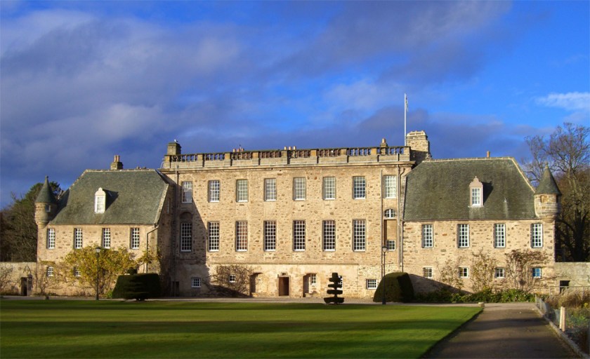
Waddell inspired Prince Charles, then a student at Gordonstoun School, to paint in the 1970s. As a result of that inspiration, Prince Charles has become one of the UK’s most successful living artists, where he paints en plein air (outdoors) and exclusively in watercolours, according to Insider.

With the announced expansion of the Gordonstoun School into North America, and into Nova Scotia, in particular, a fitting tribute to Robert Waddell could excite our Maritime visual art movement. Could Annapolis County and the Town of Annapolis Royal help host/showcase such an event in collaboration with the Gordonstoun School, to celebrate the school’s Nova Scotia roots?

banner_2019_paint-outSEASON 
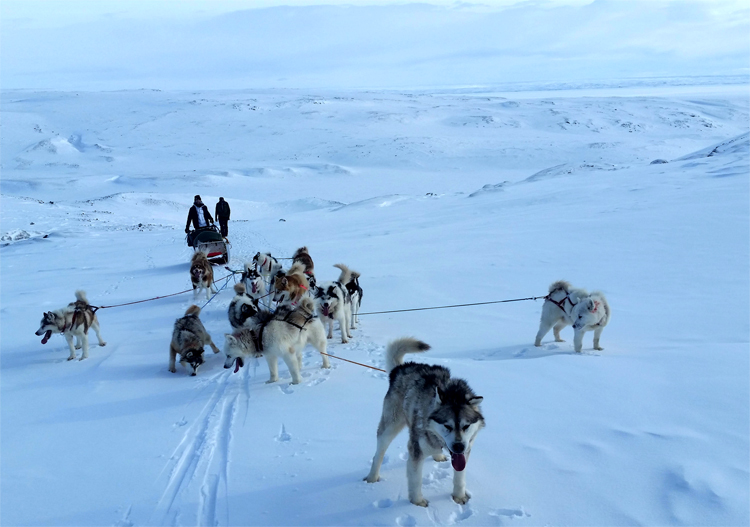
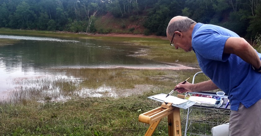
The Plein Air Artists Annapolis Valley group, now in its fifth year painting at outdoor locations throughout the Valley, could help organize the launch of such an event alongside ARTsPLACE, Paint The Town, and NSCAD.

Thinking even more inclusively,banner_KingsTheatre  
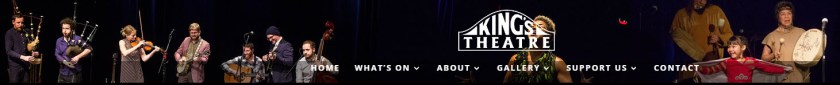
connections could be made with performing arts, considering … the rich arts culture in the region, Annapolis Royal’s historical link to “L’Ordre de Bon Temps“, storytelling/plays/music at King’s Theatre, talk of a Liberal Arts University, and workshop/conference facilities such as those at Cornwallis Park. You see, “English master, Eric Anderson—like the art teacher Waddell, also in his 20s … encouraged Charles to act in several of Shakespeare’s dramas” (Vanity Fair).

Maybe this is where our Valley’s cultural history and environment can fuse with the traditions of the Gordonstoun School to make for exciting times.

References

Zoë Ettinger, Insider. Prince Charles is one of the UK’s most successful living artists. Here are 15 of his works, 30 March 2020.
Lawrence Powell, Spectator/Chronicle Herald, Gordonstoun a Go, 17 March 2020.
Plein Air Artists Annapolis Valley. 2020 Paint-out schedule.
Sally Bedell Smith in Vanity Fair. The Lonely Heir. April 2017.

Postscript

It would be excellent if Prince Charles joined Tom Forrestall and Geoff Butler on the inaugural judging panel. (Bob Maher)

Posted in Art, Event Review

From Snowshoes to Snowdrops

bookCover_healingWalksAnne and I arrived in Halifax by plane in the wee hours of last Saturday and were instructed by border officials to self-isolate for 14 days. We had returned from our stay in Bradenton, Florida. I read the interesting article Bob’s brother, Peter Maher, sent on confinement from “The Book of Life”. This got me thinking. Where and what is your geography when you are confined?

Bob and Heather, I thought, were fortunate to freely survey their property on snowshoes during this call to self-isolate and to physically distance ourselves. I suggested he take a camera with him when he goes on his outings alone or with Heather. Check out this free Shambala title, “Healing Walks for Hard Times” … “Walking awakens the profound healing power of the human spirit“.

I used to carry a (Zoom H4) field audio recorder with me on my walks and travels. I noticed how different the experience was to replay a walk/trip captured in audio versus captured in images — the clickity-clack of the narrow-gauge Skagway train; the sound of a 1890s replica gold-rush saloon; the passing of a Prairie train in the wee early morning hours outside our motel room; the soothing lapping of water on a lake’s shoreline near Petit-Saguenay; announcements at an airport waiting-area in Halifax; the crunch of soldiers’ footsteps on gravel at the Fortress of Louisburg or our own footsteps on our walks.

map_montrealSoundMap

How many of us truly listen to our geography? I once thought about how exciting it would be to explore a “sonic map” of Canada or Nova Scotia and then I discovered Sound Maps, as in the Montreal Sound Map. “The Montréal Sound Map is a web-based soundscape project that allows users to upload field recordings to a Google Map of Montréal“.

My wife, Anne, created some spontaneous “sound art” during a walking tour last October 2019, inside the Halifax Central Library, headed by a Dalhousie University architecture student as part of a Sketching Tours event with the Nova Scotia Association of Architects.

banner_PoppyBalserNewsletterIn these turbulent times, I notice how people are, lately, appreciating the little things in life. One of my favourite artists, Poppy Balser from Digby, for example, has been busy in her backyard garden, preparing for spring. She writes in her latest email newsletter, “Hope Springs Eternal“,

I found these snowdrops buried deep within a blackberry bramble in a neglected part of my garden.  I’m making an effort to get outside every day as we wait all this out. One of the projects I’ve undertaken is to clean up that portion of my garden and that is how I found the snowdrops“.

Anne and I are doing well. We exercise, dance, paint, illustrate, solve puzzles, read, write and think while being grounded. Today, I bake rustic bread and continue to illustrate Marshall Ennis‘ upcoming book, “The Legend of Great Uncle Arthur”, about a strong fisherman who once lived in a small outport on the northeast coast of Newfoundland.

Acknowledgements

Bob Maher for continuing to fire my imagination and motivating me to connect the dots. To my field recorder taken with me on my sonic-travels across Canada. To the many diversions on the internet, books and art that keeps us occupied during periods of self-isolation. Poppy Balser for bringing her outstanding watercolour paintings into my life. Marshall Ennis for helping me be strong in body and mind.

References

Healing Walks for Hard Times. Carolyn Scott Kortge. Shambala Publications.
Canadian Geographic. 8 July 2011. Surround Sound. by Samia Madwar.
Montreal Sound Map.
Poppy Balser Newsletter. Hope Springs Eternal.
MelsKitchenCafe.com. Rustic Bread.
Marshall Ennis Website.

Postscripts

RUSTIC BREAD

My rustic bread turned out well and was delicious — crunchy crust and the chewy centre. Next time I’ll add more whole grain flour and flaxseed for an even heartier bread.rusticBread

#PLANKTHECURVE


Posted in Art, Event Review, New thinking

AI in Plein Air Art

pleinAirArtists
My goal at the recent Art Impact AI workshop held in Dartmouth, Nova Scotia, was to see how AI (Artificial Intelligence) might play a role in plein air art. The workshop was headed by Valentine Goddard and Jerrold McGrath.

The participant numbers were of a convenient size that we could delve into the subject matter at some depth. What struck me first was the diversity of backgrounds in attendance — from wood sculptor to theatre-savvy software developer, from cellular biologist to explorers of biologic/geologic forms, from filmmaker to former art director. But we all had the creative artistic mind and AI interest in common.

I learned all sorts of AI concepts such as Neural Networks, Machine Learning, CV, and Deep Learning, and dominant AI values such as transparency, fairness, accountability, and more. We were shown a book entitled Neural Networks for Babies by Fernie and Kaiser. We played games to immerse ourselves in the mechanism of AI thinking. “Finding the Criminal” game taught us about the significance of algorithm development, application, confidence, bias, and use/abuse. That type of game, upon later discussions with filmmaker Kimberly Smith from Canning, could have implications in his Movie Games project.

So, how does AI apply to my plein air art world? In the short term, I do not see AI having immediate impact. I do see where AI has the potential for the visual artist; playing a role in my art, down the road, as mentor, coach, teacher and critic. I do not see AI in art as something to be feared. I see AI as something to augment the creative learning process and development of the human artist — where AI and human collaborate.

In plein air art that AI augmentation also includes the process of seeing and interpreting the geography that surrounds us as an artist.

ACKNOWLEDGEMENTS
Participants in the Art Impact AI Dartmouth workshop, for their lively and insightful discussions.
Valentine Goddard and Jerrold McGrath for heading the Art Impact AI workshop.

REFERENCES

Neural Networks for Babies, by Chris Ferrie and Dr Sarah Kaiser,  Sourcebooks, March 2019
Movie Games, by Kimberly Smith

Posted in Art, Nature, Opinion

Behold Cape Breton

Anne and I recently spent a week travelling through picturesque Cape Breton, Nova Scotia, taking in the popular sites, such as the Fortress of Louisbourg, and discovering some underrated nooks and crannies.

pleinair_margareeRiverFishHatchery_Sep2019_750w96dpi
Fish Hatchery on the  Northeast Margaree River, watercolour by Edward Wedler

We couldn’t help but notice the various ways people move through and note the landscape. As artists, we spent several hours documenting specific sites en plein air — Anne with her oils and me with my watercolours. Spending time at each location lets us absorb the landscape with all our senses. Our recall for detail is heightened.

20190919_110952_2While painting Pillar Rock from Presqu-île, near the southern part of the Cape Breton Highlands National Park, we noted dozens of visitors come for a few minutes to snap photos then move on. Did they see the otters swim the nearby pond? Did they note how the sun lit up the rocky shoreline as it rose above Jerome mountain? Did they hear the high-pitched piping notes of the eagle?

appleMapVehicleAt the other extreme, we were greeted several times by the “Apple Map vehicle” taking rapid-fire snapshots of the landscape as it motored throughout the Cape Breton Highlands. We were surprised to see it in the small northern community of White Point. It had a different purpose — to engorge its databanks with a future, retrievable, online, photo and map record of the region.

Whether painting, hiking, photographing, video-recording or “apple-mapping” we all move through the landscape at different rates and with different pursuits in mind. How do you move through the landscape? How much do you absorb from your travels? What record do you log and keep?

ACKNOWLEDGEMENTS
Anne Wedler for being my supportive, painting buddy. All those Cape Breton visitors we met attached to their iPhones and smartphones.


Posted in Art, New thinking

Mapping Plein Air Paint-outs

As an artist, I experimented with Google mapping tools to view the geographic distribution of paint-out sites for the Plain Air Artists Annapolis Valley (PAAAV) and Plein Air Artists HRM (PAAHRM) 2019 season. Members of PAAAV and PAAHRM are artists of all levels, from beginner to professional; painting in oils, acrylics, watercolours, pastels, ink, graphite, and other media. Fifty-two sites are mapped.

Your feedback is welcome. (Click on the map’s top left icon to activate ALL sites — PAAAV and PAAHRM  )icon_PAAmap Click on any numbered site to see details of when paint-out is/was scheduled.

Posted in Art, Nature, New thinking

Viewing vs Interpreting the Landscape

Last fall, I drove through New Brunswick on my way to/from Québec and Ontario with my wife, Anne. The roads have improved immeasurably from a couple of decades ago, so we actually had time to savour the landscape and talk about what we saw. As we travelled, I noticed something strange about our conversation.

We increasingly saw the landscape as artists.

mixPaintsThe sky wasn’t just overcast or sunny. The sky was a mix of Burnt Sienna with a touch of French Ultramarine Blue or was a variegated wash from Cerulean Blue to Cadmium Yellow. We were not just engulfed in fall foliage of colours. Hills became brushstrokes of Alizarin Crimson, Quinacridone Gold (I love that colour) and Prussian Blue.

foreMidBackgroundWe divided the landscape into zones (foregrounds, mid-grounds, and backgrounds) and described how we would paint aerial perspective, “treat edges” and change tonal contrasts, to give a sense of distance.

POIMany times we would identify a focal point in the landscape (almost with “eye-spy-with-my-little-eye enthusiasm) and would suggest ways to direct viewers’ eyes to that point. Would it be the slope of the hills, the line of our winding road, edges of forest stands or the illumination of light breaking through the clouds? How would our favourite artists, or The Group Of Seven treat that focal point?

IMG_6235pair
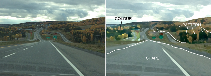
As we drove, we unpacked our landscape NOT in terms of “things” (such as houses, fence rows, barns, silos or cows) but in terms of shape, line, colour, patterns, gradation and composition. We became exhilarated, as artists, to not only view the landscape but to offer ways to interpret the landscape — whether it be as a realist, impressionist or abstract artist — in oils, acrylics, watercolours or inks.

Anne and I enjoyed kilometres (miles) of child-like revelations and “aha” moments on what could have been just an ordinary road trip through New Brunswick, Quebec and Ontario (although the scenery was spectacular). We did not just see the landscape. We interpreted the landscape.047_BlueBarnsBaieStPaul_Sep17_90dpi

Great to be an artist!

LINKS:
Edward Wedler website: www.edwardwedlerart.blogspot.com
Anne Wedler website: www.annewedlerart.wordpress.com


sealevelInstallationPOSTSCRIPT:
Bob Maher brought to my attention an article where art and science meet to bring the issue of rising sea levels to the public’s attention in dramatic fashion (that helps connect my left brain and right brain).
LINK:  https://www.thisiscolossal.com/2019/03/lines-hebrides/

Posted in New thinking, Opinion

Maps from an animal’s perspective

We often talk about geography and the land from a human perspective. What about from an animal’s perspective?
How do they understand the land? They do not use our compasses and maps but must understand landmarks, boundaries and “sense”.
I think of the resilient service sledding dogs offer to travel in the North, such as those shown here on Andrew Maher’s recent trip.
dogsledTeam_Apr2018_750w90dpi
I think of migrating caribou and how they are impacted by human interaction.
I think of the industrious beaver and how their drive to “use the land” is different from our “land-use”.
I think of the wolf — how we “re-introduce” species and we learn, serendipitously, over time how important they are to the health of the (ours and theirs) ecosystem and physical geography.
Bob’s past posts on clearcutting highlights, for me, our insensitivities; placing our needs to strip bare our land ahead of animals’ needs of land to maintain their livelihood and form basic shelter and protection.
dawsonOnMoshersIsland
As an experiment, I decided one morning to carry a video camera at knee height (my dog’s eye view)  for almost an hour as I walked an island in The La Have area of Nova Scotia (this was no easy task). Upon review, I was intrigued to experience the world’s perspectives, vistas, obstacles, nooks and crannies as my dog saw them.
And, what would maps look like if crafted from an animal’s
point of view?
Posted in New thinking, Opinion

Can maps do a better job in our back-yard?

If the technology exists to instantly light up our phones when our village has been hit in the game “Clash of Clans” surely we can work to do the same when our land/water/air is being impacted in real-life.

clashOfClansClearCut
With the many technical advances these days maybe we need to set aside or identify tracts of land where we research ideal mapping practices — maps that readily and fully inform and seamlessly engage us, citizens.

Sure, Google has made mapping strides with easy access to street view, traffic assists, and feature identification. Many of us use these maps. ESRI lets us, not as easily, mash databases and tell stories to create personalized maps. Fewer of us use these maps. I suggest, however, that maps can reflect a larger part of our DNA when they subsume social-media/market value. We need to explore the real market potential for interactive, immersive, and adaptive maps.
As I have been south this season and have read many of Bob  Maher’s blogs I have been pondering as to WHO, these days, most interacts with the natural landscape and HOW we interact with it, and of the role of maps. Seeing forest clear-cuts first-hand, for example, contrasts drastically with viewing them on a screen, days/weeks/months later. If we could better connect maps with our daily lives we could find greater transparency of forestry and other practices or issues.
If game developers can market and make b/millions with “what if” scenarios and if we can be tweeted, poked and notified instantly then surely we can create maps to do do the same for us citizens. Can we improve maps by better connecting them via social media network for all stakeholders and citizens?
Maybe, Bob and Heather who live in Paradise, Nova Scotia would not have had to discover, with surprise, that their “back-yard” had been violated with forest clear-cuts.
Posted in Uncategorized

There’s Nothing There: a rural myth

There’s nothing there!” scolded Joan, my plein air artist friend. “You’re sending us to a place next week, to a crossroads, where there is absolutely nothing to paint”. Joan was referring to the intersection of Black Rock Road and Brooklyn Street, Kings County, Nova Scotia — our fifth paint-out site of the season (we have 21 more to paint). “I go by there almost every week. Why are we going THERE?”

057_100dayChallenge_rainyWayfarersBrewery_BW_90dpi
En Plein Air sketch of decaying home along Brooklyn Street, Kings County, Nova Scotia by Edward Wedler at http://www.dootdootdaddy.blogspot.ca

That’s part of the problem. Through familiarity, Joan has become numbed to the nuances of this rural setting — the details many would miss just driving past. Along with six other artist friends we rhymed off to her the many scenes that can be captured there. “You can do the graveyard or the decaying house across the road from the Grafton Community Hall. What about the cows or the rows of corn in the farmer’s fields? Have you ever looked up the road, towards North Mountain, to see the thick fog hanging in the air from the Bay of Fundy? If you drive up the mountain you can look back at the patchwork quilt of farmer’s fields and see the sunlit silos across the Valley on the South Mountain. “

My wife, Anne, was trained in acrylic art by Floridian artist Joseph Melançon. He paints in the form of the Canadian Group of Seven artists and can create masterpieces from what looks like banal landscape photos, devoid of details. He opens our artists’ eyes to the understated geography of rural settings. He creates something from what appears to be nothing.

In my travels across Canada, it was the Prairies that struck me most as an artist. The smallest glimmer from a pond, the most subtle grouping of wildflowers, the flutter of startled ducks, the line of telephone pole after telephone pole, was magnified ten-fold in contrast to the expanse of fields and open sky. One notices more clearly the slightest shift in colour, line and form.

I have learned that, through the artist’s eyes, when we focus we begin to see what may appear ordinary but in a new light. Bear River photographer and filmmaker, Tim Wilson, reminds me of that every time he posts another photo or video to his Facebook or website from rural Nova Scotia. Anyone see the film Maudie? Stricken with arthritis and almost stuck in a small house in rural Nova Scotia folk artist Maude Lewis managed to paint and paint and paint. There was always something to paint.

Look carefully and maybe stop awhile. There is always something to see (and do). To say that there’s “nothing there” is a rural myth.


Posted in New thinking

Using online games to study what tourists find attractive here.

Imagine if we could, through games, explore the preferences of European, Asian, Middle Eastern, North American and other visitors to our region and cater our tourist destinations (and direct our dollars) to meet those preferences.

We THINK we know what attracts tourists to our area, but how can we measure that objectively?  How can we rank one destination over another? I propose we have tourists play games — online games. Apply game concepts to unearth the mindset of our potential visitors. Here I pilot a basic game called “ValleySeen”, the results of which can be used to evaluate what landscapes/streetscapes appeal to our visitors. Go ahead and play in my test area of Annapolis Royal, Nova Scotia.

streetSeen569votes

ValleySeen applies the urban “StreetSeen” project, created by students at Ohio State University and used in the MOOC, Technicity, to explore gaming in a rural setting. StreetScene is based on the work of Open Plans Beautiful Street Project and MIT’s Media Lab Place Pulse Project .

This is how it works …

Display pairs of images that are randomly selected from a library of Google Street View images within an area. Pose a planning question. Have the player vote on the image that best suits the question. Tabulate and analyse the responses to rank users’ preferences and even generate ‘heat maps’.

I applied StreetSeen to look at Annapolis Royal through the eyes of a tourist. I wanted to know what tourists found attractive. I focused on Annapolis Royal as a test area. I randomly selected twenty Google Street View images and generated results in spreadsheet and map form. I ranked the preferred images based on the question asked, and analysed results.

valleySeen_02

My pilot was limited in scope: geography, number of images, analyses. In future, I propose adding the geographic source of respondents in the analyses.

Furthermore, I propose that gaming concepts be used to study our tourism and tourists to better develop destination plans for Nova Scotia.