Posted in biographical sketch

Musique Royale

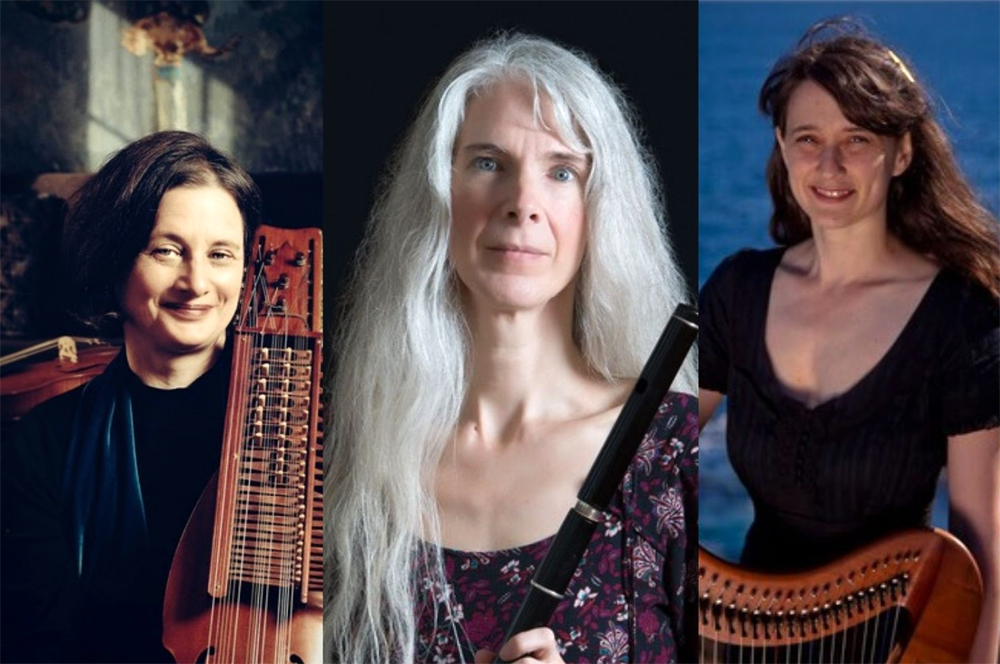
On Saturday, we hope to attend the Musique Royale concert by the Harpaflojt Trio at the Dawn Oman Art Gallery in Bridgetown.

It will be the third performance weekend in a row. Last weekend, it was Lisa Huyer and ‘Lief Forever’. Supporting musicians included Shelly Wallace, Mike Donnelly, Michael Robertson, Ray Devries and Patrick O’Brien.

From the Lisa Huyer collection of songs, I was impressed by the way each told a story about living in a place, within a community, in these challenging times.

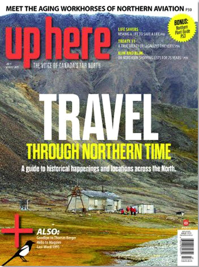
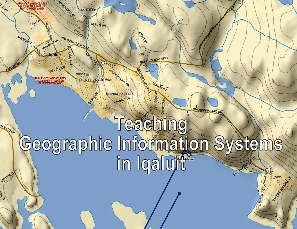
As usual, because of Dawn’s connection to the North, I had the opportunity to catch up on back issues of ‘Up Here’ magazine with articles on the Yukon, Northwest Territories and Nunavut.

Afterwards, we headed to New Glasgow. Returning home, the sun was deep orange because of the smoke from the fires in the West. We took our usual route. Turning off Highway #102 at exit #10, passed Mill Village, MacPhees Corner, Cheese Factory Corner, Rawdon Gold Mines, Brooklyn before joining Highway #101 at exit 5, Windsor. On this route, there are long stretches of road where you can see the hills ahead of you, as you pass through the rural landscape.

Unlike the politicians who want to twin the #100 series highways, I like it the way it is.

Today, I received two gifts.

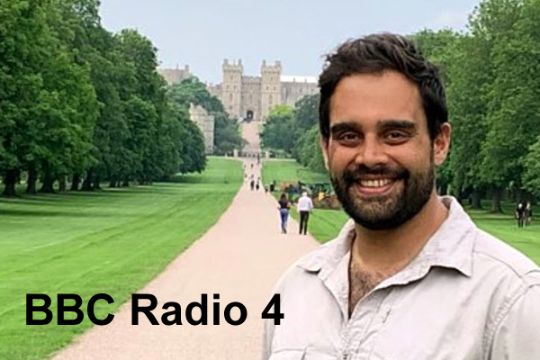
From my brother, a link to a Radio 4 broadcast on Windsor Great Park. From Frank Fox, the book by Jay Appleton ‘The Experience of Landscape’. My weekend listening and reading.

Postscript

From Brain Pickings, July 28, 2021, Beatrix Potter: A Life in Nature, by Linda Lear.

Acknowledgements

Dawn and Scott for bringing live music to Bridgetown. The talented local musicians. Heather shared the spectacular drive. Edward added the graphics. Peter and Frank for the gifts.

References

Dawn Oman Art Gallery, Bridgetown.

Up Here magazine, www.up here.ca

Jay Appleton, 1975, The Experience of Landscape, John Wiley.

BBC Radio 4, Open Country Windsor Great Park (aired July 29, 2021).

Posted in Article Review

North and South

Julia, my daughter-in-law, sent me a link to an Esri Canada article on teaching GIS in Iqaluit. She makes a couple of excellent observations.

”I believe GIS and mapping can have a role in cultural reclamation and identity due to the power held by maps, as control over land and resources often begins with lines on a map … It would one day be my goal to integrate traditional Inuit knowledge (or IQ) into Esri mapping.”


From the South shore, Lunenburg Brian Arnott sent me to the latest issue of Harpers Magazine. It contains an essay by Leanne Shapton ‘Writ in Water’ on Roger Deakin’s indelible swims.

From Harper’s Magazine “Writ in Water”

Afterwards, I had to go to the bookshelf and find Deakin’s books:

Waterlog: A Swimmer’s Journey through Britain.
Notes from Walnut Tree Farm.

Shapton does a great job capturing the spirit of Deakin.

It is not often that a new enterprise comes to town. This week, we stopped at Brickbean Coffee Roaster. It is in Brickton on Highway #1. Josue Duff has opened a coffee roaster. Located in a beautiful garden, full of lilies. From the web site, you can order coffee beans from Mexico, Peru and Bolivia.

References

Esri Canada article. https://resources.esri.ca/education-and-research/adaptation-is-the-theme-for-nunavut-arctic-college-instructor-julia-landry

Leanne Shapton, 2021, Writ in Water. Harper’s Magazine, August. p.76.

Roger Deakin, 2000, Waterlog: a Swimmer’s Journey through Britain, Vintage Books.

Roger Deakin, 2009, Notes from Walnut Tree Farm, Penguin Books.

Brickbean Coffee Roaster website www.brickbean.ca

Acknowledgements

Thanks to Julia Landry and Brian Arnott for providing me with the North and South. Heather joined me at Brickbean and other travels. Edward added the graphics.

Posted in biographical sketch

Two Conversations

As part of my research on Historical GIS, I have been thinking about aerial photographs and satellite imagery of Nova Scotia. On the weekend, I went to talk to John Wightman in Bridgetown.

John has had several careers in his work life. He was Vice-Principal at NSLSI when they hired me to teach Scientific Computer Programming in 1980. John has had a long standing interest in the landscape and it’s geological structure. He reminded me that the Nova Scotia Department of Lands and Forests had taken aerial photographs of the provincial forest cover, every ten years. Likely since the 1950’s. He was also familiar with the work of the Canada Centre for Remote Sensing (CCRS) and their support of the LANDSAT series of satellites.

Given this background, it seems highly likely that we could document changes in the forest and agricultural landscape over the last ninety years. This would be a significant challenge for the total province, but we could sponsor a pilot project for a sub-region (eg. the Annapolis Valley).

Researching the availability of these images would take some time. However, the availability of imagery in combination with historical maps would give us the background story on landscape change.


My second conversation was online. In response to my recent blogs on maps and mapping, Sandra Barry sent me a poem by Elizabeth Bishop, ‘The Map’.

Sandra is a remarkable resource on the life and work of Bishop. Here is the poem, published in 1946 from the book, North and South.

THE MAP
 by Elizabeth Bishop
 
Land lies in water; it is shadowed green.
Shadows, or are they shallows, at its edges
showing the line of long sea-weeded ledges
where weeds hang to the simple blue from green.
Or does the land lean down to lift the sea from under,
drawing it unperturbed around itself?
Along the fine tan sandy shelf
is the land tugging at the sea from under?
 
The shadow of Newfoundland lies flat and still.
Labrador's yellow, where the moony Eskimo
has oiled it. We can stroke these lovely bays,
under a glass as if they were expected to blossom,
or as if to provide a clean cage for invisible fish.
The names of the seashore towns run out to sea,
the names of cities cross the neighboring mountains
--the printer here experiencing the same excitement
as when emotion too far exceeds its cause.
These peninsulas take the water between thumb and finger
like women feeling for the smoothness of yard-goods.
 
Mapped waters are more quiet than the land is,
lending the land their waves' own conformation:
and Norway's hare runs south in agitation,
profiles investigate the sea, where land is.
Are they assigned, or can the countries pick their colors?
--What suits the character of the native waters best.
Topography displays no favorites; North's as near as West.
More delicate than the historians' are the map-makers' colors.
 
(from North & South, 1946)

The appeal for me is the link between place, the cartographer’s craft and the poet’s sensibilities.

Two separate conversations, taking place, between Bridgetown and Middleton.

My hope is that COGS faculty and students believe it is worthwhile to develop an Historical GIS that incorporates both the early cartography and the subsequent image analysis.

Postscript

Tuesday evening, David Colville described a current student project that looks at the sand barrens ecosystem, using historical photography, in the Annapolis Valley. It is a collaboration with CARP. This fits well with my thinking. It covers the period 1930-2020.

Postscript

This weekend, we picked red currants, gooseberries and high bush blueberries. Lots of jams, jellies and desserts.

Acknowledgements

To John Wightman and Sandra Barry, both of whom, added to my initial story. David Colville provide current information on satellite imagery, and the student project. Edward Wedler added both his knowledge of remote sensing and technical skills.

References

Elizabeth Bishop,1946, North and South, (It includes the poem ‘The Map’).

Posted in Book Review, Opinion

Map Stories

If you want to discover stories about maps, a good starting point is the Library at COGS. Speak to the Librarian, Andrew Hannam. In my case, I recalled a book on the History of GIS. Instead, I found two other books.

Joan Dawson, The Mapmakers’ Legacy.
Anne Knowles, Placing History

The book by Dawson provided me with a context for the Church maps. Chapter 4, Natural Resources : minerals, wood and water, highlights the geology of Gesner and Dawson, as well as Church’s mineral map.

The second book, edited by Anne Knowles for Esri Press, contains essays in historical GIS.

Brian Donahue ‘Mapping husbandry in Concord: GIS as a tool for Environmental History’.
GIS mapping can help build a complex, productive engagement between people and the places they inhabit. It can pull together the layers of environmental history to inform how we care for our land today.” p.175.

Michael Goodchild ‘Combining space and time: new potential for temporal GIS’.
In short, the transition to object-oriented data modeling in GIS has solved some basic problems, allowing a rapid expansion of interest in the use of GIS to improve our understanding of historical and other time-dependent phenomena.” p.196.

While at COGS, I wanted to check out the Walter Morrison Map Collection.

Because of COVID, things were closed up, however I was able to find a listing of the maps online. I will have to return another day to take a closer look at the Church maps.

It remains remarkable that I can find these resources, locally available in Lawrencetown, and to find Cartographer Monica Lloyd responsible for the site.

The Church maps give us a picture of settlement in Nova Scotia from the mid-nineteenth century. What we need is a picture of the landscape from the pre-settlement (colonial) period to the twenty-first century (2021).

If we could look at landscape change, in Nova Scotia, in terms of forest cover, agricultural land use, mineral exploitation over time, we would have a better understanding of the impact of today’s land use management decisions.

What resources exist to map these changes? Within a historical GIS (see an upcoming blog post)?

Postscript

The Esri Press book was published 2008. What is the status of Historical GIS in 2021? We shall find out!

Acknowledgements

Andrew Hannam and Monica Loyd at COGS. David Raymond, Michael Goodchild and Brent Hall for their intellectual companionship. Edward Wedler added the graphics and links.

References

Joan Dawson, 2007, The Mapmakers’ Legacy. Nineteenth-century Nova Scotia through Maps, Nimbus Publishing.

Anne Knowles (Ed), 2008, Placing History. How maps, spatial data and GIS are changing historical scholarship, Esri Press.

The Walter Morrison Map Collection.

Posted in Book Review

Story Maps

This weekend, we were away from the Valley at Pictou Lodge. It gave me the opportunity to read John Higgs’ book, Watling Street. Higgs uses the geography of Watling Street from Dover to Anglesey, stopping in Canterbury, St Albans and Rugby to tell the story of the British landscape

Watling Street is simultaneously mundane and extraordinary. It facilitates movement, which generates stories, which creates history.

At Western Park (Chapter 12), hé raises the Lloyd George question:

Who made 10,000 owners of the land and the rest of us trespassers in the land of our birth?” P.308.

Many who campaigned to leave the European Union did so because they want to ‘take their country back’“. There is one perspective from which the slogan becomes meaningful and one way it could be achieved.

When a new system to replace European farming subsidies is debated, the subject of land reform and a Land Value Tax may be finally be exposed to light.”

This presents a parallel to discussion in Nova Scotia about the definition and use of Crown Land.


David Raymond sent me a paper by Charles Fergusson, published in the Dalhousie Review, on Ambrose F. Church, Map-Maker. Church published a series of topographical township maps between 1865-1888.

Photo of A.F. Church via https://www.mircs.ca/geogen/concept/

He forwarded an electronic copy of the Church map for Cumberland County, which I was able to display on my iMac. I had planned to visit Heather’s family farm (South Victoria and Streets Ridge).

My next step is to obtain a smaller subset of the Church map. Second, from David Raymond, his document for genealogists to add census data from that time period. This will form the basis of my next blog, entitled, Map Stories.

Acknowledgements

David Raymond for creating a digital copy of the Church maps, and for instructions on adding early census data. Heather and John Stewart have expressed an interest in the project. Edward added the graphics.

References

John Higgs, 2017, Watling Street: Travels through Britain and it’s ever-present past, Weidenfeld and Nicholson.

Charles Fergusson, Dalhousie Review, P.505-516, Ambrose F. Church: Map-Maker.

Posted in Book Review

Journey back in Time

Tuesday morning I went down to Smith’s Cove to visit David Raymond. David, like myself, had taught at the Centre of Geographic Sciences (COGS). In his case, in the Cartography program; in my case in the Department of Computer Programming. David has invited me to be a speaker at an event planned for Truro, August 14th. It is a workshop on the A.F. Church Historical Maps hosted by the Genealogical Association of Nova Scotia.

Clearly, I have much to catch up on, specifically the topic of Historical GIS. As I undertake my background research, I anticipate a series of blogs on the topic.

In Canada, it is hard to use the term GIS (Geographic Information System) without reference to Roger Tomlinson.

Roger was instrumental in the development of the Canada Geographic Information System (CGIS) initially designed to handle the Canada Land Inventory (CLI) for the federal government. Roger ran a consulting company, Tomlinson Associates from Ottawa. In the 1980’s, as COGS developed training programs in GIS, our paths crossed on many occasions. In the Maritimes, I recall the competition between the CARIS system from New Brunswick (Sam Masry and YC Lee), the STRINGS system used by MRMS in Amherst and the Arc/Info system from Esri in California.

There was a time when new COGS graduates were a pre-requisite for Esri systems as they were installed across North America.

What was a GIS? It was computer software that managed geographic data, portrayed on maps as points, lines and polygons, their associated attributes, as well as imagery (e.g. aerial photographs and satellite imagery). It allowed for a wide range of analyses of both the geography and the related attributes.

COGS was well positioned, with access to survey science, photogrammetry, remote sensing, cartography, planning as well as computer programming.

For a more recent view, I have pulled from my bookshelves three seminal texts.

  1. Roger Tomlinson, 2013, Thinking about GIS: Geographic Information System Planning for Managers (5th. Edition), Esri Press.
  2. Paul Longley, Michael Goodchild, David Maguire, and David Rhind, 2015, Geographic Information Science and Systems, (4th. Edition), Wiley.
  3. Christian Harder (Ed.), 2015, The ArcGIS book: 10 Big Ideas about applying Geography to your world, Esri Press.

David Raymond lent me his copy of ‘Cartographica Extraordinaire’ The Historical Map Transformed by David Rumsey and Edith Punt. Punt was a Cartography graduate from COGS. She works for Esri in Redlands, California.

From the back cover,

Extraordinary is the value of this book as a gateway into the Rumsey web site – the chronological listing of all illustrations in the book is carefully referenced to the digital collection on the Internet where users can select their own details”.

David Woodward, Arthur Robinson Professor of Geography Emeritus, University of Wisconsin- Madison,

David Rumsey and Edith Punt, 2004, Cartographica Extraordinaire: The Historical Map Transformed, Esri Press.

Postscript

Please note my references are all before 2015. There have been many new developments in the last six years. Time for more research.

Just returned from the Lawrencetown library, John Higgs’ book, Watling Street, has arrived from the University of Alberta. Travels through Britain and its ever-present past. Recommended by Peter Maher.

Acknowledgements

Thanks to David Raymond for sharing his knowledge and expertise. Edward added the graphics. Edward was Remote Sensing instructor at COGS, contemporary with David and myself.

Posted in Article Review

Through the Lens

Visiting Dick Groot’s exhibition last weekend made me realize that each of us sees the world through a particular lens (see his website). Whether it is photography, painting or writing, we capture a particular personal perspective.

This observation was confirmed for me, when I received a couple of emails from Europe. As someone born in England after the Second World War, I left the country in 1969 to undertake graduate work in Canada. This has shaped my lens.

From my old school friend, Andrew Ronay, I received a notice from the Royal Horticultural Society Garden at Wisley. RHS Hilltop at Wisley calls itself the ‘Home of Gardening Science’. I was impressed by the opportunity to both read and listen for more information on this venture.

RHS Garden at Wisley

Later in the week, Peter, my brother sent me a link to Radio 4, Guide Books with Damian Barr, Episode 3 ‘On Nature with Helen MacDonald and Melissa Harrison’ broadcast in the UK on Tuesday, June 29th at 11:30 am. The series of three episodes is subtitled ‘Books to help us navigate everyday life’.

These two emails illustrated a couple of perspectives on my own lens. The RHS email reminded me of the gardening culture in the UK. The Radio 4 program was a fond reminder of some of the best of BBC programming.

Meanwhile home in Nova Scotia, we are busy gardening; harvesting rhubarb and red currants; producing jams for the Winter months.

Postscript

How are our youthful memories of the English or Dutch landscape translated into our perception of the Canadian landscape? Or the class Society of mid-Twentieth century Europe into present day Canada ? They have shaped the lens.

Watercolour by Nova Scotia artist, Edward Wedler. Spoordonk in Brabant, Netherlands.

Acknowledgements

To Andrew and Peter for keeping in touch. Heather for the recipes and jam making. Edward brings his artistic lens to the blog.

References

Special Welcome to RHS Hilltop – the Home of Gardening Science.

Radio 4, Guide Books with Damian Barr, Episode 3 On Nature with Helen MacDonald and Melissa Harrison.

Posted in Event Review

Canning trip

In the June 2021 issue of the Grapevine (p.12) there was a notice of a retrospective exhibit of the work by Dick Groot, photographer at the ArtCan Gallery in Canning. It ends on July 3rd and is open Tuesday- Saturday 10 am – 5 pm.

We took a run up to Canning on Saturday morning.

Dick Groot’s exhibition is titled ‘From Kodak Brownie to Smartphone’. “Dick has been working out of his studio in Wolfville since 2002. His work ranges from tidal landscapes and abandoned mills to street scenes and portraits.”

Dick trained as a survey engineer in the Netherlands. He emigrated to Canada in 1967. He worked at the GSC in Ottawa and later at the ITC, Enschede. As you might imagine our paths have crossed a couple of times, when I was at COGS (1980-88) and later at AGRG (2000-2011).

It was an absolute delight to stop at the ArtCan Cafe ‘Sketch or write in your journal with a drink and dessert’. Browse the books for sale. I could not resist ‘As the twig is bent’ by Russell Elliott. The story of growing up in the 1920’s and 1930’s in rural Nova Scotia (New Ross).

Afterwards, we stepped outside to enjoy Bruce Spicer Park and the Habitant River.


From the Centre of Local Prosperity News, ‘Climate-induced societal and ecological breakthrough in Atlantic Canada’ a report on the First Dialogue, hosted by the Thinkers Lodge.

“Everything at its core happens locally. And yet all of us live in the same planet. So we must simultaneously be planetarium perspective as well as local perspective. What can we do to facilitate greater engagement by all localities everywhere is to support localities everywhere. So our locality should support your locality, and vice versa.” Scott Leckie.

Acknowledgements

Dick Groot captured the demise of Britex (Centrelea), Minas Basin Paper Board Mill (Hantsport), Windsor Wear Mill (Windsor). Gregory Heming chaired the First Dialogue. Heather and Siqsiq enjoyed the Canning trip. Edward provided the graphics.

References


Dick Groot, 2021, From Kodak Brownie to Smartphone: My Journey in Photography, Gaspereau Press.

Russell Elliott, 1999, As The Twig is Bent, Gaspereau Press.

Centre for Local Prosperity News, First Dialogue June 23,2021, Scott Leckie, Gregory Heming, Rankin MacSween, David Orr.

The Grapevine, June 2021, Issue 18.05, Visually Speaking : sixty five years of Dick Groot’s photography. p.12.

Postscript 1

Alexander Pope (1688-1744) ‘Tis Education forms the common mind. Just as the twig is bent, the tree’s inclined.’

Postscript 2

Stories behind the lens (Dick Groot)

12A Agricultural Fair (Lawrencetown)

The Valley has a number of agricultural fairs that are very photogenic. There is a lot of activity with shows of horse pulls, riding shows, show off competitions between youths of their sheep, cows, horses, etc. Though these are all very entertaining to watch, it is sometimes as entertaining to watch the audience. I think the portraits speak for themselves.

Posted in New thinking

Historical GIS

Wednesday morning I walked along Highway #201 (Carleton Road) from our house to Lawrencetown Lane. I noticed the change in civic addresses at the Paradise/Lawrencetown boundary. In Paradise, they are four digits e.g. our house is #6326; in Lawrencetown they are three digits e.g. Lunn’s Mill Beer Company is #515.

On my growler of Brickyard Red, I find the following history of Lunn’s Mill.

”In 1760, this beautiful part of the Annapolis valley was known as Lunn’s Mill, named after the major industry in the area, a bustling saw mill owned by John Lunn. Around this time the Charming Molly (another beer) set sail from New England carrying the first New England Planters. These intrepid people helped expand the community with farms and shops and in 1822 it was renamed Lawrencetown.”

Within this context, I received an email from David Raymond, retired Cartography instructor at COGS. He now operates MapAtlantic from his home in Smith’s Cove.

”I have been working on a project for Dr. Paul Armstrong (Maritime Institute for Civil Society) since early 2020 that involves bringing the nineteenth century AF Church maps into a GIS database. The next phase involves matching the 1871 census records to those in the database.”

David put me in touch with Paul Armstrong. They want me to speak at a small gathering in Truro later in August. This will lead to my undertaking some background research on Historical GIS in the next couple of months.

Meanwhile, this week, in the Chronicle Herald, there was a further update on the MapAnnapolis project.

These connections serve to illustrate the relationship between COGS, Cartography and our appreciation of the the geography of the Annapolis Valley. It is a tribute to the work of Walter Morrison, John Wightman and John Belbin and their successors. It also illustrates the value of the map collection at the college.

Can you imagine a historical GIS system where you could operate a slider through time, and see the changes in the land use and land ownership?

Postscript

Last night, Heather and I watched the TVO documentary ‘From Earth to Sky’ produced by Ron Chapman. Watch it, and imagine thé Mi’kmaq perspective on this changing landscape.

Acknowledgements

David Raymond and Paul Armstrong for reaching out to me. I look forward to the research. David Colville for forwarding the end of year address by Don Bureaux, President at NSCC. Edward and Heather for their ongoing support.

References

Lunn’s Mill Beer. Check the label for a short history lesson.

Chronicle Herald. June 23,2021. C6. Digital Mapping chronicles Annapolis Co’s history.
Paul Pickrem.

David Raymond, MapAtlantic, Smith’s Cove.

Paul Armstrong Ph.D Historical Sociology, President, Maritime Institute for Civil Society, Chair, KITH Observatory Inc., Treasurer, Genealogical Association of Nova Scotia.

Don Bureaux, June 23, 2021, President’s Update. Year End Message.

Posted in Article Review, Video Review

Three perspectives

Saturday, I received the Healthy Forest Coalition report to members.

Two points caught my attention:

  • Removal of industrial forestry from Crown Lands;
  • Harvest Plan Map Viewer (HPMV) becomes the only portal for responses to planned harvests on public land.

This lead to the conclusion.

”This position makes it explicit that public concerns about landscape level decisions for industrial forestry activity will not be entertained.”

Monday, I received the latest quarterly newsletter from the Bras D’Or Lake Biosphere Reserve.

It included contributions on ‘Getting involved in Citizen Science’ by Kirsty Lock, ‘Mesonet Observations’ by Jonathan Buffett and ‘Springs in the Bras D’Or Lake Biosphere Reserve’ by Fred Baechter.

Also, on Monday I listened to a CBC interview on Indigenous Architecture.

Tonight (21st) TVO is showing the film ‘From Earth to Sky’. This struck me as pertinent, given the design of the new wing at COGS.


Over the weekend, Heather and I went up to the family homestead in South Victoria. We were struck by the changes in land use in that part of the province. Many fields were being recolonized by trees and shrubs. And yet, the communities (e.g. Tatamagouche, Pugwash) are eagerly waiting for the loosening of COVID restrictions.

I would encourage members of Southwest Nova Biosphere Reserve to look closely at the newsletter from Bras d’Or Lake Biosphere Reserve. There are many ideas relevant to this region.

I would also encourage the NSCC to consider ways of integrating the new wing into the COGS building, perhaps within the context of indigenous architecture and landscape design.

Acknowledgements

Bob Howard for passing conversations on landscape design. Heather shared the travels over the weekend. Edward added his graphics.

References

Healthy Forest Coalition newsletter, June 19,2021

Bras D’Or Lake Biosphere Reserve newsletter, Summer Solstice Edition, June 21,2021.

TVO documentary, June 21, 2021, From Earth to Sky.