Kevin McGuigan provided a useful update on AGRG’s history, from its early days in 2000 through the modernization era of 2016 to the challenge era of 2020 and today.
Significant events include complete LiDAR coverage of Nova Scotia and an increased web presence.
Afterwards, we joined Andrew Hannam and Chelsea Heighton in the Board Room to tour the ‘Maps as Art’ exhibition. CORAH is organizing a series of tours this Wednesday and Thursday.
We highly recommend signing up to see the exhibition.
In the afternoon, there was the opportunity to catch up with the survey companies in New Brunswick. This culminated in Kelly Bates’ keynote presentation ‘Bridging Academia and Offshore Infrastructure Planning’. Of particular interest to myself, was the role played by the M.Sc. degree in Applied Geomatics at Acadia University.
Tomorrow, the focus will be on industry displays in the gymnasium and student interviews. Overall, this was a rewarding day, with many examples of collaboration between COGS and the private sector.
On the weekend, the Premier had a paid advertisement on the front page of the Chronicle Herald. He referenced Nova Scotia’s traditional industries – fishing, farming, forestry. Plus ‘New-to-Nova Scotia: industries like hydrogen, wind and critical minerals can operate safely and the potential positive impact on our Province is massive.’
My response to the Premier, and our local MLA’s is PLEASE begin to appreciate the significance of GIS and Geomatics in mapping these resources. To the NSCC, I would recommend a ‘COGS Government Expo’ focused on the importance of these technologies, and the importance of a well-trained workforce.
Acknowledgements
Thanks to Heather who joined me for a stimulating day in Lawrencetown. Edward is busy investigating the relationship between AI and GIS. Hence this post will be short on graphics and links.
But I did want to encourage the reader to sign up for the CORAH ‘Maps as Art’ tours at COGS, Wednesday and Thursday.
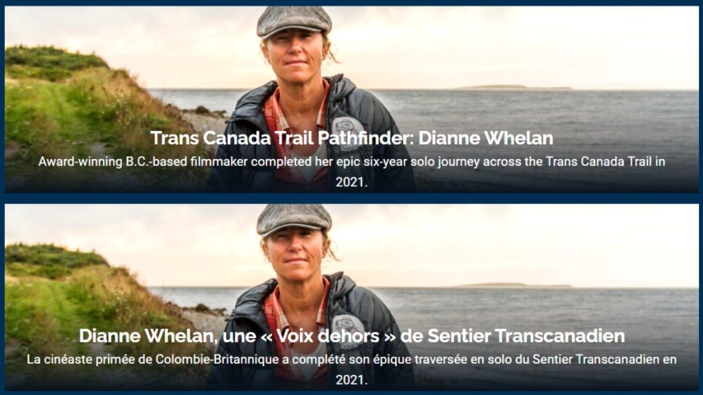
The keynote speaker was Dianne Whalen, an award-winning Canadian filmmaker, photographer, author and public speaker. The topic was ‘500 days in the Wild’.
She described her experience travelling across the country on the Trans-Canada Trail. The longest trail in the world: 24,000 kilometers. It was completed over a period of six years, and included hiking, bicycling, canoeing and skiing.
It was a memorable presentation, with numerous insights into the history and geography of Canada. It is available online.
David MacLean made the GIS Day presentation available online in the AV Room at COGS. We witnessed Alex Miller, President of ESRI Canada, present the Roger Tomlinson, Lifetime Achievement award to Gord Rasmussen, City of Calgary and the Making a Difference award to Cynthia Bettio on the partnership between the community of Stouffville and the local school. Both are well deserved.
The rest of the day included ‘lightening talks’ on AEC, Land Management, Public Safety and Health, Transportation, Utility and Emergency Management, Climate Change and the Environment.
The most shocking aspect of the day was that Heather and I were the only live audience in the AV room. Dave MacLean was available to discuss any technology issues. Everyone else at COGS was, by definition, online. This raises the question. At what point in the learning environment can be totally online? In which case, what is the future of a small college in rural Nova Scotia?
The contrast between Diane Whalen’s description, insights and experiences travelling through the Canadian landscape, and our experience visiting COGS was palpable. What is the value of gathering people into the same (virtual) location, and comparing their sense of Geography?
This weekend, we visited New Glasgow. After celebrating the birthdays of Paul Colville and Frank Fox, Heather and I took the ‘high road’ through the Rawdon Hills to New Glasgow via Truro. Heather’s Dad needed some support for his MRI at the Aberdeen hospital. While in town, we returned our library books to the deCoste Centre (also read my blog post Pictou Visit).
We stopped briefly at the Highland Mall, where I found Alec Bruce’s book, The Cooperators. I also browsed a book on the beaches of Nova Scotia.
For the last several months we have been selling the house in Paradise. As we reach the final stages, we are dealing with the Cooperators Insurance, as well as the Credit Union. The house is now sold,
Moving between Annapolis and Pictou Counties, I am always struck by the difference in the culture. New Glasgow has had a strong industrial base: Michelin, Scott Paper, Trenton. This is reflected in the information available to citizens. Pictou County produces a regular newsletter The health services at the Aberdeen hospital are second to none. This week, I also had an appointment for an MRI. We went to the hospital in Kentville.
Politically, Pictou County likely benefits from the residence of both the Premier, as well as a history of federal-level politicians. With the municipal elections behind us, we will watch to see the difference.
Acknowledgements.
We enjoyed our time away in Pictou County. We always enjoy the ups and downs of the road through the Rawdon Hills. Certainly, we appreciate the history of the Cooperators. Thank you, John, Heather and Edward.
In 2011, I proposed the concept of a Community Information Utility. The concept came originally, I think from Paul Beach in Sault Ste Marie.
Now, 2024, in my retirement, there have been many changes in the planning process in Annapolis County. Today, I am a resident of the Town of Middleton. As a retiree, I become more aware of the needs of the local population. In Middleton, there is CORAH, (Centre of Rural Aging and Health) to meet the needs of our population (read also Antiques Map Tour and Applied Geomatics/CORAH Presentation).
We should review the CIU concept.
What is needed from a CIU? Who determines the content? How is it maintained?
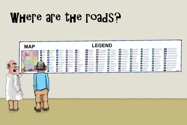
Cartoon by Edward. Lots of community information, but we always miss something.
Throughout my career at COGS I have been a proponent of understanding our geography and its relationship to both physical and mental health. This means access to information, for example:
Walking, bicycle and canoe trails. Maps and description
Access to businesses and services in the landscape: location, hours, services
Health services, education/library resources
Voting, community planning services
What is needed to make this a reality?
Access to the resources at the NSCC, Annapolis campus:
courses, workshops, seminars:
Information on self-guided tours
Material in both electronic form, and printed hard copy
The bottom line is that members of our rural society (in Canada) need access to geographic information to keep healthy.
PROPOSAL Expand the capabilities of CORAH to include access to geographic information related to the resources that support an ageing population and their mental/physical health.
What does that mean? Information related to our current landscape and information on how to access these resources (both electronic and hard copy).
If we implement a CIU, it must be portable, and the concept transferrable to other rural geographies.
Acknowledgements
This morning, I met with David MacLean at COGS. He helped me troubleshoot the WordPress software. He also offered helpful feedback on the CIU concept. Part of the problem is that access to geographic information does not arrive in the form of a ‘utility’ — just turn on the tap, or switch on the light.
Thanks to Brian Arnott and Edward Wedler for their encouragement in this pursuit.
EMAIL NOTES FROM EDWARD During the writing of this CIU concept, Edward offered some observations and views. Food for thought.
ESTONIA You have a great opportunity to advocate your “Community Information Utility”. Like having on-demand access to water when we turn on the tap or to electricity and light when we flip the switch, we should have ready access to [data] and to what is happening in our backyards.
I would argue that one of the most plugged-in countries in the world is Estonia; a potential CIU role model.
“Over the last decade, Estonia has constructed a system of digital infrastructure that made nearly all of its government services available online. 99.9% of Estonian public services are digitally accessible. This includes everything from filing taxes to viewing healthcare records to voting in federal elections.” (Wiki)
THE CIU IDEA
I do take issue with [your colleague’s] sentiment, “Part of the problem is that access to information does not arrive in the form of a ‘utility’. Just turn on the tap, or switch on the light.“
I couldn’t disagree more. The fuel for this information utility is US; as in you, me and others — in the form of social media, the internet, big data, AI, “Hey Siri …”, “Hey Google …”, etc. We “turn on the tap” daily when we go to YouTube, request auto-route directions when we travel, or click on the weather button. WE are the utility. It’s a matter of feeding the utility (like rain), storing the utility (like dams), and distributing the utility (like pipes and taps). Look at Google Maps and Street View. As I travel the Google terrain, I discover the coffee shops and restaurant locations. I click on one and find their hours of operation, their contact info and much more.
Check out the Fisherman’s Cove Gallery where I post my art, for example. https://tinyurl.com/2yy99p3h or the painting locations for artists in the Annapolis Valley and HRM tinyurl.com/PleinAirMap (clicked now 30,000 times).
Isn’t that Community Information?
What we need to develop is a common way to access that information. Maybe this is where search engines and AI voice inquiries play a role. Maybe … we already HAVE a community information utility. We just need to feed the utility for it to be of value to our communities.
Maybe we are asking the wrong question about CIU.
Let’s not ask, “Do we have a CIU?” (because I think we already do) but “Do we have a CIU that best serves our [local] communities’ interests?“
On Sunday, Heather had attended Shambala Meditation at the hall and had accidentally left her jacket on the hook.
We arrived early and stopped at JoAnn’s Chocolate Shop & Café and bookstore in Annapolis Royal for a take-out coffee. The books were irresistible. Picked up two.
Good news. The hall was open at 1:15 pm and we retrieved the jacket from the hook. Afterwards, we stopped at Bob and Dessie Howard’s house outside of Granville Ferry. Bob gave us a wonderful tour of his garden; in particular, hydrangeas, and dahlia species. The conversation covered the history of market gardening in both England and North America. Bob has spent a career, tending a range of species, growing different varieties from seed.
Buoyed by the conversation, we decided to explore the Nova Scotia landscape on a beautiful September day. We headed to Victoria Beach.
Sketch at Victoria Beach by Edward
This reminded me of our need to fully appreciate the geography of Annapolis County. We drove to the end of the paved road. En route, we noted the changing colours, the beautiful houses – the domes, and the Mare Gold retreat at the end. We marvelled at the residents who drive this road. Like, Russell who runs the Mare Gold bookstore in Annapolis Royal (see An Authors’ Market) .
Before setting out for Granville Ferry, I had stopped at CORAH to register for sessions later in the week. I had the inspiration that CORAH, the Centre of Rural Aging and Health could benefit from a Community Information Utility. But that is another blog post, for another day.
The drive to Victoria Beach, the conversation with Bob Howard reinforced the need for a better understanding of our landscape. Beyond, the simple economic view of the landscape as a resource for exploitation.
Both Jeff and David worked at COGS/AGRG. Besides teaching, David was responsible for a network of climate stations. David has retired. Jeff works for the NS Department of Agriculture. Both Jeff and I left COGS in 2011.
Part of the conversation was about the status of agriculture in the Annapolis Valley. Anyone driving through Clarence will have noticed the increase in vineyards on the slopes of North Mountain.
Talking with David, I was interested in the region’s microclimate network status (see the post COGS Weather Network). Talking to Jeff, I was interested to hear about the use of technology in support of resilient agriculture.
In recent years the college has introduced a Forestry Geomatics program. Both of these Agriculture and Forestry programs would demonstrate the application of a suite of geo-technologies to different parts of the landscape.
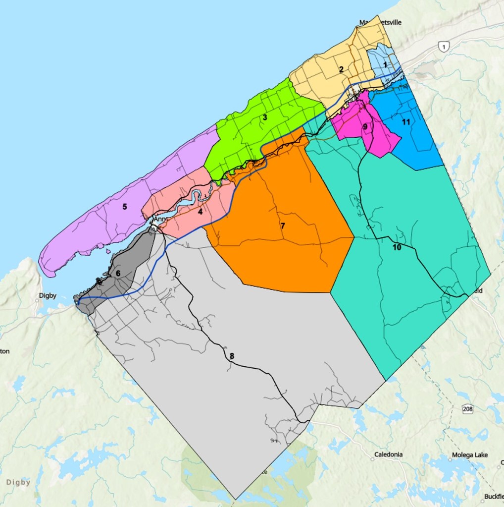
In my previous blog post, I noted the lack of district maps for the town of Middleton. I stand corrected there are no districts within the town. The town’s administrative structure is a Mayor ( Gail Smith) and six council members. In Annapolis County, we have eleven districts. If you wish to discover your district, you can go online, Google search Annapolis County Election District Map and enter your civic address.
Annapolis County Municipal Districts
Acknowledgements
I want to acknowledge the creativity of Edward Wedler. Edward added the links and graphics. He also transformed the original title ‘Agriculture Geomatics’ into ‘In-Cider talk’.
On Friday, GoGeomatics hosted a back-to-school social at COGS (see previous post A Hidden Gem: Harbourville). It included a series of short presentations in the AV room by Tim Webster, Colin MacDonald, Jon Murphy and Ted MacKinnon. The audience was primarily COGS students and a few friends of COGS (e.g. Cliff Drysdale, Simeon Roberts and myself).
The meeting theme was extreme events and climate change; in particular coastal flooding and forest fires. The speakers were forthcoming about the role of Geomatics technology in their work and careers.
Afterwards, GoGeomatics hosted a social evening at the Capitol Pub in Middleton. This allowed for further interaction across the generations.
The event gave me ‘food for thought’ especially in relation to ‘geographic information’.
My memories take me back to the 1980s. NSLSI (later COGS) was looking to bring new technology, computers, into land surveying, cartography and planning. Today, we live in a technology-driven world — computers, cell phones and the Internet. In the 1980s we had three departments: Computer Programming, Surveying and Cartography/Planning.
Later, we renamed the institution to the College of Geographic Sciences and added the Applied Geomatics Research Group. Today, the technology drives learning. Many students attend COGS online. thus missing much of the physical geographic context of the local landscape.
Listening to the speakers, I wondered what had happened to ‘geographic information’. We started with geographic information systems (GIS). GIS included access to many sensing platforms and devices: satellites, aircraft, drones, LiDAR, etc.
The next day (Saturday) I received a back door visit in Middleton by a candidate for town council. She explained the challenge of trying to obtain a base map defining her district.
This made me wonder. What has happened to the cartography and planning programs at COGS? How were they serving the citizens?
Over a decade ago I remember promoting the concept of a ‘community information utility’. Where did that go? Today, the only evidence of different districts are the signs in town, as we go into a municipal election.
CONCLUSION
It is tremendous that COGS’ reputation draws students from across the country, and beyond. It is excellent that the graduates have access to modern technology. But, as a society, are we increasing our understanding of the local geography? If candidates for the municipal election have to scramble for current mapping, we clearly do not have a ‘community information utility’. We are missing the opportunity to showcase the history and talents of COGS for the betterment of citizens and groups in the Annapolis Valley and beyond.
How do we bridge that gap?
POSTSCRIPT
I just discovered in the basement, after our move:
“Mapping our Common Ground. A community and green mapping resource guide” (download PDF HERE).
Sunday (28th), Heather and I attended two meetings.
First, it was the Save Our Old-growth Forest (SOOF) meeting at the Bridgetown Legion (see also previous posts Saving Forests, Twice To Annapolis Royal, and A Day in the Life). The Arlington Forest Preservation Society provided an update for the community. Nina Newington gave an update on their work on South Mountain between Highway #10 and Highway #8, and included a proposal to protect some rare lichen habitat.
Later, Heather and I met with John Wightman. John was interested in the status of lichens in the region and their relationship to his mineral exploration activity. Heather came with a selection of authoritative lichen texts (check out previous post The Bookshelf, and also listen to Montana Public Radio’s Whether Lichens Coceal or Reveal Depends on What You’re Looking For).
At the end of the day, we were both exhausted; trying to understand the position of the Nova Scotia Department of Natural Resources and Renewables.
It left me with two simple questions. However, before I pose the questions, overnight there was time for reflection. In the mid-70’s we were in Ottawa. I was working at the National Herbarium. I produced a publication on the Rare Plants of Nova Scotia. Besides helping to raise two boys, I was surrounded at work by taxonomists: lichens (Irwin Brodo), mosses (Bob Ireland) willows (George Argus). For the publication, we worked with Paul Keddy and David White.
Here are my two questions:
Given that the streams of South Mountain flow into the Annapolis Valley, why are we spraying glyphosate on the forests in the region? It impacts the water supply and the forest ecology.
Given the presence of old-growth forest on South Mountain, why can we not map these forest stands and ensure that they are part of the ecosystem complex into the future?
These lands could be the basis of a provincial commitment to conserve a percentage of crown land from forest activity (see previous post What is Truth?).
It is hard for Heather and myself with our botanical and geographic interests to simply sit back and watch the squabbling in our own backyard. Can we not take a more collaborative approach to answering these two simple questions, based on good science?
Reference
Robert Maher, David White, George Argus and Paul Keddy, 1977, The Rare Vascular Plants of Nova Scotia, Syllogeus 18, Published by the National Museum, Ottawa.
On Thursday afternoons I pick up a copy of The Reader at the Lawrencetown Library.
This week, I was pleased to also find a copy of the current issue of The Grapevine for pick up.
In the Reader there were two articles of interest.
On the front page, an announcement by the Valley Credit Union on a Banking Needs Survey meeting, Tuesday, November 14, 6:30 pm at the Bridgetown Fire Hall.
In the centre fold, a letter from Carman Kerr, MLA Annapolis County to Krista Pridham, ScotiaBank, Director of Regional Banking, Atlantic Region. Carman notes that with the closure of the Bridgetown and Annapolis Royal branches, ScotiaBank will have no branches in Annapolis County.
While I was pleased to see some reaction in the Reader, there remain several unanswered questions.
What is the position of the Municipality of Annapolis County? Are they representing the best interests of the citizens in the County?
What about the educational institutions, e.g. Annapolis Valley campus in Middleton and Lawrencetown? Can they remain viable?
This evening, I did go down to the laundromat in Lawrencetown to see if it had a bank machine? NO.
I look forward to reading the response from ScotiaBank to Carman Kerr. I also plan to attend the Banking Needs Survey meeting in Bridgetown.
I would challenge our representatives on the municipal council of Annapolis County to host a public meeting on the potential ‘financial desert’ I.e. lack of access to face to face banking services.
I would challenge the students/faculty at COGS to produce a map that shows the potential ‘financial desert’ in Annapolis County, within the context of other Counties in Southwest Nova Scotia (note Scotia Bank closures).i.e. travel distance to nearest bank machine/bank.
This week has been challenging, living in the country. Because we were away last Fall, I have not kept abreast of the systems that support rural living: house security system, water purification system. In addition, while in Halifax, I purchased a mobile phone to be cell phone compatible with Heather.
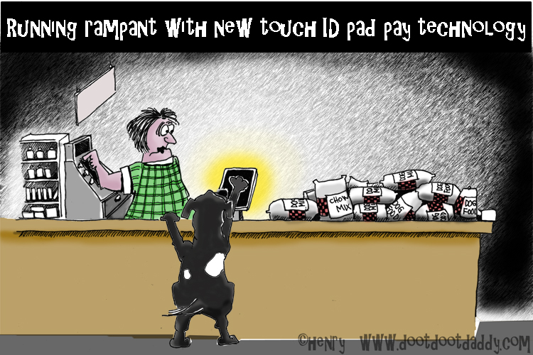
This challenge was heightened when we suffered a scamming attack. (Scamming cartoon by Edward)
Some lessons.
have access to next generation technical support.
develop a system for maintaining passcodes.
there is a gap between the use of technology and access to educational programs on the technology, especially for elders. There are some resources from the Library and NSCC (CORAH).
On the positive side, through interlibrary loan, I received notice of Merilyn Simonds “Gutenberg’s Fingerprint”. And, on another positive note, from The Grapevine, I see that photographer Dick Groot, is the new gallery artist at Tides Contemporary Arts Gallery in Kentville. Dick had a career in Geomatics with ITC, Enschede in the Netherlands.
Heather remains enthralled by the new plantings in the greenhouse, especially the herbs. For inspiration, she is reading “The View from Great Dixter: Christopher Lloyd’s Garden Legacy”. (From Lawrencetown Library).
Postscript
Windsor Salt is on strike. We checked all stores between Lawrencetown and Greenwood. No salt for purification systems.
Acknowledgements
Heather and I have been busy outside in the garden, enjoying the physicality and the changing temperatures. Weeding offers a respite from the technological woes. The Z-track started first time, for mowing the lawn. The chainsaw has been serviced. Must see if I have the strength to get it started.
Peter McAllister came by the house and helped resolve the security system issues. Edward added the graphics.