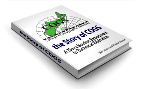
I have been invited to hand out four awards on Friday, May 3rd at the Lawrencetown Fire Hall to graduates of COGS. They are two CANMAP awards, and two Roger F. Tomlinson awards for excellence in GIS; one associated with Esri Redlands and the other with CANMAP. Given this unique opportunity, I thought that I would write a blog to share some of the history behind these relationships. If you are interested in more details, go to the web site thestoryofCOGS.ca
We have to go back to 1980. At that time, COGS was called the Nova Scotia Land Survey Institute (NSLSI). It was one of only a handful of technical institutes training surveyors in Canada. I arrived, with my young family, to establish a new program in Scientific Computer Programming (SCP) with Bruce Peveril. We purchased a Prime mini-computer. During the 1980’s we designed and delivered new programs in Business Computer Programming, Computer Graphics, GIS, and Remote Sensing. After eight years of contract employment, I was exhausted and we headed for Indonesia and later California.
With access to new digital technology, we were looking for application software. From my previous academic career at Memorial University, I was familiar with the mapping software from the Harvard Lab of Computer Graphics. I was also aware that Scott Morehouse had left Harvard to join Jack Dangermond in California at Esri. By chance, the Esri software Arc/Info and Grid ran on Prime computers.
John Wightman was Vice-Principal at NSLSI. John had previously been a Cartography instructor at NSLSI. John and Jim Doig (Principal) recognized the value of this new technology. He formed CANMAP (Centre for Advanced Numerical Mapping Applications) to apply the new technologies to government and industry projects in Nova Scotia. This was really the predecessor to the Applied Geomatics Research Group (AGRG) and the only mechanism to conduct applied research outside of the teaching environment. CANMAP made a profit. The CANMAP awards come from those funds.
In 1986, NSLSI changed its name to the College of Geographic Sciences (COGS) to better reflect the wider range of technologies in Lawrencetown. At that time, besides our industry relationship with Esri and Esri Canada, we had similar relationships with Geobase (Strings), TYDAC (Spans), Dipix and PCI.
When John instigated the name change, he consulted with his friend, and mentor, from Acadia University days, Roger Tomlinson. Roger taught Physical Geography at Acadia and John was his teaching assistant. Roger was running a Consulting Geographers business in Ottawa, called Tomlinson Associates.
Besides Roger’s fundamental role in the Canadian Geographic Information System (CGIS), he advised governments and industry on the implementation of GIS. Associates of Tomlinson included Ray Boyle (inventor of the digitizing table), Michael Goodchild (champion of Geographic Information Science) and myself (instructor at COGS). I worked with Roger on a number of GIS systems implementation for the New Brunswick government, the Nova Scotia government and the City of Ottawa.
In the 1980s diploma programs were three sixteen week semesters. The third semester was dedicated to a cooperative project with government or industry. When Alex Miller left MMM and formed Esri Canada he recruited from the SCP program: David Roscoe, John Houwelling and Eric Melanson. Almost all new Esri Canada installations hired COGS graduates to run their systems. David MacLean started his career with Alan Brackley at JD Irving in New Brunswick. We also started to send our graduates down to Redlands, California.
There is still a connection today. Current instructors: David MacLean, David Colville, Jim Verran all followed this pathway from the SCP program. Other graduates include Tim Webster, Kathleen Stewart, Joy Brown and Konrad Dramowicz. Many graduates find their first job with Esri or an Esri Canada customer.
Transition
Eventually, COGS became part of the NSCC (Nova Scotia Community College) system. It was renamed the Centre of Geographic Sciences.
Today and beyond.
This year, the NSCC has announced a new $9M expansion of the Lawrencetown campus. How will that impact the curriculum, the instructors, the relationship between industry/government and community? Will we see a new relationship with the elders? There are over a dozen ex-COGS instructors living within a one hour drive of the campus. Will we follow Albert Marshall, Mi’kmaq concept and adopt ‘two-eyed seeing’? Will we see the residences used for international students? In the 1980’s we modelled ourselves on the ITC in the Netherlands. We worked with the Environmental Management Development Indonesia (EMDI) program at Dalhousie University. Today, we have a joint Masters degree in Applied Geomatics with Acadia University. There is a program at BIOTROP in Indonesia following the original COGS curriculum. What is their status today? Valerie Thomas and Stephen Rawlinson, both COGS graduates, went there as instructors for a year, to help with the technology transfer.
Will we continue to recruit both local instructors and instructors from the global market? What is the difference between research at AGRG, and research at COGS? What is the new equivalent company to Esri today? Is there a new Roger Tomlinson? Could it be Jon Murphy who is organizing the GeoIgnite conference in Ottawa next month? Jon is a COGS graduate.
Acknowledgements
Thanks to John Wightman and David MacLean for suggesting my name to present these four awards. I look forward to meeting the next generation of Geographic Scientists. I hope you enjoy this snapshot of history. Ted MacKinnon curates the storyofcogs.ca site on my behalf. Edward Wedler, another ex-COGS instructor brings both his Remote Sensing teaching expertise and graphics skills to this blog. In memory of Pat Castel and Bill Power, both SCP instructors at COGS.
 In preparation for the EBLES event on June 29th, we have been assembling a representative list of local books. This includes the work of Bob Bent, Marilyn Jones-Bent and Dianne Legard who are part of the Panel Discussion. It is truly remarkable the number of writers living in this part of Nova Scotia. Meanwhile, we are connecting with our invited guests: Whit Fraser and John DeMont.
 With the increased use of social media, how is that impacting the quality of the reporting in the traditional media? At what point, do we stop purchasing the newspaper? If all your information arrives electronically, then you are subjected to a barrage of advertisements and other material that matches your ‘electronic profile’.
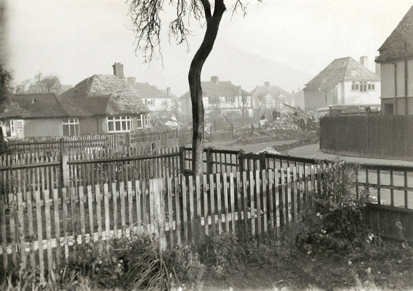 It is from another place and another time. We both grew up at 39 Hazel Close, Whitton (a suburb of London, UK). The photograph shows the damage caused by a flying bomb that hit #51 in the Second World War, shortly after my brother was born. That’s a long way from Paradise, Annapolis County.
 Another item that crossed my desk was from May 24, 2019, The Guardian Weekly. It includes an extract from

 Combine these observations by Jacobs with the
  We were comparing notes on community development in the Annapolis Valley and along the South Shore. In my previous blog, I had raised questions about technology and education from the perspective of a citizen living in rural Annapolis County. Asking difficult questions, and offering solutions are very different activities.
 Her Ph.D research is a comparative analysis of food tourism in the Okanagan Valley with the Annapolis Valley. As we talked about the structures in Nova Scotia , I realized there is a real difference in both approach and culture between BC and NS. Comparative research can help us redefine our approach to seemingly intractable issues: changing demographics, municipal competition, the relationship between communities and their educational institutions.
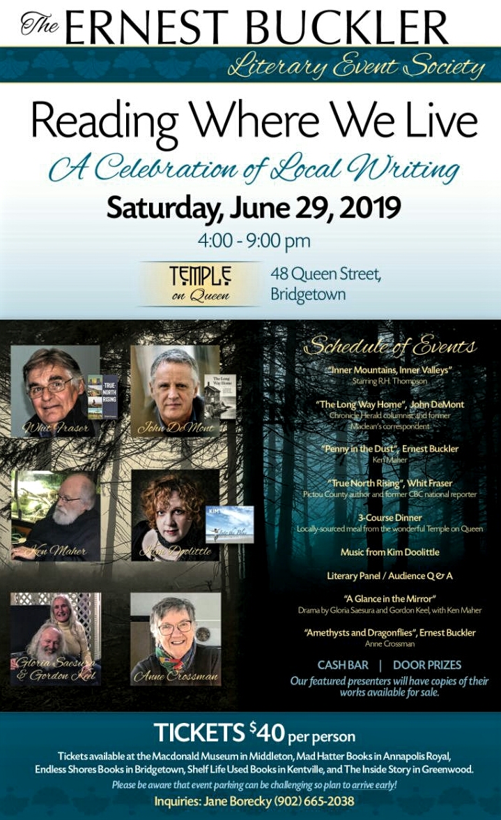 Tickets for the EBLES event are available at The Endless Shores Books, Bridgetown; Shelf Life Used Books, Kentville; The Inside Story, Greenwood; Mad Hatter Books, Annapolis Royal and the MacDonald Museum, Middleton.
 Later in the day, Heather and I stopped there for an inaugural lunch. This opening, combined with the renovations at the Lawrencetown restaurant, shows a real commitment by local business to the community. These investments are complemented by the activities across the river at the
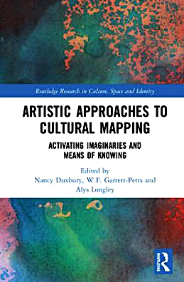 A couple of conversations caught my attention. The first was a chat about the conversion of a LiDAR-derived topographic landscape into a hooked rug. This resonated with a new book that I had signed out from the COGS library. Artistic Approaches to Cultural Mapping: activating imaginaries and means of knowing. The second conversation, with Ed Symons, related to my experience at the walk-in clinic in Berwick, looking for a doctor. There, I had picked up a brochure describing the process for 811 registration. Here was my question: why not allow communities to actively engage in the doctor shortage issue. Can we not map citizens who do not have a family doctor from the registry? Can we not map the communities where doctors are retiring? This would allow individual communities, without government oversight and control, to be
  This week, I received emails, from my brother and Frank Fox, about the new book by Robert MacFarlane,
  After five weeks in the North, what has changed on the home front? First, Dr Mackinnon has retired. This means no family doctor. Make sure that you have registered on the 811 list; not an encouraging sign, especially given the recent video that went viral on a young cancer patient. Second, Highway #201 is still full of logging trucks
  On a more positive note, courtesy of Amazon, I returned to find two new books by David Manners. You may recall from
  My last piece of reading, I picked up this week, at my father-in-law’s house in New Glasgow. The book is by Joan Dawson
 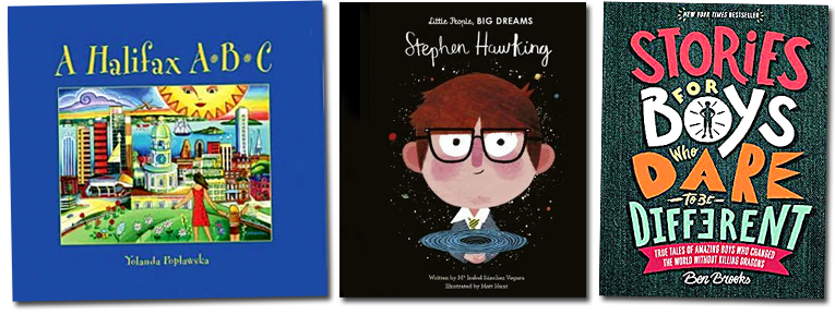 The Halifax ABC was picked up at

