Posted in Art, Nature, Travel

The Geography of Outdoor Art

As Anne and I prepare our palettes for the upcoming 2026 season, I find myself reflecting on the profound bond between geography and plein air art — painting on location.

Magic happens when we bridge the world of art and geography, as in capturing the highest tides in the Bay of Fundy.

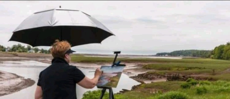
I believe that plein air painting is much more than a hobby; it is a vital way of imprinting the landscape onto our soul. Because we immerse ourselves for a few hours into the landscape, we recall so much more. It’s not like snapping a tourist photo and moving on.

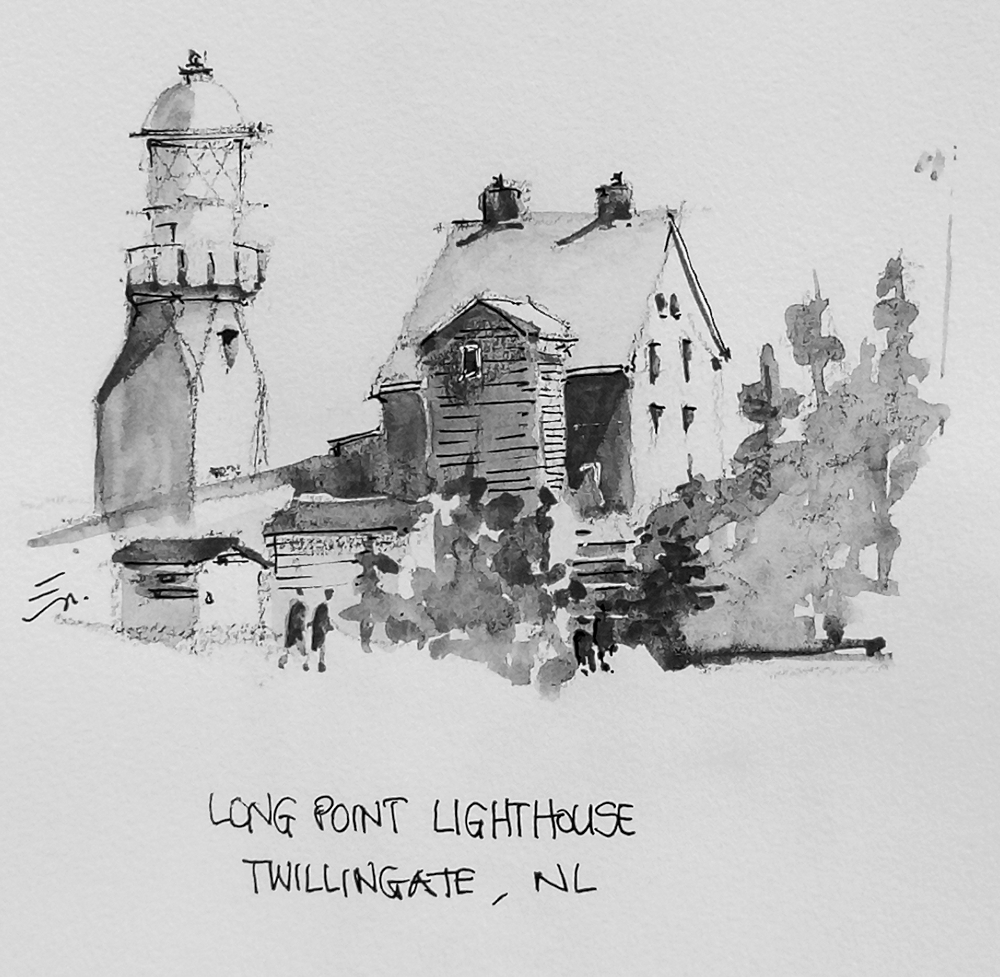
As plein air artists, we recall the July heat and wind at Long Point Lighthouse near Twillingate, Newfoundland …

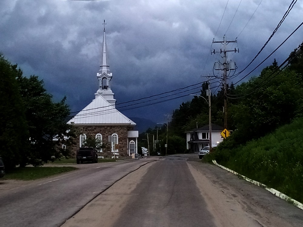
the smell and sound of a violent downpour near Petit Saguenay, Quebec, or in Pakaskwa and Neys Parks, Ontario …

the brilliance of spring colours at Nova Scotia’s Lawrencetown Beach …

or the rise and fall of monster tides at Baxter’s Harbour.

Yes, plein air painting is far more than a simple outdoor hobby. It’s where we move from being passive observers to active participants. This intersection of art and geography links our creative expressions directly to our landscape.

Our interactive community map has already garnered 40,000 views, proving just how much we all crave that spatial link to our surroundings. The current 2026 map includes over 50 paint-out sites.

Close-up of our interactive Plein Air Map around Halifax-Dartmouth (click for more)

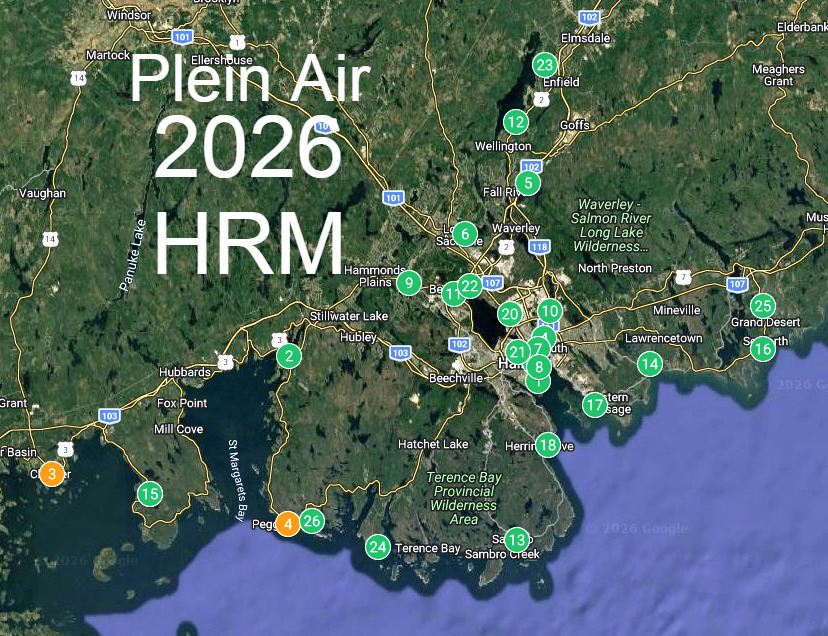
The map has become a digital bridge between traditional fine art and modern spatial exploration. Our map is viewed worldwide. Artists outside the region have contacted us to plan their visits to the region, based on the map.

I invite you to witness this connection firsthand starting May 7th at Granary Park, as the Plein Air Artists of HRM begin our weekly Thursday sessions. In the Annapolis Valley, the season begins at the Harriet Irving Botanical Gardens at Acadia University.

Plein Air artists under cover but in cold, drizzly weather (Chester, Nova Scotia)

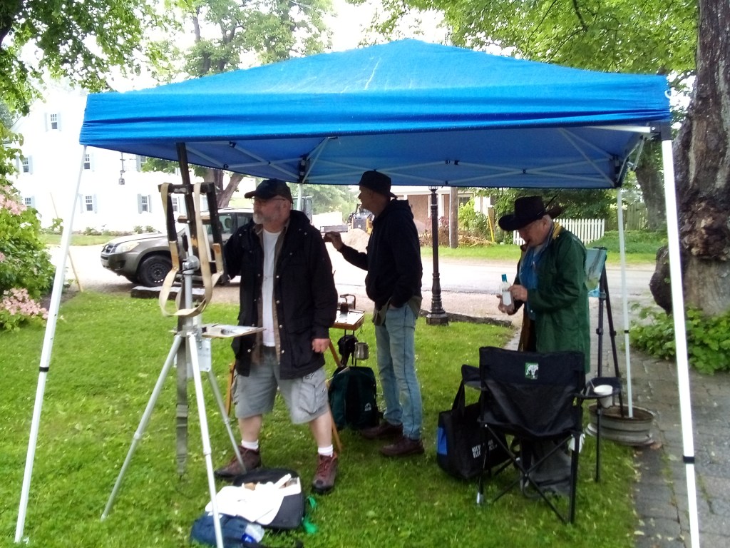
We paint regardless of the weather—whether it is a “Nova Scotia sprinkle” or a foggy morning—because we believe there is immense beauty and a unique “mood” to be captured in a storm.

For a truly world-class experience, do not miss the Parrsboro International Plein Air Festival from June 16th to 21st, held along the breathtaking Cliffs of Fundy UNESCO Global Geopark (drone footage video).

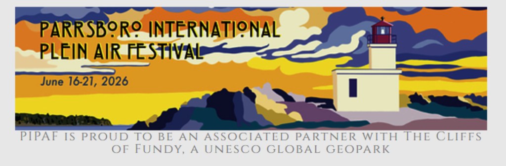
You will see incredible artists in action, translating the raw structure and light of the coastline into masterpieces.

Whether you join us for a session or just stop by for our friendly group critique around 1:30 pm, you will discover that there is no single “right” way to see the world.

Let’s celebrate “The Geography of Outdoor Art” together this season.

POSTSCRIPT

For anyone interested in exploring/developing Artificial Intelligence in creating a live interactive global plein air map please contact me.

Posted in Uncategorized

A Geographic proposal (part 2)

This afternoon, I had a half-hour meeting with Annapolis MLA, David Bowlby. I presented him with my latest blog post: A Geographic Proposal.

He asked if I could provide him with a one page description that could be shared with MLA’s in the Valley, and beyond. I promised that I would have it done by tomorrow morning (Tuesday).

He also shared with me two thoughts:
a) the need to map where in the Annapolis River they could obtain water to fight forest fires.
b) the use of drones for tree harvesting and agriculture management.

There remain a couple of unanswered questions,
a) Define the geographic extent of the Valley?
See A Guide to Moving to the Annapolis Valley, p12.
Three First Nations Communities.
Eight Municipal Units.
b) what is the extent of the Valley REN?

A Geographic Proposal

Ernest Buckler has written about ‘ The Mountain and the Valley’. From a landscape perspective, we should include South Mountain, the Valley, North Mountain and the Bay of Fundy.

Today, the Annapolis Valley is home to NSCC’s Annapolis Valley campus in Middleton, the Centre of Geographic Sciences in Lawrencetown and Kingstec in Kentville, offering full-time programs and continuing education (www.nscc.ca). The town of Wolfville is home to one of Canada’s premier undergraduate universities, Acadia University, http://www.acadia.ca “ p.30.

At the NSCC campus in Middleton, we have CORAH, Centre of Rural Aging and Health. We also host the Applied Geomatics Research Group (AGRG).

At the Centre of Geographic Sciences (COGS) in Lawrencetown we have access to Geomatics technology and Geographic information Science.

The proposition is to redefine CORAH to include access to the technology at COGS, and retired faculty to address the application of these modern technologies, and apply them to all aspects of the Valley landscape: sea level rise, changes in global climate that impact agriculture, forestry and fisheries resources management. Could become the Centre of Rural Landscape and Human Health (?)

This builds upon current and retired faculty who live in the region. It permits access to the technology, and its application to resource issues in rural Nova Scotia. It can also be combined with the ‘creative rural economy’ and the Shorefast economic model from Fogo Island

Step 1 would be to host a conference of thinkers, dreamers/doers and next generation entrepreneurs at the Centre of Geographic Sciences in the Spring 2026.